Arkansas | Ozark Highlands
Mulberry River
Redding Recreation Area to Turner Bend
Check current paddling conditions for this Mulberry River route, including water level, recent gauge trend, weather, and route details.
Route snapshot
Loading the route snapshot. This usually takes a few seconds.
Today
Get the answer fast, then scan the route.
Start with the verdict, current conditions, route plan, and quick facts before you commit to the drive.
Today's conditions
Gauge
Recent trend
Checking preferred range.
Checking trend.
Gauge source
-- Checking timestampMN DNR provides the current paddling level here, but not chart-ready recent samples.
Weather
Best window today
Checking weather.
Today by hour
Short-route forecast
Checking the next several hours.
Quick facts
Plan
Dial in the shuttle, distance, and access.
Use this section once the route looks viable and you need to turn it into an actual trip plan.
Access plan
Access, shuttle, and map
Launch at the Forest Service Redding Recreation Area and take out at the private-fee Turner Bend landing for a short Mulberry River whitewater run. Use the downstream USGS Mulberry gauge as the Paddle Today scoring source, then make a same-day visual call at Redding and Turner Bend.
Put-in
Redding Recreation Area canoe launch Open mapRedding Recreation Area is an official Forest Service river access with a rock canoe launch and day-use fees, but road, parking, and flood cleanup conditions can still vary.
Take-out
Turner Bend landing / Highway 23 bridge Open mapTurner Bend is a private-fee landing. Private boaters need current access wristbands, parking permits, or shuttle arrangements; do not assume unpaid or after-hours landing use.
Pulling access map tiles. Usually under 5 seconds.
Access caveats
- Redding Recreation Area is an official Forest Service river access with a rock canoe launch and day-use fees, but road, parking, and flood cleanup conditions can still vary.
- Turner Bend is a private-fee landing. Private boaters need current access wristbands, parking permits, or shuttle arrangements; do not assume unpaid or after-hours landing use.
- The route uses the USGS Mulberry River near Mulberry stage range published by American Whitewater. Turner Bend also publishes a local staff-gauge ladder, but Paddle Today does not treat that as the live product gauge.
- The take-out coordinate is a practical Highway 23 / Turner Bend bridge corridor anchor. Confirm the signed Turner Bend landing and loading rules before launching.
Watch for
- Class I-III rapids, wave trains, sharp bends, rocks, ledges, and pushy current when the river is up.
- Low water below about 1.55 ft at the USGS gauge, when scraping, dragging, and pinning risk increase.
- High water around and above 6.0 ft at the USGS gauge, outside the American Whitewater runnable envelope used by Paddle Today.
- Fast rises after Ozark storms, fresh wood, strainers, muddy water, cold swims, and limited cell service in the forest corridor.
- Private-access limits at Turner Bend, busy spring weekends, rural shuttle delays, and late-day darkness if the group waits on access logistics.
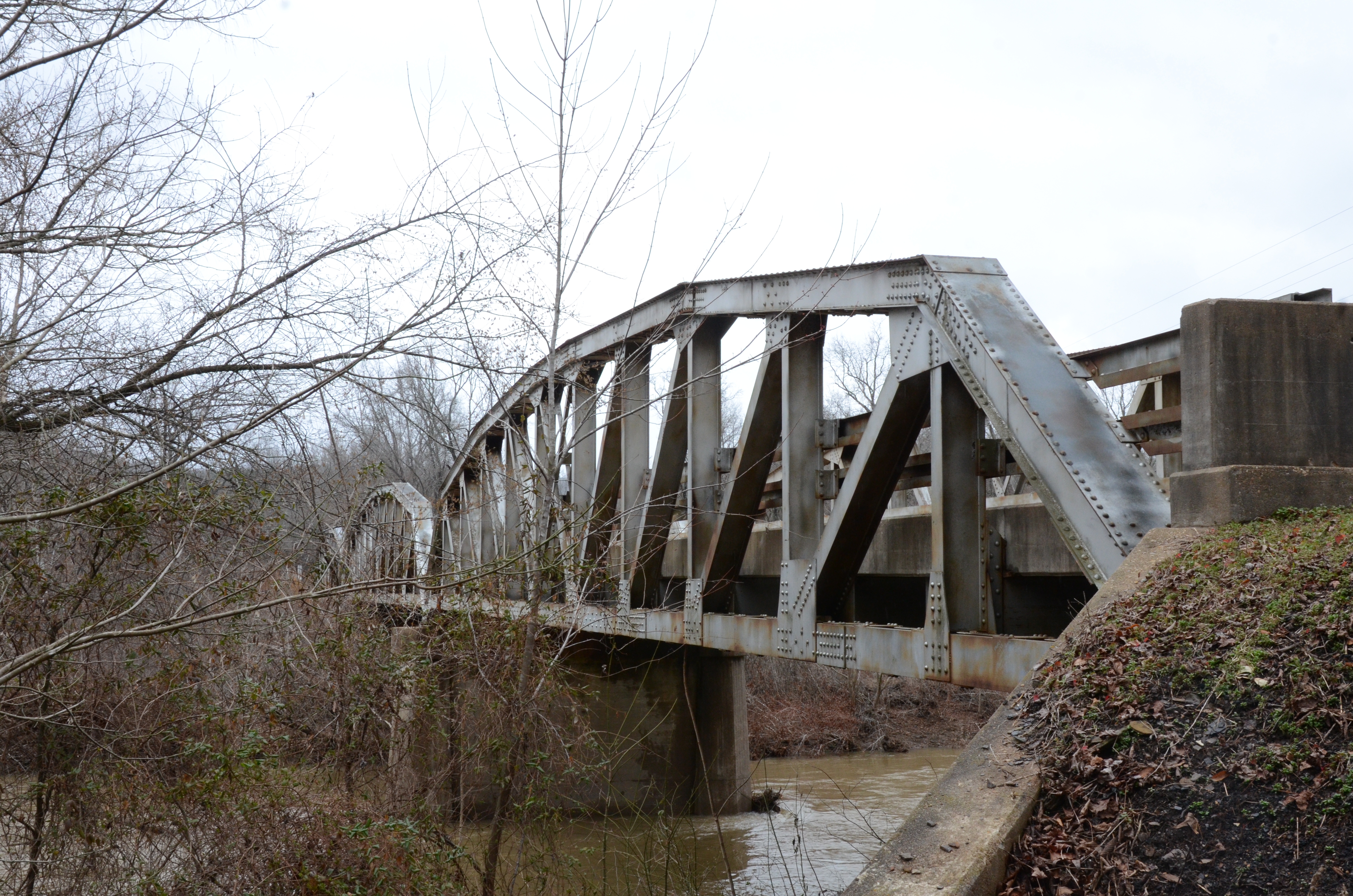
Route gallery
See this route on the water
Photos help show what the access looks like and what the route actually feels like on the water.
Sources
Check the data behind today's call.
Use this section when the page shows stale data, limited confidence, or a call you want to verify before driving.
Why this score Today's data confidence is checking
Data confidence mostly comes down to three things: how direct the gauge is, how clear the range is, and how fresh the data is.
- Checking data confidence notes.
- Checking data confidence cautions.
Outlook Tomorrow and weekend
This is a cautious early look. If the data is too thin, we leave it out.
Waiting on forecast.
Waiting on forecast.
Data behind the score Gauge, thresholds, and timing
These are the live readings and threshold notes behind today's score.
| Gauge site | Mulberry River near Mulberry, AR |
| Gauge height | Checking |
| Discharge | Checking |
| 24h trend | Checking |
| 24h change | Checking |
| Current band | Checking |
| Rain last 24h | Checking |
| Rain last 72h | Checking |
| Air temp | Checking |
| Water temp | Checking |
| Wind | Checking |
| Gusts | Checking |
| Rain timing | Checking |
| Target band | 1.55 ft to 6.00 ft |
| Low threshold | 1.55 ft |
| High threshold | 6.00 ft |
| Data confidence behind the range | Local route guidance |
| Gauge observed | Checking |
| Paddle Today updated | Checking |
| Main source behind this score | American Whitewater Redding-to-Turner-Bend reach gauge range |
| Gauge source | Checking |
| Weather source | Checking |
| Rainfall source | Checking |
Notes What to know before you go
These notes cover the access details, route quirks, and source caveats most likely to matter once you get there.
- Official put-in Redding Recreation Area
The Forest Service says Redding Recreation Area sits next to the Wild and Scenic Mulberry River and offers a rock canoe launch and river access. The page lists the site as open all year with a day-use fee and official coordinates.
- Route shape Redding to Turner Bend, about 3.6 to 4.0 miles
American Whitewater identifies Redding Campground to Highway 23 / Turner Bend as a 3.6-mile Mulberry reach. National Rivers Project lists Redding to Turner Bend as a 4-mile section managed by the Ozark-St. Francis National Forest.
- Direct live gauge USGS 07252000
USGS Mulberry River near Mulberry showed same-day May 31, 2026 data during review, including 1,050 cfs and 2.84 ft at 16:30 CDT.
- Stage model 1.55 / 1.55-6.0 / 6.0 ft
American Whitewater ties the exact Redding-to-Turner-Bend reach to USGS 07252000 and lists 1.55 to 6.00 ft as barely runnable to high runnable for Class I-III water. Paddle Today uses that as a conservative two-sided stage envelope without adding a stronger ideal subrange.
- Private-fee take-out Turner Bend landing
Turner Bend documents private-boater shuttles, access wristbands, parking permits, a loading/unloading landing, and the requirement to buy access for use of its landings.
- Local hazard context Fast rises, technical water, and beginner limits
National Rivers Project warns that heavy rain can quickly transform the Mulberry into a rampaging torrent. Turner Bend local guidance says 2.7-2.8 ft is challenging for beginners, 2.9-3.0 ft is not a casual picnic float, and 4.5-5.0 ft is too much water for most boaters on its local staff gauge.
- Coordinate anchors Redding 35.68282778, -93.78651111; Turner Bend 35.671667, -93.829444
The put-in uses Forest Service Redding coordinates. The take-out uses the Turner Bend / Highway 23 bridge corridor coordinate from the Commons NRHP bridge record, backed by Turner Bend access pages that place the landing at the Highway 23 / Mulberry River junction.
Verify it yourself Check the source links
Use these links to double-check the gauge, route details, and access notes before you head out.
- Forest Service Redding Recreation Area
- American Whitewater Redding to Turner Bend
- American Whitewater Mulberry gauge information
- USGS 07252000 Mulberry River near Mulberry
- USGS 07252000 legacy current conditions
- National Rivers Project Redding to Turner Bend
- Turner Bend private boating shuttle and access
- Turner Bend water level guidance
Paddler reports
Recent notes from paddlers
A few quick notes from people who were on this route recently.
Reports
Photos, paddler notes, and updates.
See what others have shared, then add a condition report, upload photos, or flag anything that needs fixing.
Share your trip
Keep exploring
More routes to check next
Compare another stretch on this river, or jump to nearby options before you pick a plan.
More in Arkansas
All 8 routesNearby routes by distance
Quick answers
Mulberry River paddling FAQ
What water level is good for paddling Mulberry River?
Paddle Today watches Mulberry River near Mulberry, AR and treats 1.55 ft to 6.00 ft as the target band for this route, with weather and recent trend included in the final score.
Where does this Mulberry River route start and end?
This route starts at Redding Recreation Area canoe launch and ends at Turner Bend landing / Highway 23 bridge, about About 3.6 to 4 mi on the water.
Is this Mulberry River route good for beginners?
This is listed as a hard route. Treat the live score as a planning aid, then confirm conditions, hazards, access, and group skill before launching.
Flag a change
See something outdated?
Access, hazards, wood, and shuttle details change. Send a quick correction if something looks off.