State routes
Ohio Rivers
Compare 5 tracked Ohio paddle routes with route links, water-level context, difficulty, and access planning details.
Paddle Today only lists routes when the gauge, threshold, and source support are defensible enough for live route scoring.
Showing route starts. Interactive map loading.
Coverage snapshot
Where Paddle Today tracks Ohio
Use the map to scan route density, then start with beginner routes, planning routes, or the full directory below.
Live conditions
Best Ohio routes today
Loading current scores, gauge reads, and weather signals.
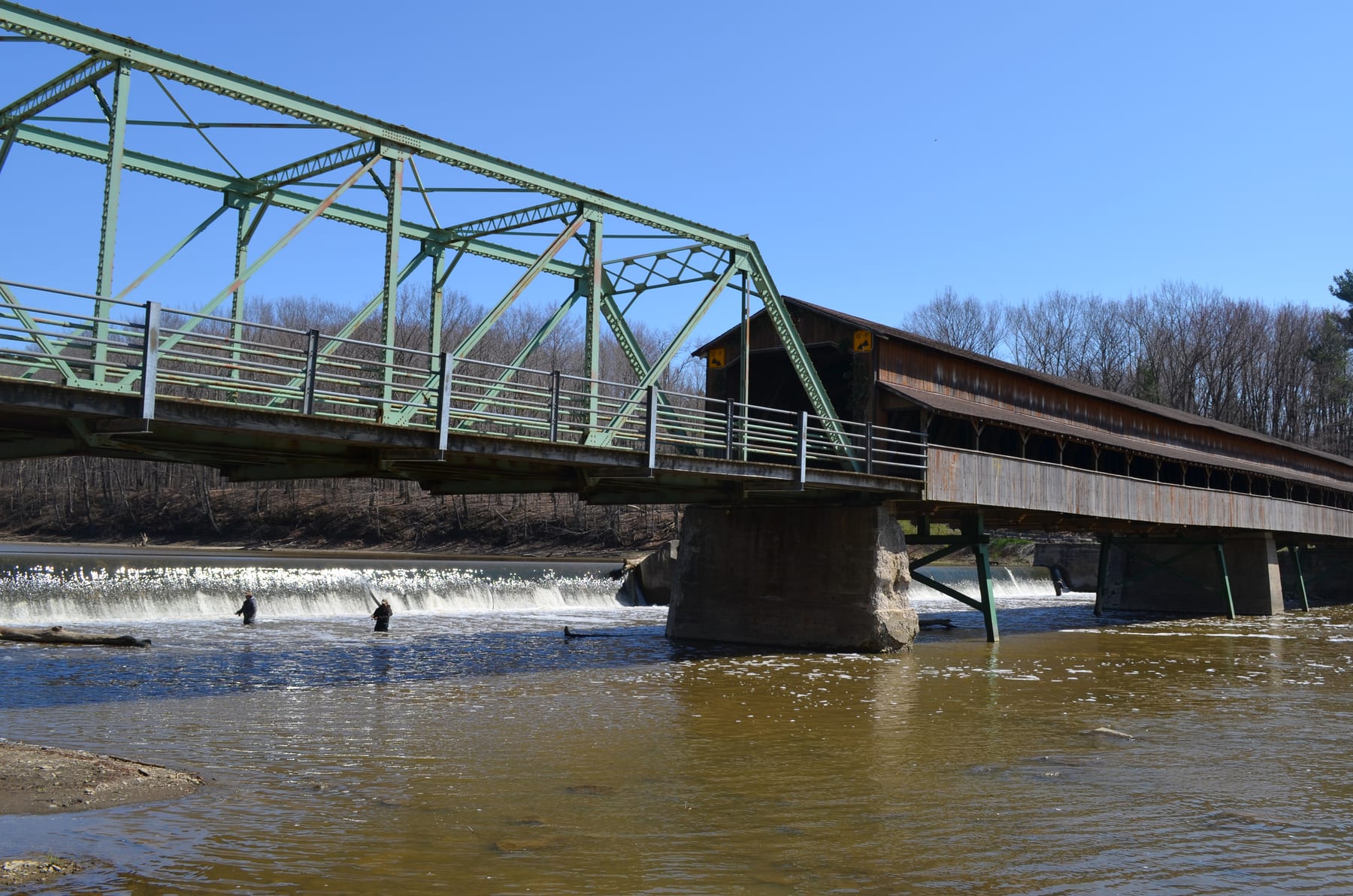
Grand River
Harpersfield Covered Bridge to Hidden Valley Park
Moderate | 8.4 mi | About 3 hr to 5 hr depending on level and stopsCuyahoga River
Ira Road to Lock 29 / Route 303
Moderate | 6.9 mi | About 2.5 hr to 4 hr depending on level, scouting, and flatwater paceVermilion River
Schoepfle Garden / Birmingham to Mill Hollow
Moderate | 8.1 mi | About 3 hr to 4.5 hr depending on stage and scoutingLittle Miami River
Kelley Nature Preserve to Jim Terrell Park
Moderate | 4.9 mi | About 1.5 hr to 3 hr depending on level, play stops, and windThis panel hydrates from live Paddle Today scores. The route links above remain useful when JavaScript or the score API is unavailable.
Best route options
Good starting points in Ohio
Ranked from route metadata, source support, difficulty, and logistics.
Route facts

Route facts
Route facts
Route facts
Route facts
Weekend planning
Routes with practical logistics
Use the live weekend board for score-based recommendations.
Browse coverage
Rivers and regions
Compact directory links for crawlers and planners.
By river
Cuyahoga River 1
Grand River 1
Great Miami River 1
Little Miami River 1
Vermilion River 1
By region
Cuyahoga Valley 1
North Central Ohio 1
Northeast Ohio 1
Need broader planning context?
Weekend board Explore all routes Request a routeAll tracked routes
Every Ohio route on Paddle Today
5 server-rendered route links.
Showing all 5 routes.
Quick answers
Ohio paddling FAQ
How does Paddle Today choose Ohio paddle routes?
Paddle Today lists Ohio routes when the route has enough defensible gauge, threshold, source, and logistics support to make a live route score useful. The current Ohio page includes 5 tracked routes across 5 rivers.
Are these Ohio river conditions live?
The route links on this page are server-rendered and crawlable. Each route page then checks live gauge readings, weather, water-level context, and route score data before you make a same-day call.
Can I request another Ohio route?
Yes. Use the request form to send the river, reach, access points, and any source links. Paddle Today prioritizes routes where a public gauge or defensible threshold support can back the live score.