See all 2 routes on Vermilion River
Ohio | North Central Ohio
Vermilion River
Schoepfle Garden / Birmingham to Mill Hollow
Check current paddling conditions for this Vermilion River route, including water level, recent gauge trend, weather, and route details.
Route snapshot
Loading the route snapshot. This usually takes a few seconds.
Today
Get the answer fast, then scan the route.
Start with the verdict, current conditions, route plan, and quick facts before you commit to the drive.
Today's conditions
Gauge
Recent trend
Checking preferred range.
Checking trend.
Gauge source
-- Checking timestampMN DNR provides the current paddling level here, but not chart-ready recent samples.
Weather
Best window today
Checking weather.
Today by hour
Short-route forecast
Checking the next several hours.
Quick facts
Plan
Dial in the shuttle, distance, and access.
Use this section once the route looks viable and you need to turn it into an actual trip plan.
Access plan
Access, shuttle, and map
Launch from the Birmingham / Schoepfle Garden access context and take out at Mill Hollow in Vermilion River Reservation. American Whitewater documents this as an 8.1-mile middle Vermilion run with mostly Class I water and a couple light Class II sections.
Put-in
Birmingham Community Center / Schoepfle Garden river access Open mapODNR publishes Schoepfle Garden / Birmingham coordinates for the Vermilion River access area, but the exact riverbank launch should be confirmed on arrival with local signage and current park rules.
Take-out
Mill Hollow / Vermilion River Reservation Open mapMill Hollow is an official Vermilion River Reservation / water-trail access area, but shoreline conditions can change after high water.
Pulling access map tiles. Usually under 5 seconds.
Access caveats
- ODNR publishes Schoepfle Garden / Birmingham coordinates for the Vermilion River access area, but the exact riverbank launch should be confirmed on arrival with local signage and current park rules.
- Mill Hollow is an official Vermilion River Reservation / water-trail access area, but shoreline conditions can change after high water.
- Do not continue downstream into the lower Vermilion or Lake Erie unless you have a separate open-water and take-out plan.
Watch for
- Low, scrapable water below the AW runnable floor and during dry summer spells.
- Light Class II riffles after the SR 113 crossing and before Dean Hollow Bridge when the river is in the preferred stage range.
- Wood, strainers, fast rises after rain, and stronger current or bridge hazards at high water.
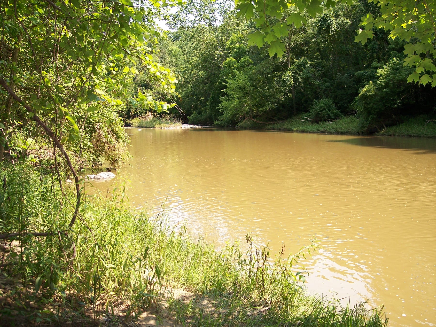
Route gallery
See this route on the water
Photos help show what the access looks like and what the route actually feels like on the water.
Sources
Check the data behind today's call.
Use this section when the page shows stale data, limited confidence, or a call you want to verify before driving.
Why this score Today's data confidence is checking
Data confidence mostly comes down to three things: how direct the gauge is, how clear the range is, and how fresh the data is.
- Checking data confidence notes.
- Checking data confidence cautions.
Outlook Tomorrow and weekend
This is a cautious early look. If the data is too thin, we leave it out.
Waiting on forecast.
Waiting on forecast.
Data behind the score Gauge, thresholds, and timing
These are the live readings and threshold notes behind today's score.
| Gauge site | Vermilion River near Vermilion, OH |
| Gauge height | Checking |
| Discharge | Checking |
| 24h trend | Checking |
| 24h change | Checking |
| Current band | Checking |
| Rain last 24h | Checking |
| Rain last 72h | Checking |
| Air temp | Checking |
| Water temp | Checking |
| Wind | Checking |
| Gusts | Checking |
| Rain timing | Checking |
| Target band | 3.50 ft to 4.25 ft |
| Low threshold | 2.55 ft |
| High threshold | 6.00 ft |
| Data confidence behind the range | Local route guidance |
| Gauge observed | Checking |
| Paddle Today updated | Checking |
| Main source behind this score | American Whitewater Vermilion middle reach gauge guidance |
| Gauge source | Checking |
| Weather source | Checking |
| Rainfall source | Checking |
Notes What to know before you go
These notes cover the access details, route quirks, and source caveats most likely to matter once you get there.
- Route and distance 8.1 miles, Class I(II)
American Whitewater lists the middle Vermilion reach from Edison Hwy / US 20 at Schoepfle Gardens to Mill Hollow Park as 8.1 miles with Class I(II) difficulty.
- Published AW range 2.55 to 6.00 ft
American Whitewater ties the reach to USGS 04199500 and labels 2.55 to 6.00 ft as barely runnable through high runnable.
- Novice target 3.5 to 4.25 ft
A same-reach American Whitewater trip report recommends 3.5 to 4.25 ft for novice kayakers, with the middle of that range most fun.
- Direct live gauge USGS 04199500
USGS operates the Vermilion River near Vermilion, OH monitoring location used by American Whitewater for this reach.
- Put-in coordinate support Birmingham Community Center / Schoepfle Garden public-access coordinates
ODNR public-access materials list Schoepfle Garden as a Vermilion River access site and publish Birmingham-area coordinates, including the community-center point used here for the AW Birmingham put-in context.
- Take-out coordinate support Mill Hollow / Vermilion River Reservation coordinates
ODNR public-access materials and the Vermilion-Lorain Water Trail identify Mill Hollow / Vermilion River Reservation as the western trailhead area and publish coordinates for the Mill Hollow side.
- Hazards Low water, light Class II riffles, wood, bridge hydraulics downstream
AW notes the light Class II sections on this middle reach; ODNR water-trail materials warn the lower Vermilion can include log jams and bridge abutment hazards during high water.
Verify it yourself Check the source links
Use these links to double-check the gauge, route details, and access notes before you head out.
Paddler reports
Recent notes from paddlers
A few quick notes from people who were on this route recently.
Reports
Photos, paddler notes, and updates.
See what others have shared, then add a condition report, upload photos, or flag anything that needs fixing.
Share your trip
Keep exploring
More routes to check next
Compare another stretch on this river, or jump to nearby options before you pick a plan.
Quick answers
Vermilion River paddling FAQ
What water level is good for paddling Vermilion River?
Paddle Today watches Vermilion River near Vermilion, OH and treats 3.50 ft to 4.25 ft as the target band for this route, with weather and recent trend included in the final score.
Where does this Vermilion River route start and end?
This route starts at Birmingham Community Center / Schoepfle Garden river access and ends at Mill Hollow / Vermilion River Reservation, about 8.1 mi on the water.
Is this Vermilion River route good for beginners?
This is listed as a moderate route. Expect more planning than an easy float, and use the live score, route notes, and source links before committing.
Flag a change
See something outdated?
Access, hazards, wood, and shuttle details change. Send a quick correction if something looks off.