Iowa | Southeast Iowa
Des Moines River
Bentonsport Boat Ramp to Bonaparte Boat Ramp
Check current paddling conditions for this Des Moines River route, including water level, recent gauge trend, weather, and route details.
Route snapshot
Loading the route snapshot. This usually takes a few seconds.
Today
Get the answer fast, then scan the route.
Start with the verdict, current conditions, route plan, and quick facts before you commit to the drive.
Today's conditions
Gauge
Recent trend
Checking preferred range.
Checking trend.
Gauge source
-- Checking timestampMN DNR provides the current paddling level here, but not chart-ready recent samples.
Weather
Best window today
Checking weather.
Today by hour
Short-route forecast
Checking the next several hours.
Quick facts
Plan
Dial in the shuttle, distance, and access.
Use this section once the route looks viable and you need to turn it into an actual trip plan.
Access plan
Access, shuttle, and map
Launch at Bentonsport Park and paddle the Lower Des Moines River downstream to Bonaparte Riverfront Park. This short historic-village segment is best when lower water exposes riffles, rock bars, and geode-hunting stops without making the route a scrape-heavy walk.
Put-in
Bentonsport Park / Bentonsport Boat Ramp Open mapBentonsport Park is a county park with a public boat ramp on the Lower Des Moines River Water Trail, but the saved coordinate is park/access-area context rather than a ramp-survey point.
Take-out
Bonaparte Riverfront Park / Bonaparte Boat Ramp Open mapBonaparte Riverfront / City Park is the public riverfront take-out context; use posted local signs for the exact boat-ramp approach and parking.
Pulling access map tiles. Usually under 5 seconds.
Access caveats
- Bentonsport Park is a county park with a public boat ramp on the Lower Des Moines River Water Trail, but the saved coordinate is park/access-area context rather than a ramp-survey point.
- Bonaparte Riverfront / City Park is the public riverfront take-out context; use posted local signs for the exact boat-ramp approach and parking.
- The Des Moines River is meandered here, but private property begins above the ordinary high-water mark. Keep stops to legal bars, public parkland, and clearly public access areas.
Watch for
- Old lock-and-dam remnants and riffles near Bentonsport and Bonaparte, especially when low water exposes more rock.
- Walking or dragging boats when the Keosauqua gauge is around 700 to 800 cfs or lower.
- Rock bars disappearing and current getting less beginner-friendly above roughly 6,000 cfs on the Keosauqua gauge.
- Large-river wind, floating debris after rain, motorboat traffic, and soft or muddy landings.
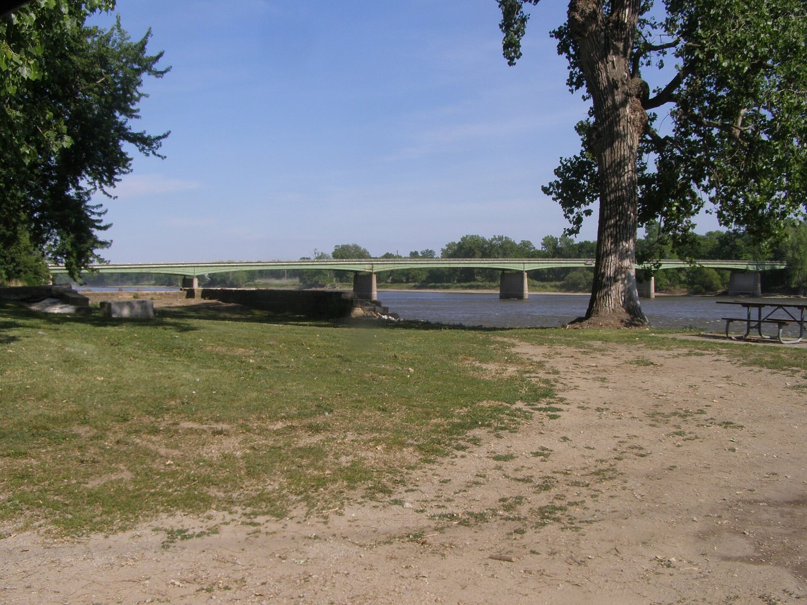
Route gallery
See this route on the water
Photos help show what the access looks like and what the route actually feels like on the water.
Sources
Check the data behind today's call.
Use this section when the page shows stale data, limited confidence, or a call you want to verify before driving.
Why this score Today's data confidence is checking
Data confidence mostly comes down to three things: how direct the gauge is, how clear the range is, and how fresh the data is.
- Checking data confidence notes.
- Checking data confidence cautions.
Outlook Tomorrow and weekend
This is a cautious early look. If the data is too thin, we leave it out.
Waiting on forecast.
Waiting on forecast.
Data behind the score Gauge, thresholds, and timing
These are the live readings and threshold notes behind today's score.
| Gauge site | Des Moines River at Keosauqua, IA |
| Discharge | Checking |
| Gauge height | Checking |
| 24h trend | Checking |
| 24h change | Checking |
| Current band | Checking |
| Rain last 24h | Checking |
| Rain last 72h | Checking |
| Air temp | Checking |
| Water temp | Checking |
| Wind | Checking |
| Gusts | Checking |
| Rain timing | Checking |
| Target band | 3,000 cfs to 4,500 cfs |
| Low threshold | 800 cfs |
| High threshold | 6,000 cfs |
| Data confidence behind the range | Local route guidance |
| Gauge observed | Checking |
| Paddle Today updated | Checking |
| Main source behind this score | Outdoor Adventures Made Easy Bentonsport-to-Bonaparte level notes |
| Gauge source | Checking |
| Weather source | Checking |
| Rainfall source | Checking |
Notes What to know before you go
These notes cover the access details, route quirks, and source caveats most likely to matter once you get there.
- Official water trail Bentonsport to Bonaparte
The Iowa DNR lower Des Moines water-trail planning material names Segment 6 as Bentonsport Boat Ramp to Bonaparte Boat Ramp, and local water-trail pages list both as access points.
- Put-in access Bentonsport Park boat ramp
Van Buren County / MyCountyParks says Bentonsport Park sits along the Des Moines River and has a boat ramp giving access to the Lower Des Moines River Water Trail.
- Take-out access Bonaparte Riverfront / City Park
Villages of Van Buren lists Bonaparte among the Lower Des Moines River Trail access points, and NPS identifies Bonaparte Riverfront Park as a city-managed riverfront park with auto parking.
- Direct gauge USGS 05490500
USGS operates Des Moines River at Keosauqua, IA, upstream on the same lower-river corridor; the Iowa DNR AQuIA record ties the Keosauqua bridge site to USGS NWIS 05490500.
- Route-specific levels 700-6,000 cfs used; about 3,500 cfs preferred
Outdoor Adventures Made Easy describes the Bentonsport-to-Bonaparte paddle, says 700 to 800 cfs or less can require walking, prefers about 3,500 cfs, and says higher than 6,000 cfs covers many rock bars.
- Route character 3.6 to 5 miles
The route report gives 3.6 miles for the main Bentonsport-to-Bonaparte paddle, while local water-trail access spacing lists Bentonsport to Bonaparte as about five miles. Plan it as a short day with time to stop at bars and historical features.
- Access coordinates Bentonsport 40.72454, -91.85125; Bonaparte 40.69785, -91.80552
Coordinates are anchored to named public park/access map features: Bentonsport Riverside Park / Bentonsport Park and Bonaparte City Park / Riverfront Park. Use posted signs to identify the exact ramp approach.
Verify it yourself Check the source links
Use these links to double-check the gauge, route details, and access notes before you head out.
- Iowa DNR Lower Des Moines River Water Trail plan
- Van Buren County Bentonsport Park
- Villages of Van Buren Des Moines River Trail
- Outdoor Adventures Made Easy Geode Paddle
- USGS 05490500 monitoring location
- Iowa DNR Fish Iowa Des Moines River Ottumwa Dam to Farmington
- NPS Bonaparte Riverfront Park
- Bonaparte City Park map record
Paddler reports
Recent notes from paddlers
A few quick notes from people who were on this route recently.
Reports
Photos, paddler notes, and updates.
See what others have shared, then add a condition report, upload photos, or flag anything that needs fixing.
Share your trip
Keep exploring
More routes to check next
Compare another stretch on this river, or jump to nearby options before you pick a plan.
More in Iowa
All 31 routesNearby routes by distance
Quick answers
Des Moines River paddling FAQ
What water level is good for paddling Des Moines River?
Paddle Today watches Des Moines River at Keosauqua, IA and treats 3,000 cfs to 4,500 cfs as the target band for this route, with weather and recent trend included in the final score.
Where does this Des Moines River route start and end?
This route starts at Bentonsport Park / Bentonsport Boat Ramp and ends at Bonaparte Riverfront Park / Bonaparte Boat Ramp, about 3.6 to 5 mi on the water.
Is this Des Moines River route good for beginners?
This is listed as an easy route, but conditions still matter. Check today's score, water level, weather, and access notes before you go.
Flag a change
See something outdated?
Access, hazards, wood, and shuttle details change. Send a quick correction if something looks off.