See all 3 routes on Eleven Point River
Missouri | Missouri Ozarks
Eleven Point River
Whitten Access to Riverton East River Access
Check current paddling conditions for this Eleven Point River route, including water level, recent gauge trend, weather, and route details.
Route snapshot
Loading the route snapshot. This usually takes a few seconds.
Today
Get the answer fast, then scan the route.
Start with the verdict, current conditions, route plan, and quick facts before you commit to the drive.
Today's conditions
Gauge
Recent trend
Checking preferred range.
Checking trend.
Gauge source
-- Checking timestampMN DNR provides the current paddling level here, but not chart-ready recent samples.
Weather
Best window today
Checking weather.
Today by hour
Short-route forecast
Checking the next several hours.
Quick facts
Plan
Dial in the shuttle, distance, and access.
Use this section once the route looks viable and you need to turn it into an actual trip plan.
Access plan
Access, shuttle, and map
Launch at Whitten River Access and take out at Riverton East River Access for the Forest Service-supported lower Eleven Point day float. Expect clear cold water, shoals, spring-fed current, and a direct Bardley gauge used conservatively as a low-water check.
Put-in
Whitten River Access Open mapWhitten and Riverton East are official Forest Service river accesses, but day-use access areas have posted rules and no overnight camping.
Take-out
Riverton East River Access / Highway 160 Open mapRiverton East is the cleaner canoe/kayak take-out on river left just above the Highway 160 bridge; Riverton West is a separate river-right day-use area.
Pulling access map tiles. Usually under 5 seconds.
Access caveats
- Whitten and Riverton East are official Forest Service river accesses, but day-use access areas have posted rules and no overnight camping.
- Riverton East is the cleaner canoe/kayak take-out on river left just above the Highway 160 bridge; Riverton West is a separate river-right day-use area.
- The Eleven Point corridor includes private lands under scenic easement. Do not assume banks away from public accesses, designated float camps, or legal gravel-bar stops are public.
Watch for
- Shallow shoals and occasional scraping when the Bardley gauge falls near the 300 cfs floor.
- Halls Bay near the end of the route: the right channel is a fast ledge line above normal water, while the left is a tricky shallow S-curve with swift current.
- Cold spring-fed water, rapid rises after rain, fresh wood, boat traffic, and the 25 hp motor allowance on this part of the National Wild and Scenic River.
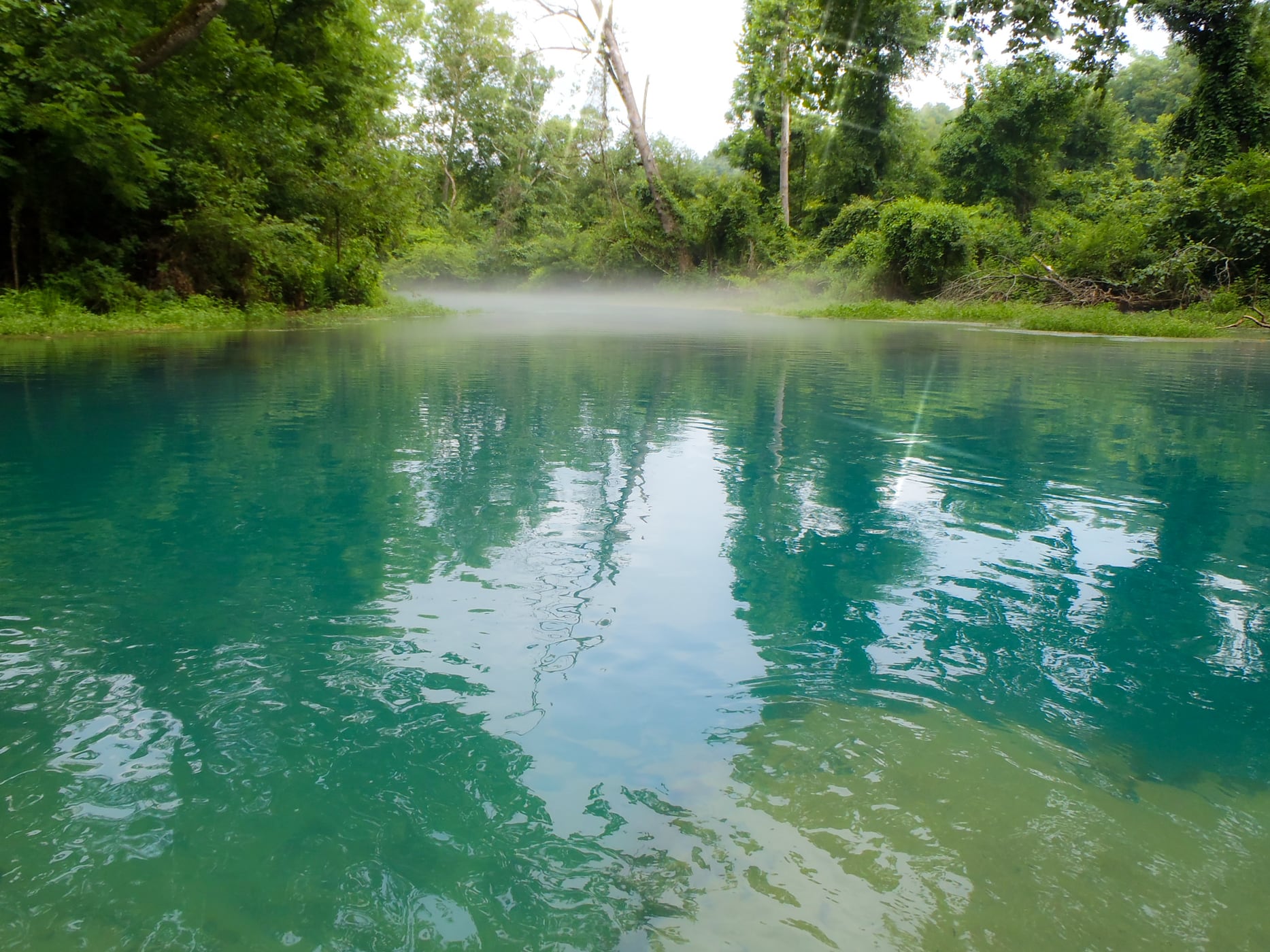
Route gallery
See this route on the water
Photos help show what the access looks like and what the route actually feels like on the water.
Sources
Check the data behind today's call.
Use this section when the page shows stale data, limited confidence, or a call you want to verify before driving.
Why this score Today's data confidence is checking
Data confidence mostly comes down to three things: how direct the gauge is, how clear the range is, and how fresh the data is.
- Checking data confidence notes.
- Checking data confidence cautions.
Outlook Tomorrow and weekend
This is a cautious early look. If the data is too thin, we leave it out.
Waiting on forecast.
Waiting on forecast.
Data behind the score Gauge, thresholds, and timing
These are the live readings and threshold notes behind today's score.
| Gauge site | Eleven Point River near Bardley, MO |
| Discharge | Checking |
| Gauge height | Checking |
| 24h trend | Checking |
| 24h change | Checking |
| Current band | Checking |
| Rain last 24h | Checking |
| Rain last 72h | Checking |
| Air temp | Checking |
| Water temp | Checking |
| Wind | Checking |
| Gusts | Checking |
| Rain timing | Checking |
| Ideal range | Needs paddler reports |
| Known low-water floor | 300 cfs |
| High threshold | Not calibrated yet |
| Data confidence behind the range | Local route guidance |
| Gauge observed | Checking |
| Paddle Today updated | Checking |
| Main source behind this score | Rivers.MOHERP Bardley gauge rating and Whitten-to-Riverton trip logs |
| Gauge source | Checking |
| Weather source | Checking |
| Rainfall source | Checking |
Notes What to know before you go
These notes cover the access details, route quirks, and source caveats most likely to matter once you get there.
- Official day-float shape Whitten to Riverton, about 8 miles
The Forest Service says Whitten is a popular launch/take-out and specifically notes visitors travelling downriver 8 miles from Whitten to Riverton.
- Public put-in Whitten River Access
The Forest Service lists Whitten as open, located on the right bank, with a vault toilet, single-lane concrete boat ramp, parking for vehicles with trailers, and coordinates 36.732356, -91.214837.
- Public take-out Riverton East River Access
The Forest Service lists Riverton East as open and 7.6 miles downriver of Whitten, with a paved road, concrete boat ramp, parking, canoe launch, vault toilet, no fee, and coordinates 36.649183, -91.199614.
- Direct gauge USGS 07071500
USGS operates Eleven Point River near Bardley, MO, downstream in the same lower Eleven Point corridor; American Whitewater also ties the broader Highway 19-to-Highway 160 reach to the Bardley gauge.
- Low-water floor 300 cfs minimum-only
Rivers.MOHERP rates the Bardley gauge good beginning at 300 cfs and includes Whitten-to-Riverton trip evidence at 644 cfs where the paddler notes the water was just high enough to carry nearly every riffle without hitting rocks.
- Route character Shoals, cold water, Halls Bay
Forest Service river-mile notes call out Conner Chute, Boze Mill Spring, and Halls Bay, where the river divides and the right channel is best above normal water while the left is a tricky shallow S-curve with swift water.
Verify it yourself Check the source links
Use these links to double-check the gauge, route details, and access notes before you head out.
Paddler reports
Recent notes from paddlers
A few quick notes from people who were on this route recently.
Reports
Photos, paddler notes, and updates.
See what others have shared, then add a condition report, upload photos, or flag anything that needs fixing.
Share your trip
Keep exploring
More routes to check next
Compare another stretch on this river, or jump to nearby options before you pick a plan.
Quick answers
Eleven Point River paddling FAQ
What water level is good for paddling Eleven Point River?
Paddle Today watches Eleven Point River near Bardley, MO and uses 300 cfs as the conservative low-water floor for this route. The ideal range still needs more paddler reports.
Where does this Eleven Point River route start and end?
This route starts at Whitten River Access and ends at Riverton East River Access / Highway 160, about About 8 mi on the water.
Is this Eleven Point River route good for beginners?
This is listed as an easy route, but conditions still matter. Check today's score, water level, weather, and access notes before you go.
Flag a change
See something outdated?
Access, hazards, wood, and shuttle details change. Send a quick correction if something looks off.