Minnesota | East Central Minnesota
Kettle River
#5 trailer access to #6 trailer access
Check current paddling conditions for this Kettle River route, including water level, recent gauge trend, weather, and route details.
Route snapshot
Loading the route snapshot. This usually takes a few seconds.
Today
Get the answer fast, then scan the route.
Start with the verdict, current conditions, route plan, and quick facts before you commit to the drive.
Today's conditions
Gauge
Recent trend
Checking preferred range.
Checking trend.
Gauge source
-- Checking timestampMN DNR provides the current paddling level here, but not chart-ready recent samples.
Weather
Best window today
Checking weather.
Today by hour
Short-route forecast
Checking the next several hours.
Quick facts
Plan
Dial in the shuttle, distance, and access.
Use this section once the route looks viable and you need to turn it into an actual trip plan.
Access plan
Access, shuttle, and map
The official Map 2 reach is a mostly-flatwater day trip with one Class I rapid around river mile 11. Use the Sandstone gauge as a trend check and stay conservative after rain.
Put-in
#5 trailer access (Kettle River State Water Trail - Map 2) Open mapThe route pair and mileage are backed by MN DNR Map 2, but landing amenities and seasonal closures still need on-site confirmation.
Take-out
#6 trailer access (Kettle River State Water Trail - Map 2) Open mapVerify parking and launch conditions at both trailer accesses before you leave a shuttle vehicle.
Pulling access map tiles. Usually under 5 seconds.
Access caveats
- The route pair and mileage are backed by MN DNR Map 2, but landing amenities and seasonal closures still need on-site confirmation.
- Verify parking and launch conditions at both trailer accesses before you leave a shuttle vehicle.
Watch for
- Debris or strainers after storms and in high water.
- The Class I rapid around river mile 11.
- Cold-water risk in shoulder seasons.
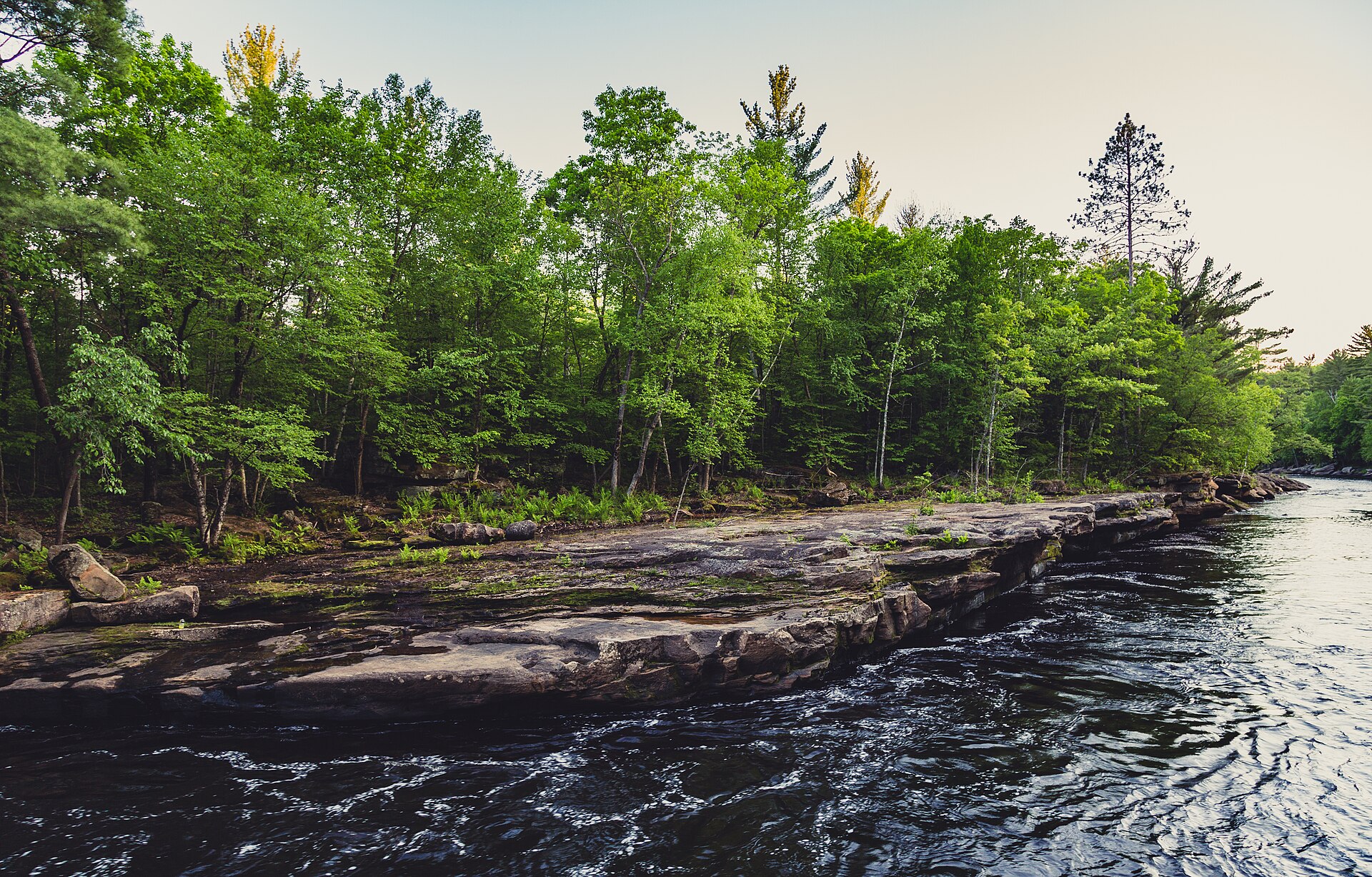
Route gallery
See this route on the water
Photos help show what the access looks like and what the route actually feels like on the water.
Sources
Check the data behind today's call.
Use this section when the page shows stale data, limited confidence, or a call you want to verify before driving.
Why this score Today's data confidence is checking
Data confidence mostly comes down to three things: how direct the gauge is, how clear the range is, and how fresh the data is.
- Checking data confidence notes.
- Checking data confidence cautions.
Outlook Tomorrow and weekend
This is a cautious early look. If the data is too thin, we leave it out.
Waiting on forecast.
Waiting on forecast.
Data behind the score Gauge, thresholds, and timing
These are the live readings and threshold notes behind today's score.
| Gauge site | Kettle River near Sandstone, MN |
| Gauge height | Checking |
| Discharge | Checking |
| 24h trend | Checking |
| 24h change | Checking |
| Current band | Checking |
| Rain last 24h | Checking |
| Rain last 72h | Checking |
| Air temp | Checking |
| Water temp | Checking |
| Wind | Checking |
| Gusts | Checking |
| Rain timing | Checking |
| Target band | 6.00 ft to 10.00 ft |
| Low threshold | 6.00 ft |
| High threshold | 10.00 ft |
| Data confidence behind the range | Official and local sources |
| Gauge observed | Checking |
| Paddle Today updated | Checking |
| Main source behind this score | American Whitewater Lower Kettle gauge info |
| Gauge source | Checking |
| Weather source | Checking |
| Rainfall source | Checking |
Notes What to know before you go
These notes cover the access details, route quirks, and source caveats most likely to matter once you get there.
- Working gauge band 6.0 to 10.0 ft
American Whitewater lists this as the Lower Kettle gauge range at Sandstone for the same reach family.
- DNR route context Mostly flat water, one Class I rapid
MN DNR Map 2 describes the #5 to #6 day trip as mostly flat water with a noted Class I rapid around river mile 11.
- Flow style Runoff sensitive
The Sandstone gauge trend matters almost as much as the current reading because this reach responds to rain and spring runoff.
- Difficulty Moderate
This is not technical whitewater, but it is still a longer river day that deserves respect once levels rise.
Verify it yourself Check the source links
Use these links to double-check the gauge, route details, and access notes before you head out.
Paddler reports
Recent notes from paddlers
A few quick notes from people who were on this route recently.
Reports
Photos, paddler notes, and updates.
See what others have shared, then add a condition report, upload photos, or flag anything that needs fixing.
Share your trip
Keep exploring
More routes to check next
Compare another stretch on this river, or jump to nearby options before you pick a plan.
More in Minnesota
All 46 routesNearby routes by distance
Quick answers
Kettle River paddling FAQ
What water level is good for paddling Kettle River?
Paddle Today watches Kettle River near Sandstone, MN and treats 6.00 ft to 10.00 ft as the target band for this route, with weather and recent trend included in the final score.
Where does this Kettle River route start and end?
This route starts at #5 trailer access (Kettle River State Water Trail - Map 2) and ends at #6 trailer access (Kettle River State Water Trail - Map 2), about 7.2 river mi on the water.
Is this Kettle River route good for beginners?
This is listed as a moderate route. Expect more planning than an easy float, and use the live score, route notes, and source links before committing.
Flag a change
See something outdated?
Access, hazards, wood, and shuttle details change. Send a quick correction if something looks off.