Minnesota | Northwest Minnesota
Red Lake River
Smiley Bridge to Centennial Park
Check current paddling conditions for this Red Lake River route, including water level, recent gauge trend, weather, and route details.
Route snapshot
Loading the route snapshot. This usually takes a few seconds.
Today
Get the answer fast, then scan the route.
Start with the verdict, current conditions, route plan, and quick facts before you commit to the drive.
Today's conditions
Gauge
Recent trend
Checking preferred range.
Checking trend.
Gauge source
-- Checking timestampMN DNR provides the current paddling level here, but not chart-ready recent samples.
Weather
Best window today
Checking weather.
Today by hour
Short-route forecast
Checking the next several hours.
Quick facts
Plan
Dial in the shuttle, distance, and access.
Use this section once the route looks viable and you need to turn it into an actual trip plan.
Access plan
Access, shuttle, and map
Put in at Smiley Bridge and take out at Centennial Park for MN DNR's 12.3-mile beginner-friendly Red Lake River trip into Thief River Falls.
Put-in
Smiley Bridge public water access Open mapSmiley Bridge is a public access at County Road 7, while Centennial Park is a trailer access at Highway 1 with city-park amenities.
Take-out
Centennial Park / Highway 1 trailer access Open mapThe route ends near Thief River Falls; know downstream dam and access locations before continuing past Centennial Park.
Pulling access map tiles. Usually under 5 seconds.
Access caveats
- Smiley Bridge is a public access at County Road 7, while Centennial Park is a trailer access at Highway 1 with city-park amenities.
- The route ends near Thief River Falls; know downstream dam and access locations before continuing past Centennial Park.
- Upstream Red Lake Reservation waters have separate restrictions; this route starts downstream at Smiley Bridge.
Watch for
- Several dams exist elsewhere on the Red Lake River; stay with the planned Centennial Park take-out.
- Higher water can increase current and debris even on this generally gentle segment.
- Wind exposure on open farmland bends and low grassy banks.
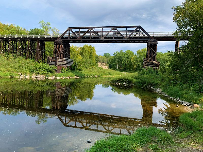
Route gallery
See this route on the water
Photos help show what the access looks like and what the route actually feels like on the water.
Sources
Check the data behind today's call.
Use this section when the page shows stale data, limited confidence, or a call you want to verify before driving.
Why this score Today's data confidence is checking
Data confidence mostly comes down to three things: how direct the gauge is, how clear the range is, and how fresh the data is.
- Checking data confidence notes.
- Checking data confidence cautions.
Outlook Tomorrow and weekend
This is a cautious early look. If the data is too thin, we leave it out.
Waiting on forecast.
Waiting on forecast.
Data behind the score Gauge, thresholds, and timing
These are the live readings and threshold notes behind today's score.
| Gauge site | Red Lake River at Thief River Falls, Zeh St W |
| Gauge elevation | Checking |
| Discharge | Checking |
| 24h trend | Checking |
| 24h change | Checking |
| Current band | Checking |
| Rain last 24h | Checking |
| Rain last 72h | Checking |
| Air temp | Checking |
| Water temp | Checking |
| Wind | Checking |
| Gusts | Checking |
| Rain timing | Checking |
| Target band | 1099.00 ft to 1103.00 ft |
| Low threshold | 1098.00 ft |
| High threshold | 1105.00 ft |
| Data confidence behind the range | Official data source |
| Gauge observed | Checking |
| Paddle Today updated | Checking |
| Main source behind this score | MN DNR river-level interpretation bands for Red Lake River at Thief River Falls |
| Gauge source | Checking |
| Weather source | Checking |
| Rainfall source | Checking |
Notes What to know before you go
These notes cover the access details, route quirks, and source caveats most likely to matter once you get there.
- DNR bands 1,098 / 1,099-1,103 / 1,105 ft gauge elevation
MN DNR interprets the Thief River Falls gauge elevation as Scrapable below 1,098 ft, Low from 1,098 to 1,099, Medium from 1,099 to 1,103, High from 1,103 to 1,105, and Very High above 1,105. This is not river depth.
- Recommended trip 12.3 river miles
MN DNR recommends Smiley Bridge carry-in to Centennial Park trailer access as a gentle Red Lake River day trip that is good for beginner paddlers.
- Map support Smiley Bridge RM 140.9 to Centennial Park RM 128.6
DNR Map 1 places Smiley Bridge / County Road 7 at river mile 140.9 and Centennial Park / Highway 1 at river mile 128.6, with park amenities at the take-out.
- Take-out amenities Picnic, toilets, water, fishing pier, parking
DNR Map 1 notes that Centennial Park has a picnic shelter, toilets, drinking water, fishing pier, and public parking.
Verify it yourself Check the source links
Use these links to double-check the gauge, route details, and access notes before you head out.
Paddler reports
Recent notes from paddlers
A few quick notes from people who were on this route recently.
Reports
Photos, paddler notes, and updates.
See what others have shared, then add a condition report, upload photos, or flag anything that needs fixing.
Share your trip
Keep exploring
More routes to check next
Compare another stretch on this river, or jump to nearby options before you pick a plan.
More in Minnesota
All 46 routesNearby routes by distance
Quick answers
Red Lake River paddling FAQ
What water level is good for paddling Red Lake River?
Paddle Today watches Red Lake River at Thief River Falls, Zeh St W and treats 1099.00 ft to 1103.00 ft as the target band for this route, with weather and recent trend included in the final score.
Where does this Red Lake River route start and end?
This route starts at Smiley Bridge public water access and ends at Centennial Park / Highway 1 trailer access, about 12.3 mi on the water.
Is this Red Lake River route good for beginners?
This is listed as an easy route, but conditions still matter. Check today's score, water level, weather, and access notes before you go.
Flag a change
See something outdated?
Access, hazards, wood, and shuttle details change. Send a quick correction if something looks off.