See all 12 routes on Wisconsin River
Wisconsin | Lower Wisconsin Riverway
Wisconsin River
Sauk City to Arena Landing
Check current paddling conditions for this Wisconsin River route, including water level, recent gauge trend, weather, and route details.
Route snapshot
Loading the route snapshot. This usually takes a few seconds.
Today
Get the answer fast, then scan the route.
Start with the verdict, current conditions, route plan, and quick facts before you commit to the drive.
Today's conditions
Gauge
Recent trend
Checking preferred range.
Checking trend.
Gauge source
-- Checking timestampMN DNR provides the current paddling level here, but not chart-ready recent samples.
Weather
Best window today
Checking weather.
Today by hour
Short-route forecast
Checking the next several hours.
Quick facts
Plan
Dial in the shuttle, distance, and access.
Use this section once the route looks viable and you need to turn it into an actual trip plan.
Access plan
Access, shuttle, and map
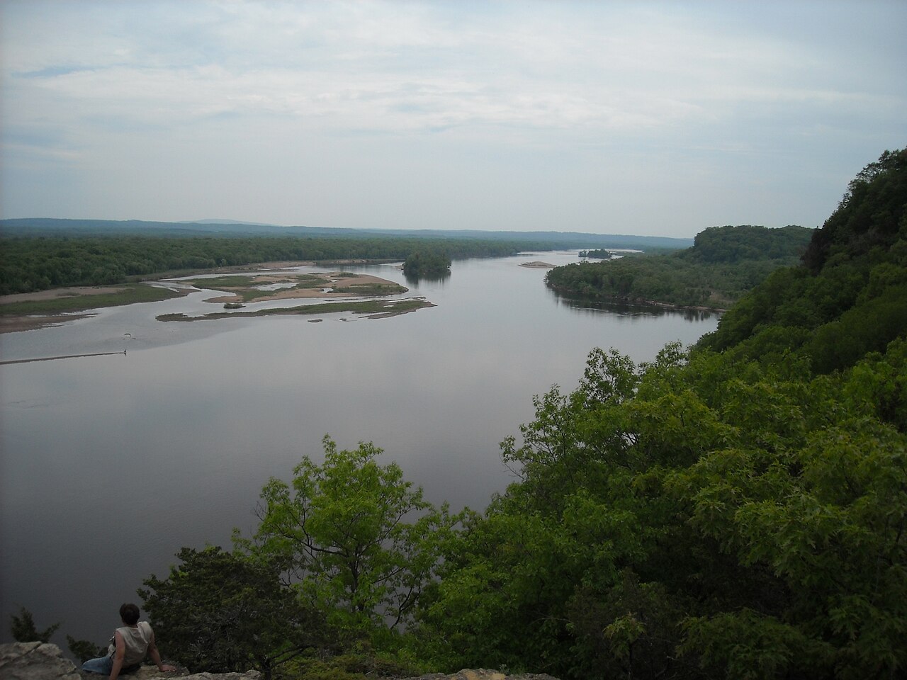
Launch from the Sauk City/Sauk Prairie landing corridor and take out at Arena Landing. This is one of the classic upper Lower Wisconsin day trips, with broad sandbars and easy current in the normal summer gauge window.
Put-in
Sauk Canoe Access Open mapWisconsin DNR lists both the Sauk/Prairie du Sac corridor and Arena among major public access points for the Lower Wisconsin State Riverway; the saved put-in is the Sauk Canoe Access point used by Lower Wisconsin paddling guides.
Take-out
Arena Landing Open mapPaddling.com describes the Sauk Canoe Access as having a large parking lot and sandy carry, but warns the river-side access can be easy to miss from the water.
Pulling access map tiles. Usually under 5 seconds.
Access caveats
- Wisconsin DNR lists both the Sauk/Prairie du Sac corridor and Arena among major public access points for the Lower Wisconsin State Riverway; the saved put-in is the Sauk Canoe Access point used by Lower Wisconsin paddling guides.
- Paddling.com describes the Sauk Canoe Access as having a large parking lot and sandy carry, but warns the river-side access can be easy to miss from the water.
- The Lower Wisconsin has many optional landings, but this route is scored specifically for Sauk City to Arena so distance and shuttle timing stay honest.
Watch for
- Crowded summer weekends and outfitter traffic.
- Hidden current and sudden sandbar drop-offs, especially when wading.
- High water that reduces sandbars and opens faster side channels with strainers.
Route gallery
See this route on the water
Photos help show what the access looks like and what the route actually feels like on the water.
Sources
Check the data behind today's call.
Use this section when the page shows stale data, limited confidence, or a call you want to verify before driving.
Why this score Today's data confidence is checking
Data confidence mostly comes down to three things: how direct the gauge is, how clear the range is, and how fresh the data is.
- Checking data confidence notes.
- Checking data confidence cautions.
Outlook Tomorrow and weekend
This is a cautious early look. If the data is too thin, we leave it out.
Waiting on forecast.
Waiting on forecast.
Data behind the score Gauge, thresholds, and timing
These are the live readings and threshold notes behind today's score.
| Gauge site | Wisconsin River at Muscoda, WI |
| Discharge | Checking |
| Gauge height | Checking |
| 24h trend | Checking |
| 24h change | Checking |
| Current band | Checking |
| Rain last 24h | Checking |
| Rain last 72h | Checking |
| Air temp | Checking |
| Water temp | Checking |
| Wind | Checking |
| Gusts | Checking |
| Rain timing | Checking |
| Target band | 4,000 cfs to 10,000 cfs |
| Low threshold | 2,500 cfs |
| High threshold | 20,000 cfs |
| Data confidence behind the range | Official and local sources |
| Gauge observed | Checking |
| Paddle Today updated | Checking |
| Main source behind this score | Wisconsin Trail Guide Lower Wisconsin Riverway suggested river levels |
| Gauge source | Checking |
| Weather source | Checking |
| Rainfall source | Checking |
Notes What to know before you go
These notes cover the access details, route quirks, and source caveats most likely to matter once you get there.
- Official route Sauk City to Arena, 11 miles
Wisconsin DNR lists Sauk City to Arena as an 11-mile Lower Wisconsin State Riverway canoe route with an estimated 3.5-hour paddling time.
- Put-in support Sauk Canoe Access
Paddling.com lists Sauk Canoe Access on the Wisconsin River at 43.2566, -89.742 with a large parking lot and sandy carry to the river.
- Published level bands 4,000 to 10,000 cfs normal
Wisconsin Trail Guide treats 4,000 to 10,000 cfs at Muscoda as normal summer conditions, 17,000 to 20,000 cfs as high-water day-trip only, and above 20,000 cfs as paddling not recommended.
- Route structure Separate scored segment
The Lower Wisconsin can be chained between many landings, but the app keeps Sauk City to Arena separate so mileage, shuttle time, and day-trip expectations stay accurate.
- Primary hazards Hidden current and sandbar drop-offs
Wisconsin DNR and Wisconsin Trail Guide both warn that the river can look slow while hidden current, sudden drop-offs, and shifting sandbars create real risk.
Verify it yourself Check the source links
Use these links to double-check the gauge, route details, and access notes before you head out.
Paddler reports
Recent notes from paddlers
A few quick notes from people who were on this route recently.
Reports
Photos, paddler notes, and updates.
See what others have shared, then add a condition report, upload photos, or flag anything that needs fixing.
Share your trip
Keep exploring
More routes to check next
Compare another stretch on this river, or jump to nearby options before you pick a plan.
Quick answers
Wisconsin River paddling FAQ
What water level is good for paddling Wisconsin River?
Paddle Today watches Wisconsin River at Muscoda, WI and treats 4,000 cfs to 10,000 cfs as the target band for this route, with weather and recent trend included in the final score.
Where does this Wisconsin River route start and end?
This route starts at Sauk Canoe Access and ends at Arena Landing, about 11 mi on the water.
Is this Wisconsin River route good for beginners?
This is listed as an easy route, but conditions still matter. Check today's score, water level, weather, and access notes before you go.
Flag a change
See something outdated?
Access, hazards, wood, and shuttle details change. Send a quick correction if something looks off.