See all 2 routes on Cannon River
Minnesota | Southeast Minnesota
Cannon River
Cannon Falls to Welch
Check current paddling conditions for this Cannon River route, including water level, recent gauge trend, weather, and route details.
Route snapshot
Loading the route snapshot. This usually takes a few seconds.
Today
Get the answer fast, then scan the route.
Start with the verdict, current conditions, route plan, and quick facts before you commit to the drive.
Today's conditions
Gauge
Recent trend
Checking preferred range.
Checking trend.
Gauge source
-- Checking timestampMN DNR provides the current paddling level here, but not chart-ready recent samples.
Weather
Best window today
Checking weather.
Today by hour
Short-route forecast
Checking the next several hours.
Quick facts
Plan
Dial in the shuttle, distance, and access.
Use this section once the route looks viable and you need to turn it into an actual trip plan.
Access plan
Access, shuttle, and map
Put in at Riverside Park in Cannon Falls and take out at Welch Mill. Confirm access rules and any fees at both endpoints before staging a shuttle.
Put-in
Riverside Park canoe launch (Cannon Falls) Open mapRiverside Park has an official canoe launch, but local parking or day-use rules can still change.
Take-out
Welch Mill Canoeing, Tubing & Kayaking (Welch) Open mapWelch Mill is a private take-out. Confirm landing rules and any take-out fee before leaving a vehicle there.
Pulling access map tiles. Usually under 5 seconds.
Access caveats
- Riverside Park has an official canoe launch, but local parking or day-use rules can still change.
- Welch Mill is a private take-out. Confirm landing rules and any take-out fee before leaving a vehicle there.
Watch for
- Wood or debris after storms, especially on outside bends and blind corners.
- Heavy tuber traffic in summer can slow the day and complicate landing space.
- Cold-water risk outside summer.
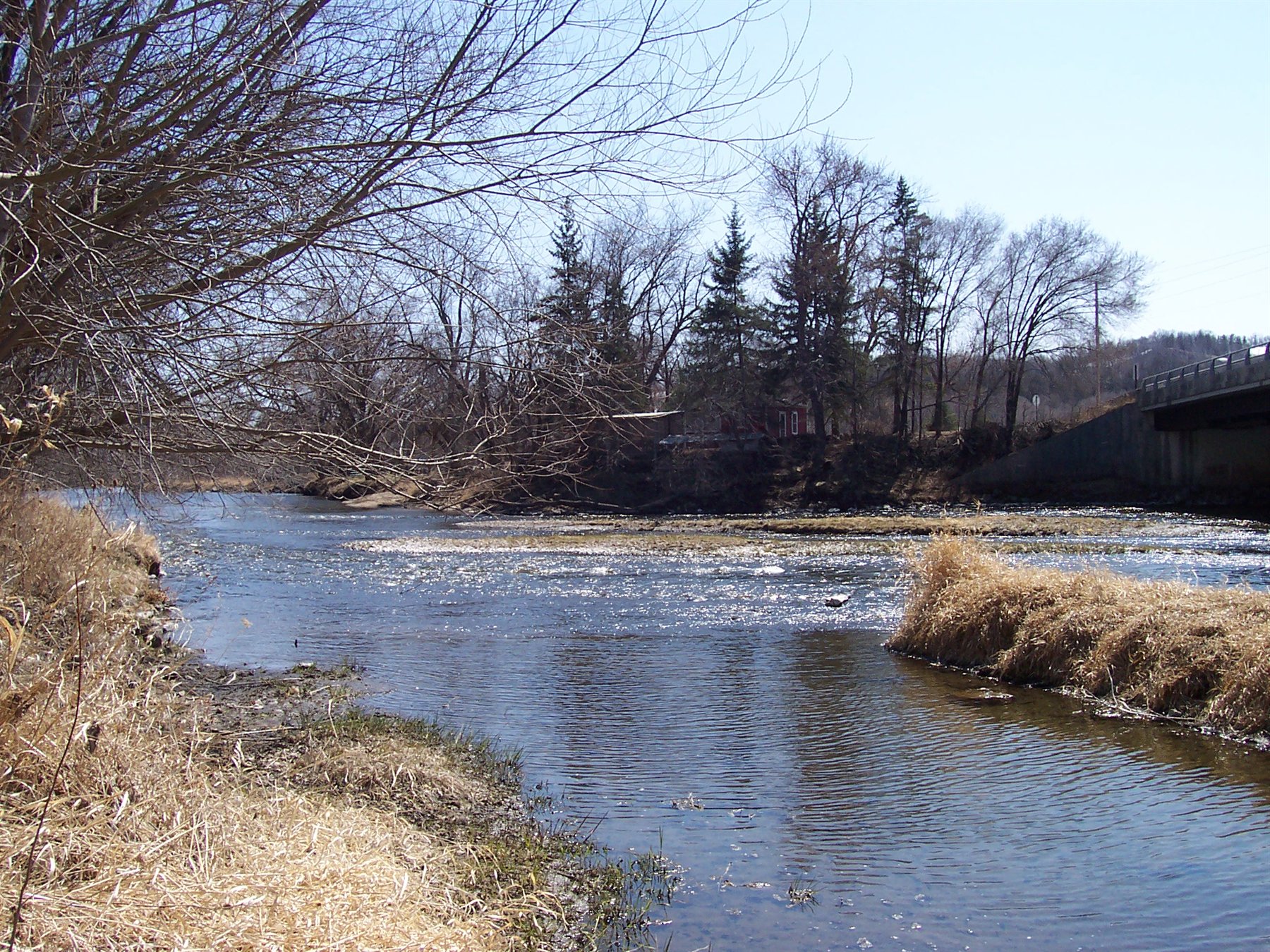
Route gallery
See this route on the water
Photos help show what the access looks like and what the route actually feels like on the water.
Sources
Check the data behind today's call.
Use this section when the page shows stale data, limited confidence, or a call you want to verify before driving.
Why this score Today's data confidence is checking
Data confidence mostly comes down to three things: how direct the gauge is, how clear the range is, and how fresh the data is.
- Checking data confidence notes.
- Checking data confidence cautions.
Outlook Tomorrow and weekend
This is a cautious early look. If the data is too thin, we leave it out.
Waiting on forecast.
Waiting on forecast.
Data behind the score Gauge, thresholds, and timing
These are the live readings and threshold notes behind today's score.
| Gauge site | Cannon River at Welch, MN |
| Discharge | Checking |
| Gauge height | Checking |
| 24h trend | Checking |
| 24h change | Checking |
| Current band | Checking |
| Rain last 24h | Checking |
| Rain last 72h | Checking |
| Air temp | Checking |
| Water temp | Checking |
| Wind | Checking |
| Gusts | Checking |
| Rain timing | Checking |
| Target band | 300 cfs to 700 cfs |
| Low threshold | 220 cfs |
| High threshold | 1,540 cfs |
| Data confidence behind the range | Official and local sources |
| Gauge observed | Checking |
| Paddle Today updated | Checking |
| Main source behind this score | MilesPaddled Cannon River II numeric range notes |
| Gauge source | Checking |
| Weather source | Checking |
| Rainfall source | Checking |
Notes What to know before you go
These notes cover the access details, route quirks, and source caveats most likely to matter once you get there.
- Ideal gauge 300 to 700 cfs
Primary sweet spot from MilesPaddled. The same source treats 300 to 1,540 cfs as medium rather than extreme.
- DNR level context 310 cfs = Normal; 1,840 cfs = High
MN DNR weekly stream-flow reports classified Welch as Normal at 310 cfs on October 18, 2021 and High at 1,840 cfs on May 2, 2011.
- Difficulty Easy
Good first-pass river, but not a blind yes when levels spike.
- Primary caution Welch take-out logistics
Private landing context reduces confidence outside well-known conditions.
Verify it yourself Check the source links
Use these links to double-check the gauge, route details, and access notes before you head out.
Paddler reports
Recent notes from paddlers
A few quick notes from people who were on this route recently.
Reports
Photos, paddler notes, and updates.
See what others have shared, then add a condition report, upload photos, or flag anything that needs fixing.
Share your trip
Keep exploring
More routes to check next
Compare another stretch on this river, or jump to nearby options before you pick a plan.
Quick answers
Cannon River paddling FAQ
What water level is good for paddling Cannon River?
Paddle Today watches Cannon River at Welch, MN and treats 300 cfs to 700 cfs as the target band for this route, with weather and recent trend included in the final score.
Where does this Cannon River route start and end?
This route starts at Riverside Park canoe launch (Cannon Falls) and ends at Welch Mill Canoeing, Tubing & Kayaking (Welch), about 11.75 mi on the water.
Is this Cannon River route good for beginners?
This is listed as an easy route, but conditions still matter. Check today's score, water level, weather, and access notes before you go.
Flag a change
See something outdated?
Access, hazards, wood, and shuttle details change. Send a quick correction if something looks off.