Minnesota | Southwest Minnesota
Cottonwood River
Juenemann Landing to Springfield
Check current paddling conditions for this Cottonwood River route, including water level, recent gauge trend, weather, and route details.
Route snapshot
Loading the route snapshot. This usually takes a few seconds.
Today
Get the answer fast, then scan the route.
Start with the verdict, current conditions, route plan, and quick facts before you commit to the drive.
Today's conditions
Gauge
Recent trend
Checking preferred range.
Checking trend.
Gauge source
-- Checking timestampMN DNR provides the current paddling level here, but not chart-ready recent samples.
Weather
Best window today
Checking weather.
Today by hour
Short-route forecast
Checking the next several hours.
Quick facts
Plan
Dial in the shuttle, distance, and access.
Use this section once the route looks viable and you need to turn it into an actual trip plan.
Access plan
Access, shuttle, and map
Launch at Juenemann Landing on County Road 2 and take out at Springfield Riverside Park. This short Cottonwood reach has the gauge at the put-in, so the level call is unusually direct.
Put-in
Juenemann Landing / County Road 2 public water access Open mapJuenemann is a Brown County canoe landing on County Road 2 with vehicle parking; the DNR access record does not list a restroom.
Take-out
Springfield Public Water Access / Riverside Park canoe landing Open mapSpringfield is a carry-in access in Riverside Park with restroom support in the public-access record.
Pulling access map tiles. Usually under 5 seconds.
Access caveats
- Juenemann is a Brown County canoe landing on County Road 2 with vehicle parking; the DNR access record does not list a restroom.
- Springfield is a carry-in access in Riverside Park with restroom support in the public-access record.
- DNR supports the access points and river-level ladder, but this exact short segment is not presented as a highlighted recommended day trip.
Watch for
- Scraping and slow travel when the County Road 2 gauge drops toward the scrapable band.
- Deadfall, overhanging trees, and muddy banks after higher water.
- Private shoreland; stop only at public accesses or clearly legal sites.
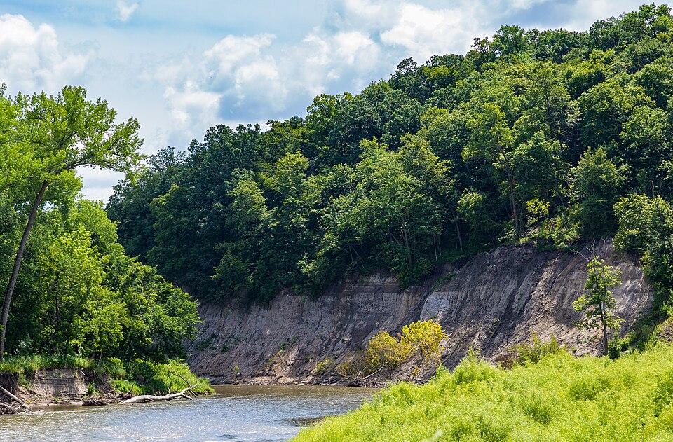
Route gallery
See this route on the water
Photos help show what the access looks like and what the route actually feels like on the water.
Sources
Check the data behind today's call.
Use this section when the page shows stale data, limited confidence, or a call you want to verify before driving.
Why this score Today's data confidence is checking
Data confidence mostly comes down to three things: how direct the gauge is, how clear the range is, and how fresh the data is.
- Checking data confidence notes.
- Checking data confidence cautions.
Outlook Tomorrow and weekend
This is a cautious early look. If the data is too thin, we leave it out.
Waiting on forecast.
Waiting on forecast.
Data behind the score Gauge, thresholds, and timing
These are the live readings and threshold notes behind today's score.
| Gauge site | Cottonwood River nr Springfield, CR2 |
| Gauge height | Checking |
| Discharge | Checking |
| 24h trend | Checking |
| 24h change | Checking |
| Current band | Checking |
| Rain last 24h | Checking |
| Rain last 72h | Checking |
| Air temp | Checking |
| Water temp | Checking |
| Wind | Checking |
| Gusts | Checking |
| Rain timing | Checking |
| Target band | 13.00 ft to 17.00 ft |
| Low threshold | 12.50 ft |
| High threshold | 19.00 ft |
| Data confidence behind the range | Official data source |
| Gauge observed | Checking |
| Paddle Today updated | Checking |
| Main source behind this score | MN DNR river-level interpretation bands for Cottonwood River near Springfield |
| Gauge source | Checking |
| Weather source | Checking |
| Rainfall source | Checking |
Notes What to know before you go
These notes cover the access details, route quirks, and source caveats most likely to matter once you get there.
- DNR bands 12.5 / 13.0-17.0 / 19.0 ft
MN DNR interprets the Springfield / County Road 2 gauge as Scrapable below 12.5 ft, Low from 12.5 to 13.0, Medium from 13.0 to 17.0, High from 17.0 to 19.0, and Very High above 19.0.
- Route shape 6.4 river miles
MN DNR Map 4 lists Juenemann carry-in access at river mile 62.8 and Springfield carry-in access at river mile 56.4 on the Cottonwood River.
- Public access records DNR access IDs WAS01422 and WAS01421
Minnesota public-water-access data identifies the put-in as Cottonwood River, Co Rd 2 Juenemann Landing and the take-out as Cottonwood River, Springfield Public Water Access Site.
- County landing support Brown County canoe access
Brown County lists Jueneman Landing as one of four county Cottonwood River canoe access points, with vehicle parking and day-use from April 15 through October 15.
- River character No major rapids
MN DNR says the Cottonwood has no major rapids and is a good river for beginning paddlers, while still warning paddlers to check water levels and avoid dead or overhanging trees.
Verify it yourself Check the source links
Use these links to double-check the gauge, route details, and access notes before you head out.
Paddler reports
Recent notes from paddlers
A few quick notes from people who were on this route recently.
Reports
Photos, paddler notes, and updates.
See what others have shared, then add a condition report, upload photos, or flag anything that needs fixing.
Share your trip
Keep exploring
More routes to check next
Compare another stretch on this river, or jump to nearby options before you pick a plan.
More in Minnesota
All 46 routesNearby routes by distance
Quick answers
Cottonwood River paddling FAQ
What water level is good for paddling Cottonwood River?
Paddle Today watches Cottonwood River nr Springfield, CR2 and treats 13.00 ft to 17.00 ft as the target band for this route, with weather and recent trend included in the final score.
Where does this Cottonwood River route start and end?
This route starts at Juenemann Landing / County Road 2 public water access and ends at Springfield Public Water Access / Riverside Park canoe landing, about 6.4 mi on the water.
Is this Cottonwood River route good for beginners?
This is listed as an easy route, but conditions still matter. Check today's score, water level, weather, and access notes before you go.
Flag a change
See something outdated?
Access, hazards, wood, and shuttle details change. Send a quick correction if something looks off.