See all 4 routes on Minnesota River
Minnesota | Lower Minnesota Valley
Minnesota River
Henderson Station to Belle Plaine
Check current paddling conditions for this Minnesota River route, including water level, recent gauge trend, weather, and route details.
Route snapshot
Loading the route snapshot. This usually takes a few seconds.
Today
Get the answer fast, then scan the route.
Start with the verdict, current conditions, route plan, and quick facts before you commit to the drive.
Today's conditions
Gauge
Recent trend
Checking preferred range.
Checking trend.
Gauge source
-- Checking timestampMN DNR provides the current paddling level here, but not chart-ready recent samples.
Weather
Best window today
Checking weather.
Today by hour
Short-route forecast
Checking the next several hours.
Quick facts
Plan
Dial in the shuttle, distance, and access.
Use this section once the route looks viable and you need to turn it into an actual trip plan.
Access plan
Access, shuttle, and map
Launch at Henderson Station and finish at Belle Plaine for the DNR lower Minnesota day trip. The Jordan gauge gives this route a real official ladder, but wind, pace, and big-river judgment still matter.
Put-in
Henderson Station public water access Open mapHenderson Station is a carry-in with a walk from the gate to the river, not a drive-to-ramp launch.
Take-out
Belle Plaine public water access Open mapBelle Plaine is a proper trailer access at County Road 25, but same-day ramp and parking conditions should still be checked before you commit to a long shuttle.
Pulling access map tiles. Usually under 5 seconds.
Access caveats
- Henderson Station is a carry-in with a walk from the gate to the river, not a drive-to-ramp launch.
- Belle Plaine is a proper trailer access at County Road 25, but same-day ramp and parking conditions should still be checked before you commit to a long shuttle.
Watch for
- Wind and wave exposure on open lower-river reaches.
- A slower-than-expected pace on a 17.4-mile day if the Jordan gauge slips toward the low band.
- Floating debris, overhanging trees, and muddy or sandy banks at landings and breaks.
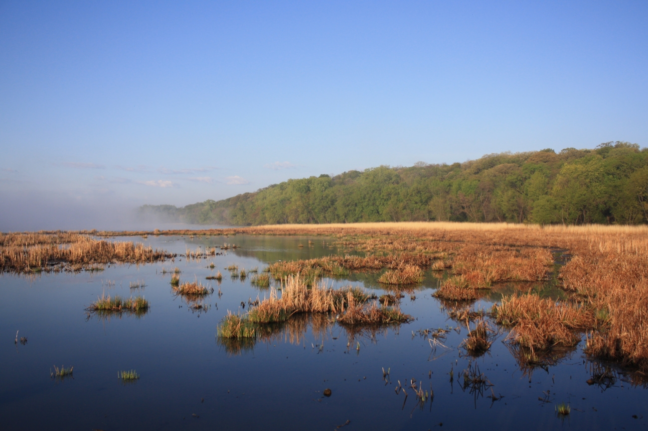
Route gallery
See this route on the water
Photos help show what the access looks like and what the route actually feels like on the water.
Sources
Check the data behind today's call.
Use this section when the page shows stale data, limited confidence, or a call you want to verify before driving.
Why this score Today's data confidence is checking
Data confidence mostly comes down to three things: how direct the gauge is, how clear the range is, and how fresh the data is.
- Checking data confidence notes.
- Checking data confidence cautions.
Outlook Tomorrow and weekend
This is a cautious early look. If the data is too thin, we leave it out.
Waiting on forecast.
Waiting on forecast.
Data behind the score Gauge, thresholds, and timing
These are the live readings and threshold notes behind today's score.
| Gauge site | Minnesota River near Jordan, MN |
| Gauge height | Checking |
| Discharge | Checking |
| 24h trend | Checking |
| 24h change | Checking |
| Current band | Checking |
| Rain last 24h | Checking |
| Rain last 72h | Checking |
| Air temp | Checking |
| Water temp | Checking |
| Wind | Checking |
| Gusts | Checking |
| Rain timing | Checking |
| Target band | 9.00 ft to 12.00 ft |
| Low threshold | 4.00 ft |
| High threshold | 16.00 ft |
| Data confidence behind the range | Official data source |
| Gauge observed | Checking |
| Paddle Today updated | Checking |
| Main source behind this score | MN DNR river-level interpretation bands for Minnesota River near Jordan |
| Gauge source | Checking |
| Weather source | Checking |
| Rainfall source | Checking |
Notes What to know before you go
These notes cover the access details, route quirks, and source caveats most likely to matter once you get there.
- DNR bands 4.0 / 9.0 / 12.0 / 16.0 ft
MN DNR interprets the Jordan gauge as Scrapable below 4.0 ft, Low from 4.0 to 9.0, Medium from 9.0 to 12.0, High from 12.0 to 16.0, and Very High above 16.0.
- Recommended trip 17.4 river miles
MN DNR Map 6 lists Henderson Station carry-in access to Belle Plaine trailer access as the day-trip segment for this lower Minnesota corridor.
- Endpoint authority State access records on both ends
Minnesota public-water-access data identifies Henderson Station Public Water Access at river mile 68.0 and Belle Plaine Public Water Access at river mile 50.4.
- Put-in support County river-access park
Le Sueur County confirms Henderson Station River Access & Park has parking along the gravel entrance road and a walk-in launch point for canoes and kayaks into the Minnesota River.
- Primary cautions Long day, wind, private shoreland
MN DNR Map 6 tells paddlers to expect 2 to 3 river miles per hour, respect private shoreland, and not underestimate wind, waves, or obstacles.
Verify it yourself Check the source links
Use these links to double-check the gauge, route details, and access notes before you head out.
Paddler reports
Recent notes from paddlers
A few quick notes from people who were on this route recently.
Reports
Photos, paddler notes, and updates.
See what others have shared, then add a condition report, upload photos, or flag anything that needs fixing.
Share your trip
Keep exploring
More routes to check next
Compare another stretch on this river, or jump to nearby options before you pick a plan.
Quick answers
Minnesota River paddling FAQ
What water level is good for paddling Minnesota River?
Paddle Today watches Minnesota River near Jordan, MN and treats 9.00 ft to 12.00 ft as the target band for this route, with weather and recent trend included in the final score.
Where does this Minnesota River route start and end?
This route starts at Henderson Station public water access and ends at Belle Plaine public water access, about 17.4 mi on the water.
Is this Minnesota River route good for beginners?
This is listed as an easy route, but conditions still matter. Check today's score, water level, weather, and access notes before you go.
Flag a change
See something outdated?
Access, hazards, wood, and shuttle details change. Send a quick correction if something looks off.