Minnesota | Twin Cities West Metro
Minnehaha Creek
Gray's Bay to Longfellow Lagoon
Check current paddling conditions for this Minnehaha Creek route, including water level, recent gauge trend, weather, and route details.
Route snapshot
Loading the route snapshot. This usually takes a few seconds.
Today
Get the answer fast, then scan the route.
Start with the verdict, current conditions, route plan, and quick facts before you commit to the drive.
Today's conditions
Gauge
Recent trend
Checking preferred range.
Checking trend.
Gauge source
-- Checking timestampMN DNR provides the current paddling level here, but not chart-ready recent samples.
Weather
Best window today
Checking weather.
Today by hour
Short-route forecast
Checking the next several hours.
Quick facts
Plan
Dial in the shuttle, distance, and access.
Use this section once the route looks viable and you need to turn it into an actual trip plan.
Access plan
Access, shuttle, and map
The official MCWD access list turns Minnehaha into a choose-your-segment corridor. Use the planner below instead of assuming one default put-in and take-out.
Access planner
Pick a shorter segment
This changes launch and take-out logistics, not today's river score.
Peltier Lake to Long Lake is the full route. Shorter access pairs are useful when wind, time, or group energy changes the plan.
Put-in
Gray's Bay headwaters Open mapSeveral official access points are parks or roadside landings rather than formal ramps. Confirm parking, legal access, and any current closures on the ground.
Take-out
Longfellow Lagoon Open mapRequired portages around dams and lake transitions matter as much as the gauge on this creek.
Pulling access map tiles. Usually under 5 seconds.
Access caveats
- Several official access points are parks or roadside landings rather than formal ramps. Confirm parking, legal access, and any current closures on the ground.
- Required portages around dams and lake transitions matter as much as the gauge on this creek.
Watch for
- Low bridges, wood, rocks, and fast current after rain, especially when flows rise toward or above 150 cfs.
- Required portages around the Edina Mills dam, the 54th Street dam, and the Lake Nokomis transition.
- Urban access complexity. Use only the designated MCWD landing points rather than random bank openings.
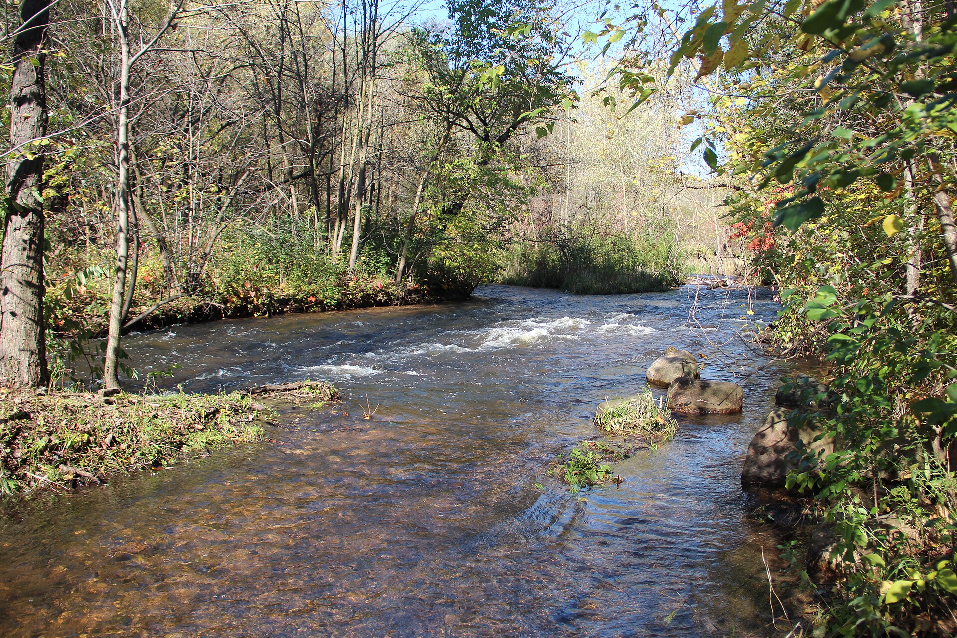
Route gallery
See this route on the water
Photos help show what the access looks like and what the route actually feels like on the water.
Sources
Check the data behind today's call.
Use this section when the page shows stale data, limited confidence, or a call you want to verify before driving.
Why this score Today's data confidence is checking
Data confidence mostly comes down to three things: how direct the gauge is, how clear the range is, and how fresh the data is.
- Checking data confidence notes.
- Checking data confidence cautions.
Outlook Tomorrow and weekend
This is a cautious early look. If the data is too thin, we leave it out.
Waiting on forecast.
Waiting on forecast.
Data behind the score Gauge, thresholds, and timing
These are the live readings and threshold notes behind today's score.
| Gauge site | Minnehaha Creek at Hiawatha Ave. in Minneapolis, MN |
| Discharge | Checking |
| Gauge height | Checking |
| 24h trend | Checking |
| 24h change | Checking |
| Current band | Checking |
| Rain last 24h | Checking |
| Rain last 72h | Checking |
| Air temp | Checking |
| Water temp | Checking |
| Wind | Checking |
| Gusts | Checking |
| Rain timing | Checking |
| Target band | 75 cfs to 150 cfs |
| Low threshold | 75 cfs |
| High threshold | 150 cfs |
| Data confidence behind the range | Official data source |
| Gauge observed | Checking |
| Paddle Today updated | Checking |
| Main source behind this score | Minnehaha Creek Watershed District paddling guidance |
| Gauge source | Checking |
| Weather source | Checking |
| Rainfall source | Checking |
Notes What to know before you go
These notes cover the access details, route quirks, and source caveats most likely to matter once you get there.
- Official band 75 to 150 cfs
MCWD says ideal paddling conditions are when the Hiawatha gauge reads between 75 and 150 cfs.
- Below range Poor
MCWD says below 75 cfs you may need to portage over portions of the creek.
- Above range Dangerous
MCWD says above 150 cfs it becomes difficult to navigate through fast-moving rapids and under bridges.
- Trip length 21.3 miles
MCWD treats the entire creek from Gray's Bay headwaters to Longfellow Lagoon as about 6 to 9 hours, with shorter official sub-segments in between.
Verify it yourself Check the source links
Use these links to double-check the gauge, route details, and access notes before you head out.
Paddler reports
Recent notes from paddlers
A few quick notes from people who were on this route recently.
Reports
Photos, paddler notes, and updates.
See what others have shared, then add a condition report, upload photos, or flag anything that needs fixing.
Share your trip
Keep exploring
More routes to check next
Compare another stretch on this river, or jump to nearby options before you pick a plan.
More in Minnesota
All 46 routesNearby routes by distance
Quick answers
Minnehaha Creek paddling FAQ
What water level is good for paddling Minnehaha Creek?
Paddle Today watches Minnehaha Creek at Hiawatha Ave. in Minneapolis, MN and treats 75 cfs to 150 cfs as the target band for this route, with weather and recent trend included in the final score.
Where does this Minnehaha Creek route start and end?
This route starts at Gray's Bay headwaters and ends at Longfellow Lagoon, about 21.3 mi on the water.
Is this Minnehaha Creek route good for beginners?
This is listed as an easy route, but conditions still matter. Check today's score, water level, weather, and access notes before you go.
Flag a change
See something outdated?
Access, hazards, wood, and shuttle details change. Send a quick correction if something looks off.