See all 3 routes on North Fork Crow River
Minnesota | Twin Cities Northwest Metro
North Fork Crow River
Rockford Access to Riverside County Park
Check current paddling conditions for this North Fork Crow River route, including water level, recent gauge trend, weather, and route details.
Route snapshot
Loading the route snapshot. This usually takes a few seconds.
Today
Get the answer fast, then scan the route.
Start with the verdict, current conditions, route plan, and quick facts before you commit to the drive.
Today's conditions
Gauge
Recent trend
Checking preferred range.
Checking trend.
Gauge source
-- Checking timestampMN DNR provides the current paddling level here, but not chart-ready recent samples.
Weather
Best window today
Checking weather.
Today by hour
Short-route forecast
Checking the next several hours.
Quick facts
Plan
Dial in the shuttle, distance, and access.
Use this section once the route looks viable and you need to turn it into an actual trip plan.
Access plan
Access, shuttle, and map
Launch at the Rockford public water access and take out at Riverside County Park near Hanover. DNR describes this as an 8.5-mile possible day trip on a straight, shallow lower North Fork Crow reach.
Put-in
Rockford Boat Launch / Rockford public water access Open mapThe Rockford access is a small-watercraft launch with moderate bank height and a fishing pier nearby.
Take-out
Riverside County Park / Riverside Park public water access Open mapRiverside County Park is a real Wright County river-access park. The DNR Riverside guide describes the access as somewhat steep but usable for small boats and canoes.
Pulling access map tiles. Usually under 5 seconds.
Access caveats
- The Rockford access is a small-watercraft launch with moderate bank height and a fishing pier nearby.
- Riverside County Park is a real Wright County river-access park. The DNR Riverside guide describes the access as somewhat steep but usable for small boats and canoes.
- This route overlaps the same lower-river gauge family as Riverside-to-Dayton; choose this if you want a shorter day.
Watch for
- Shallow gravel, cobble, and boulder sections when the Rockford gauge falls toward the low band.
- Fresh wood or debris after high water, even though the DNR guide notes few downed trees during its survey.
- Changing landing mud and bank conditions at both accesses after rain.
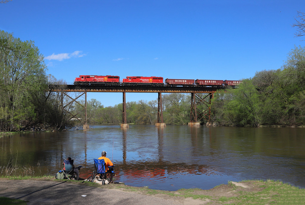
Route gallery
See this route on the water
Photos help show what the access looks like and what the route actually feels like on the water.
Sources
Check the data behind today's call.
Use this section when the page shows stale data, limited confidence, or a call you want to verify before driving.
Why this score Today's data confidence is checking
Data confidence mostly comes down to three things: how direct the gauge is, how clear the range is, and how fresh the data is.
- Checking data confidence notes.
- Checking data confidence cautions.
Outlook Tomorrow and weekend
This is a cautious early look. If the data is too thin, we leave it out.
Waiting on forecast.
Waiting on forecast.
Data behind the score Gauge, thresholds, and timing
These are the live readings and threshold notes behind today's score.
| Gauge site | North Fork Crow River nr Rockford, Farmington Ave |
| Discharge | Checking |
| Gauge height | Checking |
| 24h trend | Checking |
| 24h change | Checking |
| Current band | Checking |
| Rain last 24h | Checking |
| Rain last 72h | Checking |
| Air temp | Checking |
| Water temp | Checking |
| Wind | Checking |
| Gusts | Checking |
| Rain timing | Checking |
| Target band | 500 cfs to 1,500 cfs |
| Low threshold | 345 cfs |
| High threshold | 1,750 cfs |
| Data confidence behind the range | Official data source |
| Gauge observed | Checking |
| Paddle Today updated | Checking |
| Main source behind this score | MN DNR river-level interpretation bands for North Fork Crow River near Rockford |
| Gauge source | Checking |
| Weather source | Checking |
| Rainfall source | Checking |
Notes What to know before you go
These notes cover the access details, route quirks, and source caveats most likely to matter once you get there.
- DNR bands 345 / 500-1,500 / 1,750 cfs
MN DNR interprets the Rockford reading as Scrapable below 345 cfs, Low from 345 to 500, Medium from 500 to 1,500, High from 1,500 to 1,750, and Very High above 1,750.
- DNR route support 8.5 river miles
The DNR Rockford Access guide names Rockford Access to Riverside County Park as a possible day trip and describes the river as straight and shallow with few downed trees encountered in the guide survey.
- Public access records DNR access IDs WAS03086 and WAS01955
Minnesota public-water-access data identifies the put-in as North Fork Crow River, Rockford Public Water Access Site at river mile 22.8 and the take-out as Crow River, Riverside Park Public Water Access Site at river mile 15.4.
- Take-out support Wright County park
Wright County confirms Riverside County Park has public river access, river frontage, pit toilets, picnic area, and a reservable primitive canoe campsite.
- Take-out launch detail Steep but launchable
The DNR Riverside Access guide says Riverside County Park has a somewhat steep access, but small boats and canoes may be launched there.
- Hazard context Former low-head dams removed
The DNR Rockford guide notes that former low-head dam hazards at Hanover and Berning Mill were removed, but same-day wood and water-level checks still matter.
Verify it yourself Check the source links
Use these links to double-check the gauge, route details, and access notes before you head out.
Paddler reports
Recent notes from paddlers
A few quick notes from people who were on this route recently.
Reports
Photos, paddler notes, and updates.
See what others have shared, then add a condition report, upload photos, or flag anything that needs fixing.
Share your trip
Keep exploring
More routes to check next
Compare another stretch on this river, or jump to nearby options before you pick a plan.
Quick answers
North Fork Crow River paddling FAQ
What water level is good for paddling North Fork Crow River?
Paddle Today watches North Fork Crow River nr Rockford, Farmington Ave and treats 500 cfs to 1,500 cfs as the target band for this route, with weather and recent trend included in the final score.
Where does this North Fork Crow River route start and end?
This route starts at Rockford Boat Launch / Rockford public water access and ends at Riverside County Park / Riverside Park public water access, about 8.5 mi on the water.
Is this North Fork Crow River route good for beginners?
This is listed as an easy route, but conditions still matter. Check today's score, water level, weather, and access notes before you go.
Flag a change
See something outdated?
Access, hazards, wood, and shuttle details change. Send a quick correction if something looks off.