See all 6 routes on Current River
Missouri | Missouri Ozarks
Current River
Cedar Grove to Akers Ferry
Check current paddling conditions for this Current River route, including water level, recent gauge trend, weather, and route details.
Route snapshot
Loading the route snapshot. This usually takes a few seconds.
Today
Get the answer fast, then scan the route.
Start with the verdict, current conditions, route plan, and quick facts before you commit to the drive.
Today's conditions
Gauge
Recent trend
Checking preferred range.
Checking trend.
Gauge source
-- Checking timestampMN DNR provides the current paddling level here, but not chart-ready recent samples.
Weather
Best window today
Checking weather.
Today by hour
Short-route forecast
Checking the next several hours.
Quick facts
Plan
Dial in the shuttle, distance, and access.
Use this section once the route looks viable and you need to turn it into an actual trip plan.
Access plan
Access, shuttle, and map
Launch at Cedar Grove and take out at Akers Ferry for the NPS-listed 7.7-mile Upper Current River day float. Use the Akers USGS gauge as a direct same-day low-water check, with the app using only a conservative 230 cfs minimum floor.
Put-in
Cedar Grove Boat Launch / access Open mapCedar Grove and Akers are standard Ozark National Scenic Riverways access points, but practical launch lanes, parking, outfitter traffic, and temporary flood or maintenance restrictions can change. Follow current NPS signs on arrival.
Take-out
Akers Lower / Akers Ferry access Open mapEndpoint coordinates are practical access anchors from Mapcarta / OpenStreetMap slipway records paired with NPS route and access confirmation, not a substitute for on-site signs.
Pulling access map tiles. Usually under 5 seconds.
Access caveats
- Cedar Grove and Akers are standard Ozark National Scenic Riverways access points, but practical launch lanes, parking, outfitter traffic, and temporary flood or maintenance restrictions can change. Follow current NPS signs on arrival.
- Endpoint coordinates are practical access anchors from Mapcarta / OpenStreetMap slipway records paired with NPS route and access confirmation, not a substitute for on-site signs.
- NPS private-vessel guidance says to use designated river access points, unload promptly, and park only in designated areas; extended parking in loading zones can lead to towing or fines.
Watch for
- Shallow riffles, scraping, and possible dragging when the Akers gauge is near or below the 230 cfs floor.
- High or rising water, fresh wood, cloudy water, and faster current after rain. NPS lists Akers at 4.00 ft as a non-motorized closure level in flood conditions.
- Cold spring-fed water, crowding on warm weekends, motorized-boat interactions under park horsepower rules, and limited cell service.
- Federal river rules: PFD requirements, children under 7 wearing PFDs, no glass or polystyrene, no vessel lashing, cave closures, and leash rules for dogs when on land.
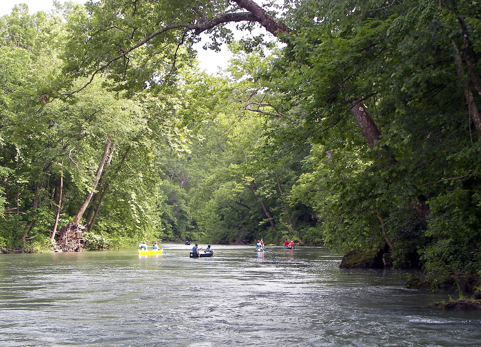
Route gallery
See this route on the water
Photos help show what the access looks like and what the route actually feels like on the water.
Sources
Check the data behind today's call.
Use this section when the page shows stale data, limited confidence, or a call you want to verify before driving.
Why this score Today's data confidence is checking
Data confidence mostly comes down to three things: how direct the gauge is, how clear the range is, and how fresh the data is.
- Checking data confidence notes.
- Checking data confidence cautions.
Outlook Tomorrow and weekend
This is a cautious early look. If the data is too thin, we leave it out.
Waiting on forecast.
Waiting on forecast.
Data behind the score Gauge, thresholds, and timing
These are the live readings and threshold notes behind today's score.
| Gauge site | Current River above Akers, MO |
| Discharge | Checking |
| Gauge height | Checking |
| 24h trend | Checking |
| 24h change | Checking |
| Current band | Checking |
| Rain last 24h | Checking |
| Rain last 72h | Checking |
| Air temp | Checking |
| Water temp | Checking |
| Wind | Checking |
| Gusts | Checking |
| Rain timing | Checking |
| Ideal range | Needs paddler reports |
| Known low-water floor | 230 cfs |
| High threshold | Not calibrated yet |
| Data confidence behind the range | Local route guidance |
| Gauge observed | Checking |
| Paddle Today updated | Checking |
| Main source behind this score | Rivers.MOHERP Akers gauge trip evidence for Cedar Grove to Akers |
| Gauge source | Checking |
| Weather source | Checking |
| Rainfall source | Checking |
Notes What to know before you go
These notes cover the access details, route quirks, and source caveats most likely to matter once you get there.
- Official route shape Cedar Grove to Akers, 7.7 mi / 3 hr
NPS Estimated Float Times lists Cedar Grove to Akers as a 7.7-mile Upper Current River float with an estimated 3-hour canoe/kayak time.
- Upper Current route context NPS standard put-ins
NPS Paddle the Upper Current River names Cedar Grove and Akers among the popular Upper Current put-in locations and lists Cedar Grove-to-Akers as a 3-hour float.
- Live direct gauge USGS 07064533 at 311 cfs / 1.09 ft
USGS Current River above Akers showed discharge and gage height at 12:30 CDT on May 30, 2026. The gauge is in the Akers take-out corridor.
- Low-water floor 230 cfs minimum-only
Rivers.MOHERP lists exact Cedar Grove-to-Akers trip evidence at 233 cfs described as just enough water to classify as good, with broader Upper Current good-condition reports nearby. Paddle Today uses 230 cfs as a conservative floor and does not infer an ideal or high-water band.
- NPS high-water closure context Akers average 2.00 ft / closed 4.00 ft
The NPS Superintendent Compendium says the Current and Jacks Fork close to non-motorized vessels during flood conditions and lists Akers at 2.00 ft average and 4.00 ft closed level. Use this as high-water caution, not an ideal range.
- Access rules Designated access points
NPS private-vessel guidance says there is no fee for private floating inside park boundaries, but paddlers should arrange their own transport, use designated river access points, follow posted signs, and park only in designated areas.
- Endpoint coordinates 37.42238, -91.6083 to 37.37591, -91.55148
Mapcarta / OpenStreetMap lists Cedar Grove Boat Launch and Akers Lower as Current River slipways. Coordinates are practical access anchors; NPS signs and current access layout should control on arrival.
Verify it yourself Check the source links
Use these links to double-check the gauge, route details, and access notes before you head out.
- NPS Estimated Float Times
- NPS Paddle the Upper Current River
- NPS Floating in the Ozarks
- NPS Ozark Superintendent Compendium
- NPS River Levels
- Rivers.MOHERP Current River Akers gauge
- USGS 07064533 Current River above Akers
- USGS 07064533 legacy current conditions
- Mapcarta Cedar Grove Boat Launch
- Mapcarta Akers Lower
Paddler reports
Recent notes from paddlers
A few quick notes from people who were on this route recently.
Reports
Photos, paddler notes, and updates.
See what others have shared, then add a condition report, upload photos, or flag anything that needs fixing.
Share your trip
Keep exploring
More routes to check next
Compare another stretch on this river, or jump to nearby options before you pick a plan.
Quick answers
Current River paddling FAQ
What water level is good for paddling Current River?
Paddle Today watches Current River above Akers, MO and uses 230 cfs as the conservative low-water floor for this route. The ideal range still needs more paddler reports.
Where does this Current River route start and end?
This route starts at Cedar Grove Boat Launch / access and ends at Akers Lower / Akers Ferry access, about 7.7 mi on the water.
Is this Current River route good for beginners?
This is listed as an easy route, but conditions still matter. Check today's score, water level, weather, and access notes before you go.
Flag a change
See something outdated?
Access, hazards, wood, and shuttle details change. Send a quick correction if something looks off.