See all 6 routes on Big Piney River
Missouri | Missouri Ozarks
Big Piney River
Boiling Spring Access to Mason Bridge Access
Check current paddling conditions for this Big Piney River route, including water level, recent gauge trend, weather, and route details.
Route snapshot
Loading the route snapshot. This usually takes a few seconds.
Today
Get the answer fast, then scan the route.
Start with the verdict, current conditions, route plan, and quick facts before you commit to the drive.
Today's conditions
Gauge
Recent trend
Checking preferred range.
Checking trend.
Gauge source
-- Checking timestampMN DNR provides the current paddling level here, but not chart-ready recent samples.
Weather
Best window today
Checking weather.
Today by hour
Short-route forecast
Checking the next several hours.
Quick facts
Plan
Dial in the shuttle, distance, and access.
Use this section once the route looks viable and you need to turn it into an actual trip plan.
Access plan
Access, shuttle, and map
Launch at MDC Boiling Spring Access and take out at Mason Bridge Access for the MDC-described six-mile Big Piney day float. Use the Big Piney USGS gauge as a same-river level check, but keep the decision conservative because the level model is community-calibrated.
Put-in
Boiling Spring Access Open mapBoiling Spring Access is an MDC public area with a boat ramp, picnic area, privy, parking, and disabled-accessible features shown on the area map.
Take-out
Mason Bridge Access Open mapMDC map material confirms Mason Bridge Access has a parking lot and boat ramp, but the coordinate is sourced from Mapcarta / OpenStreetMap rather than an MDC coordinate feed.
Pulling access map tiles. Usually under 5 seconds.
Access caveats
- Boiling Spring Access is an MDC public area with a boat ramp, picnic area, privy, parking, and disabled-accessible features shown on the area map.
- MDC map material confirms Mason Bridge Access has a parking lot and boat ramp, but the coordinate is sourced from Mapcarta / OpenStreetMap rather than an MDC coordinate feed.
- Camping is prohibited at Boiling Spring Access, and vehicle use is limited to roads and established parking areas unless posted otherwise.
- Private land borders portions of the Big Piney corridor. Stay with public accesses, lawful gravel-bar stops, and posted rules rather than climbing banks or using private land.
Watch for
- Shallow riffles, dragging, and slow pools when the Big Piney gauge is below the MoHERP low-water floor.
- Mostly Class I Ozark floating water, with higher-water push and occasional Class II-style current after rain.
- Rapid rises after storms, murky water, fresh wood, and harder landings. The current model has no defended high-water cutoff.
- Ramp and gravel-bar congestion at Boiling Spring, Mason Bridge parking limits, fishing traffic, and limited cell service.
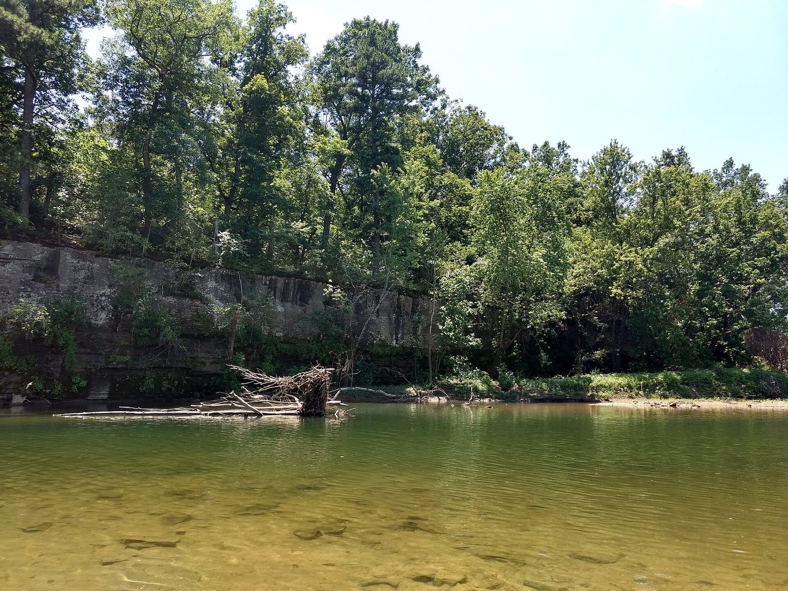
Route gallery
See this route on the water
Photos help show what the access looks like and what the route actually feels like on the water.
Sources
Check the data behind today's call.
Use this section when the page shows stale data, limited confidence, or a call you want to verify before driving.
Why this score Today's data confidence is checking
Data confidence mostly comes down to three things: how direct the gauge is, how clear the range is, and how fresh the data is.
- Checking data confidence notes.
- Checking data confidence cautions.
Outlook Tomorrow and weekend
This is a cautious early look. If the data is too thin, we leave it out.
Waiting on forecast.
Waiting on forecast.
Data behind the score Gauge, thresholds, and timing
These are the live readings and threshold notes behind today's score.
| Gauge site | Big Piney River near Big Piney, MO |
| Discharge | Checking |
| Gauge height | Checking |
| 24h trend | Checking |
| 24h change | Checking |
| Current band | Checking |
| Rain last 24h | Checking |
| Rain last 72h | Checking |
| Air temp | Checking |
| Water temp | Checking |
| Wind | Checking |
| Gusts | Checking |
| Rain timing | Checking |
| Ideal range | Needs paddler reports |
| Known low-water floor | 309 cfs |
| High threshold | Not calibrated yet |
| Data confidence behind the range | Local route guidance |
| Gauge observed | Checking |
| Paddle Today updated | Checking |
| Main source behind this score | Rivers.MOHERP Big Piney River gauge bands at Big Piney |
| Gauge source | Checking |
| Weather source | Checking |
| Rainfall source | Checking |
Notes What to know before you go
These notes cover the access details, route quirks, and source caveats most likely to matter once you get there.
- MDC route shape About 6 mi
MDC describes Boiling Spring Access to the Conservation Department Mason Bridge Access as a decent daylong Big Piney float through six scenic miles, rated Category I / Easy except during high water.
- Segment mileage Mile 26.6 to 32.5
Big Piney River Stream Team Watershed Association lists Boiling Spring to Mason Bridge as river mile 26.6 to 32.5, matching the six-mile MDC route description.
- Public put-in Boiling Spring Access
MDC lists Boiling Spring Access as a public Big Piney River area with a boat ramp and picnic area, and its area map marks parking, privy, picnic area, and boat ramp features.
- Public take-out Mason Bridge Access
MDC map material identifies Mason Bridge Access in Texas County on the Big Piney River, with parking lot and boat ramp symbols.
- Take-out coordinate anchor 37.50581, -91.98319
Mapcarta / OpenStreetMap locates Mason Bridge Access as a Big Piney slipway at this coordinate. Pair the coordinate with MDC area-map confirmation and follow posted access layout on arrival.
- Live direct gauge USGS 06930000
USGS Big Piney River near Big Piney showed same-day May 30, 2026 discharge and gage-height observations, with 251 cfs and 2.79 ft at 08:00 CDT during review.
- Low-water floor 309 cfs minimum-only
Rivers.MOHERP Big Piney gauge bands put the start of Low at 309 cfs. The app reuses this conservative floor from adjacent Big Piney routes and does not infer an ideal range or upper cutoff.
- Route character Class I, seldom II except high water
Missouri Float Trips describes the Big Piney as mostly Class I, seldom Class II except in high water, and marks Boiling Spring Access and Mason Bridge Access in the same mile-by-mile sequence.
Verify it yourself Check the source links
Use these links to double-check the gauge, route details, and access notes before you head out.
- MDC Outdoor Recreation: Access to Access
- MDC Boiling Spring Access
- MDC Boiling Spring Access map
- MDC Mason Bridge Access map
- Big Piney River Stream Team Watershed Association
- Rivers.MOHERP Big Piney gauge
- USGS 06930000 monitoring location
- USGS 06930000 legacy current conditions
- Mason Bridge Access map coordinate
- Missouri Float Trips Big Piney River
Paddler reports
Recent notes from paddlers
A few quick notes from people who were on this route recently.
Reports
Photos, paddler notes, and updates.
See what others have shared, then add a condition report, upload photos, or flag anything that needs fixing.
Share your trip
Keep exploring
More routes to check next
Compare another stretch on this river, or jump to nearby options before you pick a plan.
Quick answers
Big Piney River paddling FAQ
What water level is good for paddling Big Piney River?
Paddle Today watches Big Piney River near Big Piney, MO and uses 309 cfs as the conservative low-water floor for this route. The ideal range still needs more paddler reports.
Where does this Big Piney River route start and end?
This route starts at Boiling Spring Access and ends at Mason Bridge Access, about About 6 mi on the water.
Is this Big Piney River route good for beginners?
This is listed as an easy route, but conditions still matter. Check today's score, water level, weather, and access notes before you go.
Flag a change
See something outdated?
Access, hazards, wood, and shuttle details change. Send a quick correction if something looks off.