See all 3 routes on Jacks Fork River
Missouri | Missouri Ozarks
Jacks Fork River
Buck Hollow / Highway 17 Bridge to Rymers
Check current paddling conditions for this Jacks Fork River route, including water level, recent gauge trend, weather, and route details.
Route snapshot
Loading the route snapshot. This usually takes a few seconds.
Today
Get the answer fast, then scan the route.
Start with the verdict, current conditions, route plan, and quick facts before you commit to the drive.
Today's conditions
Gauge
Recent trend
Checking preferred range.
Checking trend.
Gauge source
-- Checking timestampMN DNR provides the current paddling level here, but not chart-ready recent samples.
Weather
Best window today
Checking weather.
Today by hour
Short-route forecast
Checking the next several hours.
Quick facts
Plan
Dial in the shuttle, distance, and access.
Use this section once the route looks viable and you need to turn it into an actual trip plan.
Access plan
Access, shuttle, and map
Launch at Buck Hollow where Highway 17 crosses the Jacks Fork and take out at Rymers for the NPS-listed upper Jacks Fork day float. Use the Mountain View gauge as a same-river low-water check, and be ready for shallow riffles if the gauge is near or below the 100 cfs floor.
Put-in
Buck Hollow / Highway 17 Bridge Access Open mapNPS names both Buck Hollow and Rymers as Jacks Fork river access points, but the published coordinates used here come from paddling-location guides rather than an NPS coordinate table. Follow park signs and road-end access layout on arrival.
Take-out
Rymers Access Open mapBuck Hollow is the Highway 17 bridge access north of Mountain View. Do not confuse it with the upstream Prongs / Highway Y section, which is a separate, more seasonal reach.
Pulling access map tiles. Usually under 5 seconds.
Access caveats
- NPS names both Buck Hollow and Rymers as Jacks Fork river access points, but the published coordinates used here come from paddling-location guides rather than an NPS coordinate table. Follow park signs and road-end access layout on arrival.
- Buck Hollow is the Highway 17 bridge access north of Mountain View. Do not confuse it with the upstream Prongs / Highway Y section, which is a separate, more seasonal reach.
- Rymers is a remote access at the end of the Highway M gravel road system. Weather, washboarding, flood damage, or temporary park management can change practical access conditions.
Watch for
- Dragging, shallow shoals, and possible poling or lining when the Mountain View gauge is below the 100 cfs floor.
- Fast riffles, tight bends, boulder runs, strainers, and Class I-II moving-water consequences on a remote upper-river route.
- Rapid rises after thunderstorms, especially in the narrow upper Jacks Fork valley.
- Cold spring-fed water, limited cell service, long rural shuttle friction, and private land away from public accesses or lawful gravel-bar stops.
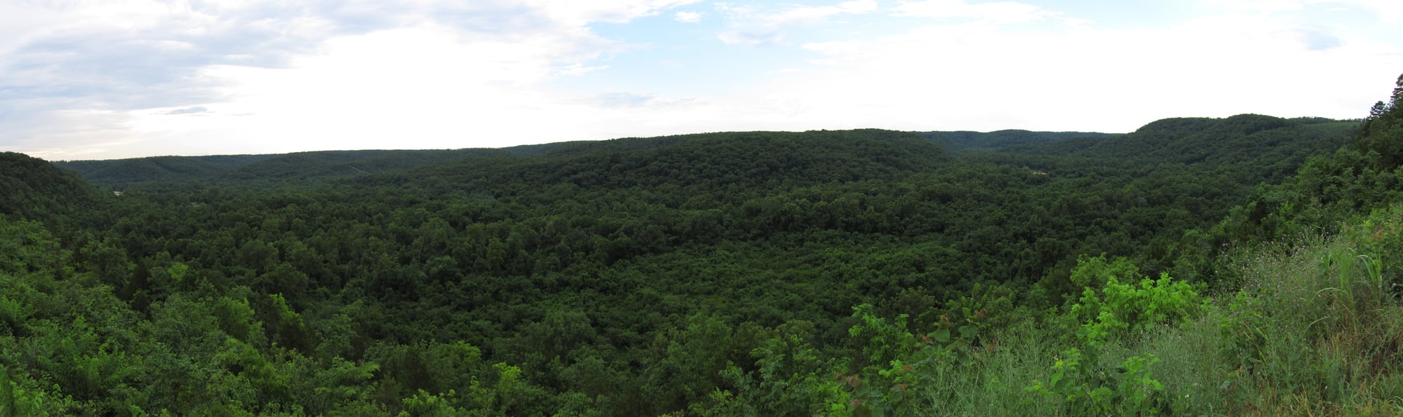
Route gallery
See this route on the water
Photos help show what the access looks like and what the route actually feels like on the water.
Sources
Check the data behind today's call.
Use this section when the page shows stale data, limited confidence, or a call you want to verify before driving.
Why this score Today's data confidence is checking
Data confidence mostly comes down to three things: how direct the gauge is, how clear the range is, and how fresh the data is.
- Checking data confidence notes.
- Checking data confidence cautions.
Outlook Tomorrow and weekend
This is a cautious early look. If the data is too thin, we leave it out.
Waiting on forecast.
Waiting on forecast.
Data behind the score Gauge, thresholds, and timing
These are the live readings and threshold notes behind today's score.
| Gauge site | Jacks Fork near Mountain View, MO |
| Discharge | Checking |
| Gauge height | Checking |
| 24h trend | Checking |
| 24h change | Checking |
| Current band | Checking |
| Rain last 24h | Checking |
| Rain last 72h | Checking |
| Air temp | Checking |
| Water temp | Checking |
| Wind | Checking |
| Gusts | Checking |
| Rain timing | Checking |
| Ideal range | Needs paddler reports |
| Known low-water floor | 100 cfs |
| High threshold | Not calibrated yet |
| Data confidence behind the range | Local route guidance |
| Gauge observed | Checking |
| Paddle Today updated | Checking |
| Main source behind this score | Rivers.MOHERP Mountain View gauge rating and Buck Hollow-to-Rymers trip logs |
| Gauge source | Checking |
| Weather source | Checking |
| Rainfall source | Checking |
Notes What to know before you go
These notes cover the access details, route quirks, and source caveats most likely to matter once you get there.
- Official route shape Hwy 17 to Rymers, 5 hr
NPS lists Highway 17 to Rymers as an estimated 5-hour Jacks Fork float and names Highway 17 Bridge / Buck Hollow and Rymers as popular Jacks Fork put-in locations.
- NPS access context Buck Hollow and Rymers park accesses
The NPS park brochure lists Buck Hollow and Rymers in the Jacks Fork river-access inventory, with Rymers at river mile 82 and Buck Hollow at river mile 88.
- Access directions Highway 17 bridge to Highway M gravel road end
NPS directions place Buck Hollow where Highway 17 crosses the Jacks Fork about 6 miles north of Mountain View, and Rymers by traveling east from Mountain View on US 60, then north on Highway M until pavement ends and continuing on gravel to the road end.
- Direct gauge USGS 07065200
USGS operates Jacks Fork near Mountain View, MO. The legacy current-conditions page showed same-day May 26, 2026 discharge and gage-height observations during review.
- Low-water floor 100 cfs minimum-only
Rivers.MOHERP rates the Mountain View gauge good beginning at 100 cfs. Buck Hollow-to-Rymers trip rows include a good report at 253 cfs and poor reports around 80 cfs where all drops required poling or lining.
- Route mileage and coordinates About 9.4 mi
Rivers.MOHERP and public paddling-location guides place Buck Hollow to Rymers at about 9.4 miles. Southwest Paddler publishes access coordinates for the Highway 17 / Buck Hollow bridge and Rymer Landing, corroborated by a separate Rymers paddling-location coordinate listing.
- River character Seasonal Class I-II upper Ozark river
Southwest Paddler describes the Jacks Fork as a Class I-II river with remoteness, rapids that are generally not highly technical, and seasonal flow dependence. MDC also describes the upper Jacks Fork as wild, scenic, and best suited to spring paddling when water is adequate.
Verify it yourself Check the source links
Use these links to double-check the gauge, route details, and access notes before you head out.
Paddler reports
Recent notes from paddlers
A few quick notes from people who were on this route recently.
Reports
Photos, paddler notes, and updates.
See what others have shared, then add a condition report, upload photos, or flag anything that needs fixing.
Share your trip
Keep exploring
More routes to check next
Compare another stretch on this river, or jump to nearby options before you pick a plan.
Quick answers
Jacks Fork River paddling FAQ
What water level is good for paddling Jacks Fork River?
Paddle Today watches Jacks Fork near Mountain View, MO and uses 100 cfs as the conservative low-water floor for this route. The ideal range still needs more paddler reports.
Where does this Jacks Fork River route start and end?
This route starts at Buck Hollow / Highway 17 Bridge Access and ends at Rymers Access, about About 9.4 mi on the water.
Is this Jacks Fork River route good for beginners?
This is listed as a moderate route. Expect more planning than an easy float, and use the live score, route notes, and source links before committing.
Flag a change
See something outdated?
Access, hazards, wood, and shuttle details change. Send a quick correction if something looks off.