Kentucky | Bluegrass Region
Elkhorn Creek
Elkhorn Creek VPA #3 to American Whitewater Access
Check current paddling conditions for this Elkhorn Creek route, including water level, recent gauge trend, weather, and route details.
Route snapshot
Loading the route snapshot. This usually takes a few seconds.
Today
Get the answer fast, then scan the route.
Start with the verdict, current conditions, route plan, and quick facts before you commit to the drive.
Today's conditions
Gauge
Recent trend
Checking preferred range.
Checking trend.
Gauge source
-- Checking timestampMN DNR provides the current paddling level here, but not chart-ready recent samples.
Weather
Best window today
Checking weather.
Today by hour
Short-route forecast
Checking the next several hours.
Quick facts
Plan
Dial in the shuttle, distance, and access.
Use this section once the route looks viable and you need to turn it into an actual trip plan.
Access plan
Access, shuttle, and map
Launch at KDFWR Elkhorn Creek VPA #3 and take out 2.6 miles downstream at the American Whitewater / Elkhorn Acres access. KDFWR gives a good boating band of 100 to 600 cfs at the Frankfort gauge, while American Whitewater frames the gorge as Class II with occasional Class III features.
Put-in
Elkhorn Creek VPA #3 Open mapElkhorn Creek VPA #3 is private property opened through KDFWR; continuing access depends on users following posted rules, daylight-hours limits, and boundary markers.
Take-out
American Whitewater / Elkhorn Acres Access Open mapThe American Whitewater / Elkhorn Acres take-out is a carry-down boating access with no bank or wade fishing; use the signed parking and do not spread onto neighboring private land.
Pulling access map tiles. Usually under 5 seconds.
Access caveats
- Elkhorn Creek VPA #3 is private property opened through KDFWR; continuing access depends on users following posted rules, daylight-hours limits, and boundary markers.
- The American Whitewater / Elkhorn Acres take-out is a carry-down boating access with no bank or wade fishing; use the signed parking and do not spread onto neighboring private land.
- KDFWR lists some nearby Elkhorn access sites as bank/wade-only with boats prohibited. Use only the named VPA #3 and American Whitewater access pair for this route.
- The current app uses USGS 03289500 as the direct gauge. The local workspace could not fetch USGS Water Services during review, so same-day live confirmation came from RiverApp text that says it imports USGS Water Services data.
Watch for
- Class II ledges, wave trains, pushy bends, and occasional Class III moves in the Elkhorn Gorge.
- Fast rises after rain, fresh wood, strainers, and limited eddies along private banks.
- Low water below 100 cfs or 2.5 ft, when scraping and pinning risk increase.
- High water above 600 cfs or 4.0 ft, when KDFWR moves the creek out of the good band and casual paddling judgment is not enough.
- Respect private-bank boundaries and ordinary access limits; do not scout, picnic, or exit on private land away from documented access points unless there is an emergency.
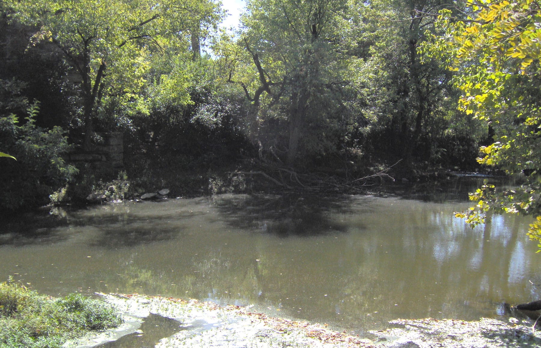
Route gallery
See this route on the water
Photos help show what the access looks like and what the route actually feels like on the water.
Sources
Check the data behind today's call.
Use this section when the page shows stale data, limited confidence, or a call you want to verify before driving.
Why this score Today's data confidence is checking
Data confidence mostly comes down to three things: how direct the gauge is, how clear the range is, and how fresh the data is.
- Checking data confidence notes.
- Checking data confidence cautions.
Outlook Tomorrow and weekend
This is a cautious early look. If the data is too thin, we leave it out.
Waiting on forecast.
Waiting on forecast.
Data behind the score Gauge, thresholds, and timing
These are the live readings and threshold notes behind today's score.
| Gauge site | Elkhorn Creek near Frankfort, KY |
| Discharge | Checking |
| Gauge height | Checking |
| 24h trend | Checking |
| 24h change | Checking |
| Current band | Checking |
| Rain last 24h | Checking |
| Rain last 72h | Checking |
| Air temp | Checking |
| Water temp | Checking |
| Wind | Checking |
| Gusts | Checking |
| Rain timing | Checking |
| Target band | 100 cfs to 600 cfs |
| Low threshold | 100 cfs |
| High threshold | 600 cfs |
| Data confidence behind the range | Official data source |
| Gauge observed | Checking |
| Paddle Today updated | Checking |
| Main source behind this score | KDFWR recommended river levels for Elkhorn Creek near Frankfort |
| Gauge source | Checking |
| Weather source | Checking |
| Rainfall source | Checking |
Notes What to know before you go
These notes cover the access details, route quirks, and source caveats most likely to matter once you get there.
- Official level band 100-600 cfs / 2.5-4.0 ft
KDFWR rates Elkhorn Creek near Frankfort as Low below 100 cfs or 2.5 ft, Good from 100 to 600 cfs or 2.5 to 4.0 ft, and High above 600 cfs or 4.0 ft.
- Official route segment VPA #3 to American Whitewater Access, 2.6 miles
KDFWR lists Elkhorn Creek VPA #3 to American Whitewater Access as a 2.6-mile access-to-access segment on the main Elkhorn Creek access table.
- Put-in access Elkhorn Creek VPA #3, 38.2517, -84.8158
KDFWR identifies VPA #3 as a Voluntary Public Access site on private property with daylight-hours-only rules, unpaved limited parking, bank access, and canoe/kayak access.
- Take-out access American Whitewater / Elkhorn Acres Access, 38.2676, -84.8155
KDFWR lists the American Whitewater / Elkhorn Acres site as a free carry-down boating access just downstream of Knight's Bridge, with unpaved parking and no bank or wade fishing.
- Whitewater character Class II(III)
American Whitewater identifies the Elkhorn Gorge reach as Class II with occasional Class III rapids and ties it to the same Frankfort gauge.
- Live-gauge support USGS 03289500
USGS lists Elkhorn Creek near Frankfort with discharge and gage-height availability through May 26, 2026 in the search-visible legacy page, and RiverApp showed same-day May 31 values imported from USGS Water Services during this run. Workspace direct fetches to Water Services were blocked by network restrictions.
Verify it yourself Check the source links
Use these links to double-check the gauge, route details, and access notes before you head out.
Paddler reports
Recent notes from paddlers
A few quick notes from people who were on this route recently.
Reports
Photos, paddler notes, and updates.
See what others have shared, then add a condition report, upload photos, or flag anything that needs fixing.
Share your trip
Keep exploring
More routes to check next
Compare another stretch on this river, or jump to nearby options before you pick a plan.
More in Kentucky
All 8 routesNearby routes by distance
Quick answers
Elkhorn Creek paddling FAQ
What water level is good for paddling Elkhorn Creek?
Paddle Today watches Elkhorn Creek near Frankfort, KY and treats 100 cfs to 600 cfs as the target band for this route, with weather and recent trend included in the final score.
Where does this Elkhorn Creek route start and end?
This route starts at Elkhorn Creek VPA #3 and ends at American Whitewater / Elkhorn Acres Access, about 2.6 mi on the water.
Is this Elkhorn Creek route good for beginners?
This is listed as a moderate route. Expect more planning than an easy float, and use the live score, route notes, and source links before committing.
Flag a change
See something outdated?
Access, hazards, wood, and shuttle details change. Send a quick correction if something looks off.