See all 2 routes on Flambeau River
Wisconsin | Northwoods Wisconsin
Flambeau River
Hervas Camp Landing to Beaver Dam Landing
Check current paddling conditions for this Flambeau River route, including water level, recent gauge trend, weather, and route details.
Route snapshot
Loading the route snapshot. This usually takes a few seconds.
Today
Get the answer fast, then scan the route.
Start with the verdict, current conditions, route plan, and quick facts before you commit to the drive.
Today's conditions
Gauge
Recent trend
Checking preferred range.
Checking trend.
Gauge source
-- Checking timestampMN DNR provides the current paddling level here, but not chart-ready recent samples.
Weather
Best window today
Checking weather.
Today by hour
Short-route forecast
Checking the next several hours.
Quick facts
Plan
Dial in the shuttle, distance, and access.
Use this section once the route looks viable and you need to turn it into an actual trip plan.
Access plan
Access, shuttle, and map
Launch at Hervas Camp Landing and take out at Beaver Dam Landing for the short, concentrated lower-FN4 whitewater run. Cedar Rapids and Beaver Dam Rapids are the main decision points.
Access planner
Pick a shorter segment
This changes launch and take-out logistics, not today's river score.
Peltier Lake to Long Lake is the full route. Shorter access pairs are useful when wind, time, or group energy changes the plan.
Put-in
Hervas Camp Landing Open mapHervas is a small state-forest landing at the end of River Road; check parking before unloading if the landing is busy with campers or through-paddlers.
Take-out
Beaver Dam Landing Open mapBeaver Dam is a hand-carry canoe landing on river right near Beaver Dam Rapids, with parking and pit toilets but no drinking water listed by WI DNR.
Pulling access map tiles. Usually under 5 seconds.
Access caveats
- Hervas is a small state-forest landing at the end of River Road; check parking before unloading if the landing is busy with campers or through-paddlers.
- Beaver Dam is a hand-carry canoe landing on river right near Beaver Dam Rapids, with parking and pit toilets but no drinking water listed by WI DNR.
- The Bruce gauge is AW-backed for this reach but still a proxy. Dams and local releases can make the actual river feel different from the number.
Watch for
- Cedar Rapids, especially the first pitch where Wisconsin Trail Guide recommends scouting from river left and portaging if in doubt.
- Beaver Dam Rapids, a river-wide ledge with a large submerged boulder and a short left-bank scout or portage option.
- Pushier waves and harder swims above the broad target window, shallow boulder gardens below it, cold water, and wood after storms.
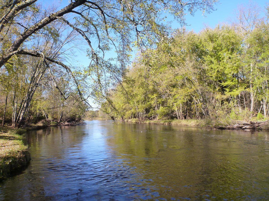
Route gallery
See this route on the water
Photos help show what the access looks like and what the route actually feels like on the water.
Sources
Check the data behind today's call.
Use this section when the page shows stale data, limited confidence, or a call you want to verify before driving.
Why this score Today's data confidence is checking
Data confidence mostly comes down to three things: how direct the gauge is, how clear the range is, and how fresh the data is.
- Checking data confidence notes.
- Checking data confidence cautions.
Outlook Tomorrow and weekend
This is a cautious early look. If the data is too thin, we leave it out.
Waiting on forecast.
Waiting on forecast.
Data behind the score Gauge, thresholds, and timing
These are the live readings and threshold notes behind today's score.
| Gauge site | Flambeau River Near Bruce, WI |
| Discharge | Checking |
| Gauge height | Checking |
| 24h trend | Checking |
| 24h change | Checking |
| Current band | Checking |
| Rain last 24h | Checking |
| Rain last 72h | Checking |
| Air temp | Checking |
| Water temp | Checking |
| Wind | Checking |
| Gusts | Checking |
| Rain timing | Checking |
| Target band | 1,320 cfs to 3,420 cfs |
| Low threshold | 680 cfs |
| High threshold | 5,000 cfs |
| Data confidence behind the range | Local route guidance |
| Gauge observed | Checking |
| Paddle Today updated | Checking |
| Main source behind this score | American Whitewater Hervas-to-Beaver Dam gauge ladder |
| Gauge source | Checking |
| Weather source | Checking |
| Rainfall source | Checking |
Notes What to know before you go
These notes cover the access details, route quirks, and source caveats most likely to matter once you get there.
- AW route and gauge 4.9 mi; Class II
American Whitewater lists Hervas Landing to Beaver Dam Landing as a 4.9-mile Class II Flambeau reach and ties it to the Flambeau River near Bruce gauge.
- AW gauge bands 680 / 1,320-3,420 / 5,000 cfs
American Whitewater lists 680-1,320 cfs as barely to medium runnable, 1,320-3,420 cfs as medium to a bit pushy runnable, 3,420-5,000 cfs as high runnable, and 5,000+ cfs as very high.
- Gauge caveat Proxy with dam variance
American Whitewater says drainage at the put-in is about five percent less than at the Bruce gauge and that three intervening dams can cause variance between gauge reading and actual flow on the section.
- Public landings Hervas and Beaver Dam
Wisconsin DNR lists Hervas ramp and Beaver Dam as established Flambeau River State Forest landings, with Hervas supporting motorized/boat/canoe access and Beaver Dam supporting canoe access.
- Endpoint coordinates 45.64051, -90.83491 to 45.61660, -90.90623
Wisconsin Trail Guide FN4 publishes WGS84 waypoints for Hervas Camp Landing and Beaver Dam Landing.
- Key rapids Cedar Rapids and Beaver Dam Rapids
Wisconsin Trail Guide describes the first pitch of Cedar Rapids as a challenging Class II rapid and Beaver Dam Rapids as a Class II-III ledge at higher flows, with scout or portage options on river left.
Verify it yourself Check the source links
Use these links to double-check the gauge, route details, and access notes before you head out.
Paddler reports
Recent notes from paddlers
A few quick notes from people who were on this route recently.
Reports
Photos, paddler notes, and updates.
See what others have shared, then add a condition report, upload photos, or flag anything that needs fixing.
Share your trip
Keep exploring
More routes to check next
Compare another stretch on this river, or jump to nearby options before you pick a plan.
Quick answers
Flambeau River paddling FAQ
What water level is good for paddling Flambeau River?
Paddle Today watches Flambeau River Near Bruce, WI and treats 1,320 cfs to 3,420 cfs as the target band for this route, with weather and recent trend included in the final score.
Where does this Flambeau River route start and end?
This route starts at Hervas Camp Landing and ends at Beaver Dam Landing, about 4.9 mi on the water.
Is this Flambeau River route good for beginners?
This is listed as a moderate route. Expect more planning than an easy float, and use the live score, route notes, and source links before committing.
Flag a change
See something outdated?
Access, hazards, wood, and shuttle details change. Send a quick correction if something looks off.