See all 3 routes on James River
Missouri | Southwest Missouri
James River
Delaware Town Access to Shelvin Rock Access
Check current paddling conditions for this James River route, including water level, recent gauge trend, weather, and route details.
Route snapshot
Loading the route snapshot. This usually takes a few seconds.
Today
Get the answer fast, then scan the route.
Start with the verdict, current conditions, route plan, and quick facts before you commit to the drive.
Today's conditions
Gauge
Recent trend
Checking preferred range.
Checking trend.
Gauge source
-- Checking timestampMN DNR provides the current paddling level here, but not chart-ready recent samples.
Weather
Best window today
Checking weather.
Today by hour
Short-route forecast
Checking the next several hours.
Quick facts
Plan
Dial in the shuttle, distance, and access.
Use this section once the route looks viable and you need to turn it into an actual trip plan.
Access plan
Access, shuttle, and map
Launch at MDC Delaware Town Access and take out at MDC Shelvin Rock Access for a 6.5-mile middle-James day float. Use the Boaz gauge as a conservative low-water check, and make a same-day visual call because the scoring model has no defended high-water cutoff.
Put-in
Delaware Town Access Open mapDelaware Town and Shelvin Rock are MDC public day-use accesses with boat ramps and parking, but posted signs and area maps control exact use.
Take-out
Shelvin Rock Access Open mapBoth endpoints prohibit camping, and MDC rules prohibit leaving boats unattended overnight on department areas.
Pulling access map tiles. Usually under 5 seconds.
Access caveats
- Delaware Town and Shelvin Rock are MDC public day-use accesses with boat ramps and parking, but posted signs and area maps control exact use.
- Both endpoints prohibit camping, and MDC rules prohibit leaving boats unattended overnight on department areas.
- The Delaware Town coordinate is a practical access anchor from a public paddling directory paired with MDC access confirmation; follow MDC signs and the current ramp layout on arrival.
Watch for
- Dragging, slow pools, and shallow riffles when the Boaz gauge is near or below the 275 cfs floor.
- Two ledge-rock drops noted in route evidence; scout or walk if the level, load, or group skill makes them questionable.
- High or rising water after rain, cloudy water, fresh wood, strainers on bends, and more difficult landings.
- Private land away from public accesses and lawful gravel-bar stops; do not assume banks are public picnic or camping areas.
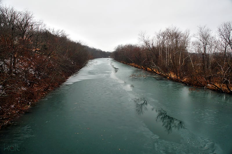
Route gallery
See this route on the water
Photos help show what the access looks like and what the route actually feels like on the water.
Sources
Check the data behind today's call.
Use this section when the page shows stale data, limited confidence, or a call you want to verify before driving.
Why this score Today's data confidence is checking
Data confidence mostly comes down to three things: how direct the gauge is, how clear the range is, and how fresh the data is.
- Checking data confidence notes.
- Checking data confidence cautions.
Outlook Tomorrow and weekend
This is a cautious early look. If the data is too thin, we leave it out.
Waiting on forecast.
Waiting on forecast.
Data behind the score Gauge, thresholds, and timing
These are the live readings and threshold notes behind today's score.
| Gauge site | James River near Boaz, MO |
| Discharge | Checking |
| Gauge height | Checking |
| 24h trend | Checking |
| 24h change | Checking |
| Current band | Checking |
| Rain last 24h | Checking |
| Rain last 72h | Checking |
| Air temp | Checking |
| Water temp | Checking |
| Wind | Checking |
| Gusts | Checking |
| Rain timing | Checking |
| Ideal range | Needs paddler reports |
| Known low-water floor | 275 cfs |
| High threshold | Not calibrated yet |
| Data confidence behind the range | Local route guidance |
| Gauge observed | Checking |
| Paddle Today updated | Checking |
| Main source behind this score | Rivers.MOHERP Boaz gauge Delaware-to-Shelvin trip evidence |
| Gauge source | Checking |
| Weather source | Checking |
| Rainfall source | Checking |
Notes What to know before you go
These notes cover the access details, route quirks, and source caveats most likely to matter once you get there.
- Public put-in MDC Delaware Town Access
MDC says Delaware Town Access provides access to the James River, with a boat ramp and two parking lots. The area is day use only and camping is not allowed.
- Public take-out MDC Shelvin Rock Access
MDC says Shelvin Rock Access provides access to the James River, with two parking lots and a boat ramp. The area is day use only and camping is not allowed.
- Route shape Delaware Town to Shelvin Rock, 6.5 miles
Rivers.MOHERP lists Delaware-to-Shelvin Rock trip rows at 6.5 miles, and James River Basin Partnership names Delaware Town to Shelvin Rock Access as a float-series route.
- Direct live gauge USGS 07052250
USGS James River near Boaz showed same-day May 30, 2026 discharge and gage-height observations during this review. The gauge is on the middle James route corridor and is the gauge used by MoHERP for Delaware-to-Shelvin rows.
- Low-water floor 275 cfs minimum-only
MoHERP exact-route evidence includes a Delaware-to-Shelvin trip at 275 cfs on the Boaz gauge where most of the river was fine but a few low areas required dragging; the report calls that about the minimum recommended water level for this section.
- Route character Ledge-rock drops and long pools
MoHERP Delaware-to-Shelvin trip notes mention at least two ledge-rock drops, and broader James River sources describe this middle reach as a mix of riffles, calm stretches, gravel bars, and scenic Ozark water.
- Coordinates 37.0511, -93.3914 to 36.99564609, -93.3697183
Delaware Town is anchored to a public paddling directory coordinate that cites USGS ScienceBase location data and MDC confirms the access name. Shelvin Rock uses the existing V2 Shelvin Rock access coordinate paired with MDC access confirmation.
Verify it yourself Check the source links
Use these links to double-check the gauge, route details, and access notes before you head out.
- MDC Delaware Town Access
- MDC Shelvin Rock Access
- Rivers.MOHERP James River Boaz gauge
- USGS 07052250 monitoring location
- USGS 07052250 legacy current conditions
- James River Basin Partnership Delaware Town to Shelvin Rock float
- James River Basin Partnership explore map
- Delaware Town Access coordinate record
Paddler reports
Recent notes from paddlers
A few quick notes from people who were on this route recently.
Reports
Photos, paddler notes, and updates.
See what others have shared, then add a condition report, upload photos, or flag anything that needs fixing.
Share your trip
Keep exploring
More routes to check next
Compare another stretch on this river, or jump to nearby options before you pick a plan.
Quick answers
James River paddling FAQ
What water level is good for paddling James River?
Paddle Today watches James River near Boaz, MO and uses 275 cfs as the conservative low-water floor for this route. The ideal range still needs more paddler reports.
Where does this James River route start and end?
This route starts at Delaware Town Access and ends at Shelvin Rock Access, about About 6.5 mi on the water.
Is this James River route good for beginners?
This is listed as an easy route, but conditions still matter. Check today's score, water level, weather, and access notes before you go.
Flag a change
See something outdated?
Access, hazards, wood, and shuttle details change. Send a quick correction if something looks off.