Minnesota | Twin Cities North Metro
Rice Creek
Peltier Lake to Long Lake
Check current paddling conditions for this Rice Creek route, including water level, recent gauge trend, weather, and route details.
Route snapshot
Loading the route snapshot. This usually takes a few seconds.
Today
Get the answer fast, then scan the route.
Start with the verdict, current conditions, route plan, and quick facts before you commit to the drive.
Today's conditions
Gauge
Recent trend
Checking preferred range.
Checking trend.
Gauge source
-- Checking timestampMN DNR provides the current paddling level here, but not chart-ready recent samples.
Weather
Best window today
Checking weather.
Today by hour
Short-route forecast
Checking the next several hours.
Quick facts
Plan
Dial in the shuttle, distance, and access.
Use this section once the route looks viable and you need to turn it into an actual trip plan.
Access plan
Access, shuttle, and map
The upper miles are mostly lake crossings before the creek narrows. Fish-barrier status, lake wind, and intermediate exits matter almost as much as the gauge.
Access planner
Pick a shorter segment
This changes launch and take-out logistics, not today's river score.
Peltier Lake to Long Lake is the full route. Shorter access pairs are useful when wind, time, or group energy changes the plan.
Put-in
Peltier Lake public boat launch (Lino Lakes) Open mapMultiple intermediate landings make it easy to shorten the route if wind or time becomes a problem.
Take-out
Long Lake Regional Park / Long Lake (New Brighton) Open mapAn electric fish barrier near Long Lake may require a marked portage depending on posted conditions.
Pulling access map tiles. Usually under 5 seconds.
Access caveats
- Multiple intermediate landings make it easy to shorten the route if wind or time becomes a problem.
- An electric fish barrier near Long Lake may require a marked portage depending on posted conditions.
Watch for
- Wind and chop on the opening lake chain.
- High-water or low-water culvert issues, especially between Baldwin Lake and I-35W.
- Fallen trees and the Long Lake fish-barrier portage decision.
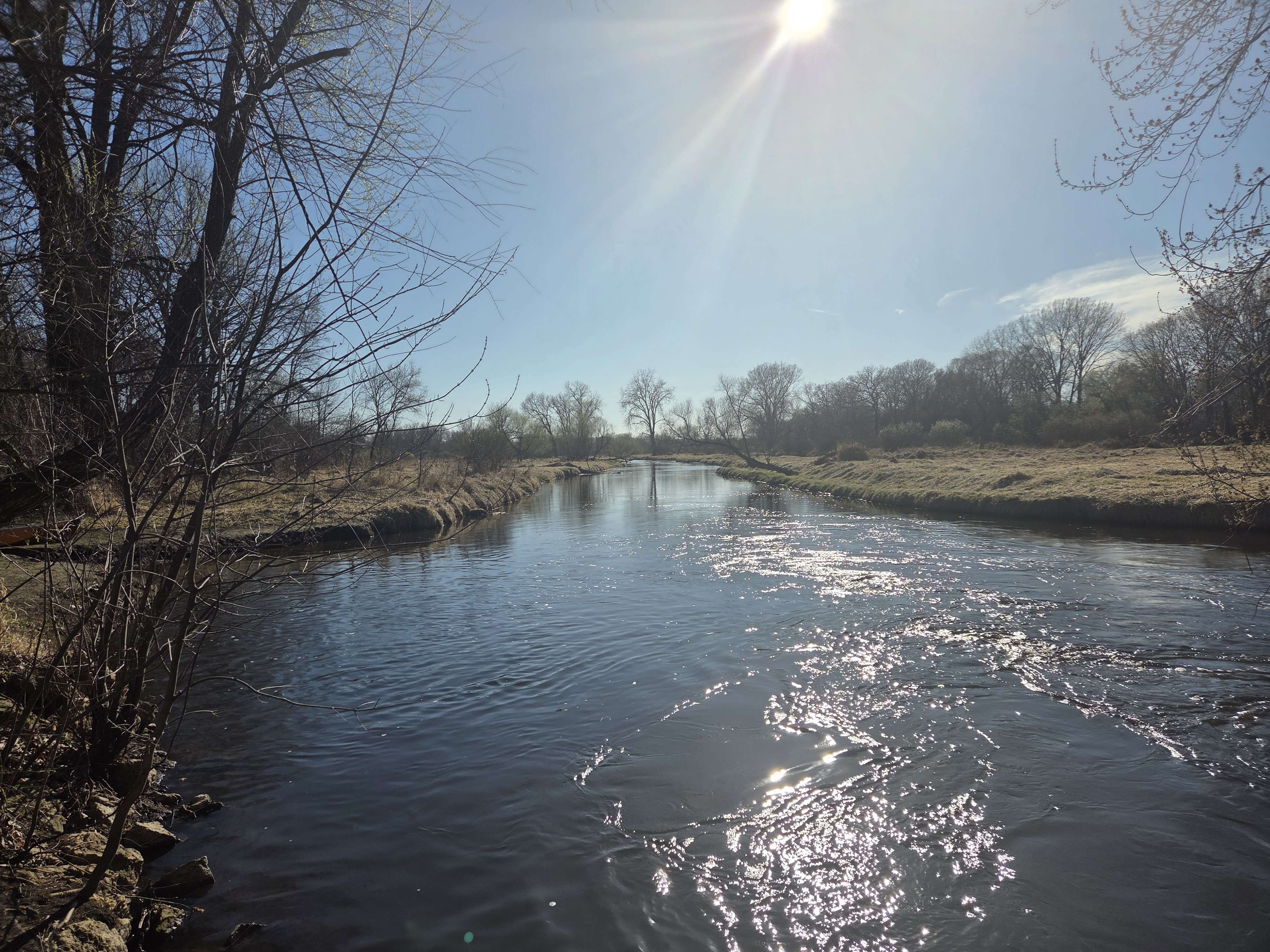
Route gallery
See this route on the water
Photos help show what the access looks like and what the route actually feels like on the water.
Sources
Check the data behind today's call.
Use this section when the page shows stale data, limited confidence, or a call you want to verify before driving.
Why this score Today's data confidence is checking
Data confidence mostly comes down to three things: how direct the gauge is, how clear the range is, and how fresh the data is.
- Checking data confidence notes.
- Checking data confidence cautions.
Outlook Tomorrow and weekend
This is a cautious early look. If the data is too thin, we leave it out.
Waiting on forecast.
Waiting on forecast.
Data behind the score Gauge, thresholds, and timing
These are the live readings and threshold notes behind today's score.
| Gauge site | Rice Creek near New Brighton, MN |
| Gauge height | Checking |
| Discharge | Checking |
| 24h trend | Checking |
| 24h change | Checking |
| Current band | Checking |
| Rain last 24h | Checking |
| Rain last 72h | Checking |
| Air temp | Checking |
| Water temp | Checking |
| Wind | Checking |
| Gusts | Checking |
| Rain timing | Checking |
| Target band | 6.30 ft to 7.90 ft |
| Low threshold | 6.30 ft |
| High threshold | 7.90 ft |
| Data confidence behind the range | Official data source |
| Gauge observed | Checking |
| Paddle Today updated | Checking |
| Main source behind this score | Rice Creek Watershed District water-level guidance |
| Gauge source | Checking |
| Weather source | Checking |
| Rainfall source | Checking |
Notes What to know before you go
These notes cover the access details, route quirks, and source caveats most likely to matter once you get there.
- Published level band 6.30 to 7.90 ft
Rice Creek Watershed District publishes this as the passable water-level recommendation.
- Route shape Five lakes before the creek narrows
The upstream miles are lake crossings, so wind can matter more than the gauge suggests.
- Portage note County Road I may require a portage in high water
The official trail map flags County Road I as a possible high-water portage point.
- Barrier note Fish barrier near Long Lake
The downstream end can require a portage near the Long Lake fish barrier depending on posted conditions.
Verify it yourself Check the source links
Use these links to double-check the gauge, route details, and access notes before you head out.
Paddler reports
Recent notes from paddlers
A few quick notes from people who were on this route recently.
Reports
Photos, paddler notes, and updates.
See what others have shared, then add a condition report, upload photos, or flag anything that needs fixing.
Share your trip
Keep exploring
More routes to check next
Compare another stretch on this river, or jump to nearby options before you pick a plan.
More in Minnesota
All 46 routesNearby routes by distance
Quick answers
Rice Creek paddling FAQ
What water level is good for paddling Rice Creek?
Paddle Today watches Rice Creek near New Brighton, MN and treats 6.30 ft to 7.90 ft as the target band for this route, with weather and recent trend included in the final score.
Where does this Rice Creek route start and end?
This route starts at Peltier Lake public boat launch (Lino Lakes) and ends at Long Lake Regional Park / Long Lake (New Brighton), about 15.2 mi on the water.
Is this Rice Creek route good for beginners?
This is listed as an easy route, but conditions still matter. Check today's score, water level, weather, and access notes before you go.
Flag a change
See something outdated?
Access, hazards, wood, and shuttle details change. Send a quick correction if something looks off.