See all 4 routes on Maquoketa River
Iowa | Northeast Iowa
Maquoketa River
Highway 410 / Backbone State Park to Dundee Access
Check current paddling conditions for this Maquoketa River route, including water level, recent gauge trend, weather, and route details.
Route snapshot
Loading the route snapshot. This usually takes a few seconds.
Today
Get the answer fast, then scan the route.
Start with the verdict, current conditions, route plan, and quick facts before you commit to the drive.
Today's conditions
Gauge
Recent trend
Checking preferred range.
Checking trend.
Gauge source
-- Checking timestampMN DNR provides the current paddling level here, but not chart-ready recent samples.
Weather
Best window today
Checking weather.
Today by hour
Short-route forecast
Checking the next several hours.
Quick facts
Plan
Dial in the shuttle, distance, and access.
Use this section once the route looks viable and you need to turn it into an actual trip plan.
Access plan
Access, shuttle, and map
Launch at the Highway 410 bridge access in Backbone State Park and paddle through the upper Maquoketa bluff corridor, Backbone Lake, and the dam-portage area before finishing at Dundee Access.
Put-in
Highway 410 bridge access / Backbone State Park Open mapThe put-in is a bridge access inside Backbone State Park rather than a developed ramp; parking is reported at either end of the bridge, but seasonal gate closures can block vehicle access.
Take-out
Dundee Access / Dundee Wildlife Area Open mapMany paddlers should consider the Backbone Lake dam/ramp as the safer take-out, because the dam-to-Dundee leg has tricky current, low branches, and strainers.
Pulling access map tiles. Usually under 5 seconds.
Access caveats
- The put-in is a bridge access inside Backbone State Park rather than a developed ramp; parking is reported at either end of the bridge, but seasonal gate closures can block vehicle access.
- Many paddlers should consider the Backbone Lake dam/ramp as the safer take-out, because the dam-to-Dundee leg has tricky current, low branches, and strainers.
- Dundee Access is the stronger public endpoint: Delaware County confirms Dundee Wildlife Area has canoe and kayak access on the Maquoketa River.
Watch for
- Three easy-portage logjams above the South Fork confluence can still change after storms.
- Backbone Lake wind exposure, especially in open-water conditions above roughly 14 mph.
- The Backbone Lake dam portage, split channels below the dam, low branches, tricky strainers, and a two-foot ledge near 129th Street.
- Very low flows that make the pre-South-Fork section wade-heavy and high/rising flows that make the dam-to-Dundee strainers more consequential.
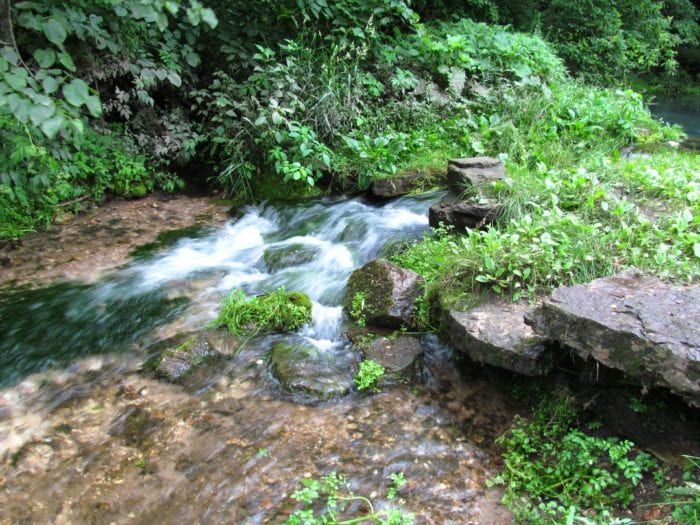
Route gallery
See this route on the water
Photos help show what the access looks like and what the route actually feels like on the water.
Sources
Check the data behind today's call.
Use this section when the page shows stale data, limited confidence, or a call you want to verify before driving.
Why this score Today's data confidence is checking
Data confidence mostly comes down to three things: how direct the gauge is, how clear the range is, and how fresh the data is.
- Checking data confidence notes.
- Checking data confidence cautions.
Outlook Tomorrow and weekend
This is a cautious early look. If the data is too thin, we leave it out.
Waiting on forecast.
Waiting on forecast.
Data behind the score Gauge, thresholds, and timing
These are the live readings and threshold notes behind today's score.
| Gauge site | Maquoketa River at Manchester, IA |
| Discharge | Checking |
| Gauge height | Checking |
| 24h trend | Checking |
| 24h change | Checking |
| Current band | Checking |
| Rain last 24h | Checking |
| Rain last 72h | Checking |
| Air temp | Checking |
| Water temp | Checking |
| Wind | Checking |
| Gusts | Checking |
| Rain timing | Checking |
| Target band | 251 cfs to 350 cfs |
| Low threshold | 50 cfs |
| High threshold | 451 cfs |
| Data confidence behind the range | Local route guidance |
| Gauge observed | Checking |
| Paddle Today updated | Checking |
| Main source behind this score | Wisconsin River Trips Maquoketa River Backbone State Park gauge ladder |
| Gauge source | Checking |
| Weather source | Checking |
| Rainfall source | Checking |
Notes What to know before you go
These notes cover the access details, route quirks, and source caveats most likely to matter once you get there.
- Published route report Highway 410 to Dundee Access, 6.2 miles
Wisconsin River Trips documents this exact route through Backbone State Park, naming Highway 410 as the put-in, Dundee Access as the take-out, and 6.2 miles as the route distance.
- Official corridor map Backbone State Park and Dundee Access
The Delaware County Upper Maquoketa River Water Trail map names Backbone State Park and Dundee Access among the mapped Maquoketa River water-trail access points.
- Take-out authority Dundee Wildlife Area canoe/kayak access
Delaware County/MyCountyParks says Dundee Wildlife Area has water access for canoeists and kayakers and specifically describes a scenic trip starting three miles upstream at Backbone State Park to Dundee Access.
- Direct gauge USGS 05416900
USGS operates Maquoketa River at Manchester, IA downstream on the same river, and Wisconsin River Trips uses this gauge for the Backbone State Park route ladder.
- Target range 251 to 350 cfs
Wisconsin River Trips describes 251 to 350 cfs at Manchester as high depth and a good target range for the upper parts of the Backbone route.
- Low-water floor 50 cfs
The route ladder says 0 to 50 cfs is likely too shallow for the pre-South-Fork stretch, while 51 to 100 cfs can require a bunch of wading before the South Fork.
- High-water ceiling 451+ cfs
WRT treats 451+ cfs as maybe too high for safe paddling on this route, and notes the dam-to-Dundee leg has pushy strainers at higher water.
- Endpoint coordinates Backbone 42.6331, -91.5617; Dundee 42.5793779, -91.5485886
The Backbone coordinate is the named Backbone State Park map context near the Highway 410 bridge access; the Dundee coordinate is the Water Quality Portal site named Maquoketa River (Dundee), matching the county-listed Dundee Access corridor.
- Hazards Dam portage, strainers, ledge, wind
WRT warns that Backbone Lake wind can be problematic, the dam portage and split channels below the dam should be scouted, and the dam-to-Dundee leg includes tricky current, low branches, strainers, and a two-foot rock ledge near 129th Street.
Verify it yourself Check the source links
Use these links to double-check the gauge, route details, and access notes before you head out.
Paddler reports
Recent notes from paddlers
A few quick notes from people who were on this route recently.
Reports
Photos, paddler notes, and updates.
See what others have shared, then add a condition report, upload photos, or flag anything that needs fixing.
Share your trip
Keep exploring
More routes to check next
Compare another stretch on this river, or jump to nearby options before you pick a plan.
Quick answers
Maquoketa River paddling FAQ
What water level is good for paddling Maquoketa River?
Paddle Today watches Maquoketa River at Manchester, IA and treats 251 cfs to 350 cfs as the target band for this route, with weather and recent trend included in the final score.
Where does this Maquoketa River route start and end?
This route starts at Highway 410 bridge access / Backbone State Park and ends at Dundee Access / Dundee Wildlife Area, about 6.2 mi on the water.
Is this Maquoketa River route good for beginners?
This is listed as a moderate route. Expect more planning than an easy float, and use the live score, route notes, and source links before committing.
Flag a change
See something outdated?
Access, hazards, wood, and shuttle details change. Send a quick correction if something looks off.