See all 2 routes on Turkey River
Iowa | Northeast Iowa
Turkey River
Elkader Whitewater Park to Motor Mill Access
Check current paddling conditions for this Turkey River route, including water level, recent gauge trend, weather, and route details.
Route snapshot
Loading the route snapshot. This usually takes a few seconds.
Today
Get the answer fast, then scan the route.
Start with the verdict, current conditions, route plan, and quick facts before you commit to the drive.
Today's conditions
Gauge
Recent trend
Checking preferred range.
Checking trend.
Gauge source
-- Checking timestampMN DNR provides the current paddling level here, but not chart-ready recent samples.
Weather
Best window today
Checking weather.
Today by hour
Short-route forecast
Checking the next several hours.
Quick facts
Plan
Dial in the shuttle, distance, and access.
Use this section once the route looks viable and you need to turn it into an actual trip plan.
Access plan
Access, shuttle, and map
Launch at Elkader Whitewater Park or the adjacent Elkader Access corridor and take out at Motor Mill Access. This is a popular Turkey River Water Trail section with riffles, wooded bluffs, Robert Creek, and a historic mill finish.
Put-in
Elkader Whitewater Park / Elkader Access #39B Open mapCasual paddlers can launch below or away from the whitewater feature; the engineered ledges at Elkader should be scouted before running.
Take-out
Motor Mill Access #32 Open mapThe water-trail guide names the corridor as Elkader Access #39B, while route reports often use Elkader Whitewater Park as the cleaner scenic put-in.
Pulling access map tiles. Usually under 5 seconds.
Access caveats
- Casual paddlers can launch below or away from the whitewater feature; the engineered ledges at Elkader should be scouted before running.
- The water-trail guide names the corridor as Elkader Access #39B, while route reports often use Elkader Whitewater Park as the cleaner scenic put-in.
- Motor Mill Access is downstream of the historic mill on river left. Identify it before continuing, because the next water-trail take-out at Garber is a much longer 12-plus-mile extension.
Watch for
- The Elkader whitewater-park ledges at the start, including more consequential lines that are not appropriate for unprepared flatwater paddlers.
- Frequent Class I riffles that become bumpy near the low band and pushier as the Elkader gauge rises.
- High-water loss of clarity, stronger current around outside bends, and more consequential landings at Motor Mill.
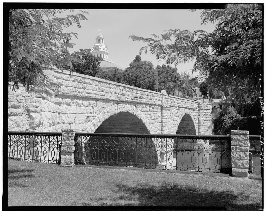
Route gallery
See this route on the water
Photos help show what the access looks like and what the route actually feels like on the water.
Sources
Check the data behind today's call.
Use this section when the page shows stale data, limited confidence, or a call you want to verify before driving.
Why this score Today's data confidence is checking
Data confidence mostly comes down to three things: how direct the gauge is, how clear the range is, and how fresh the data is.
- Checking data confidence notes.
- Checking data confidence cautions.
Outlook Tomorrow and weekend
This is a cautious early look. If the data is too thin, we leave it out.
Waiting on forecast.
Waiting on forecast.
Data behind the score Gauge, thresholds, and timing
These are the live readings and threshold notes behind today's score.
| Gauge site | Turkey River above French Hollow Cr at Elkader, IA |
| Discharge | Checking |
| Gauge height | Checking |
| 24h trend | Checking |
| 24h change | Checking |
| Current band | Checking |
| Rain last 24h | Checking |
| Rain last 72h | Checking |
| Air temp | Checking |
| Water temp | Checking |
| Wind | Checking |
| Gusts | Checking |
| Rain timing | Checking |
| Target band | 251 cfs to 450 cfs |
| Low threshold | 100 cfs |
| High threshold | 1,501 cfs |
| Data confidence behind the range | Local route guidance |
| Gauge observed | Checking |
| Paddle Today updated | Checking |
| Main source behind this score | Wisconsin River Trips Turkey River Elkader gauge ladder |
| Gauge source | Checking |
| Weather source | Checking |
| Rainfall source | Checking |
Notes What to know before you go
These notes cover the access details, route quirks, and source caveats most likely to matter once you get there.
- Official water-trail section Elkader #39B to Motor Mill #32
The Turkey River Water Trail map and guide describes the Elkader to Motor Mill section as a scenic 6.5-mile water-trail run with wooded bluffs, riffles, and a left-bank take-out at Motor Mill Access.
- Published route report Elkader Whitewater Park to Motor Mill Access
Wisconsin River Trips documents the Elkader Whitewater Park to Motor Mill Access route at about 7.0 miles and describes this as one of the better and more popular Turkey River trips.
- Target range 251 to 450 cfs
Wisconsin River Trips describes 251 to 450 cfs at the Elkader gauge as maybe an average flow rate for this route.
- Low-water floor 100 cfs
The same route ladder treats less than 100 cfs as maybe too shallow and 101 to 250 cfs as low but generally doable with bumpy riffles.
- High-water ceiling 1,501+ cfs
WRT treats 1,201 to 1,500 cfs as extremely high and perhaps suitable only for experienced paddlers, and 1,501+ cfs as maybe too high and probably dangerous.
- Direct gauge USGS 05412020
USGS operates Turkey River above French Hollow Creek at Elkader, IA with current stream observations on the same river in the route corridor.
- Put-in support Elkader Whitewater Park / Elkader Access
Iowa Whitewater Coalition publishes Elkader Whitewater Park coordinates, and the water-trail guide places Elkader Access #39B in the same downtown Elkader launch corridor.
- Take-out support Motor Mill Access
Clayton County Conservation lists water access to the Turkey River at Motor Mill Historic Site, while the Turkey River Water Trail identifies the downstream left-bank Motor Mill Access as Access #32.
Verify it yourself Check the source links
Use these links to double-check the gauge, route details, and access notes before you head out.
Paddler reports
Recent notes from paddlers
A few quick notes from people who were on this route recently.
Reports
Photos, paddler notes, and updates.
See what others have shared, then add a condition report, upload photos, or flag anything that needs fixing.
Share your trip
Keep exploring
More routes to check next
Compare another stretch on this river, or jump to nearby options before you pick a plan.
Quick answers
Turkey River paddling FAQ
What water level is good for paddling Turkey River?
Paddle Today watches Turkey River above French Hollow Cr at Elkader, IA and treats 251 cfs to 450 cfs as the target band for this route, with weather and recent trend included in the final score.
Where does this Turkey River route start and end?
This route starts at Elkader Whitewater Park / Elkader Access #39B and ends at Motor Mill Access #32, about 6.5 to 7 mi on the water.
Is this Turkey River route good for beginners?
This is listed as a moderate route. Expect more planning than an easy float, and use the live score, route notes, and source links before committing.
Flag a change
See something outdated?
Access, hazards, wood, and shuttle details change. Send a quick correction if something looks off.