See all 2 routes on Yellow River
Iowa | Northeast Iowa
Yellow River
Volney Canoe Access to Sixteen Bridge
Check current paddling conditions for this Yellow River route, including water level, recent gauge trend, weather, and route details.
Route snapshot
Loading the route snapshot. This usually takes a few seconds.
Today
Get the answer fast, then scan the route.
Start with the verdict, current conditions, route plan, and quick facts before you commit to the drive.
Today's conditions
Gauge
Recent trend
Checking preferred range.
Checking trend.
Gauge source
-- Checking timestampMN DNR provides the current paddling level here, but not chart-ready recent samples.
Weather
Best window today
Checking weather.
Today by hour
Short-route forecast
Checking the next several hours.
Quick facts
Plan
Dial in the shuttle, distance, and access.
Use this section once the route looks viable and you need to turn it into an actual trip plan.
Access plan
Access, shuttle, and map
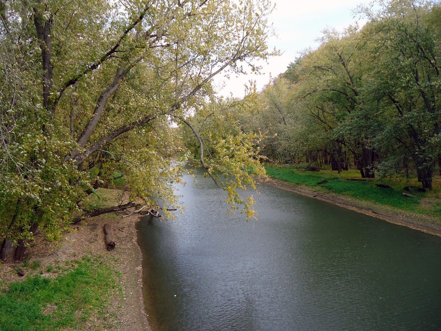
Launch at Volney Canoe Access and take out at Bridge Sixteen. This is the popular short Yellow River leg with clear water, fast riffles, trout-stream character, and limestone outcrops.
Put-in
Volney Canoe Access Open mapVolney is the cleaner public put-in than the upstream Volney Road bridge used for the longer WRT trip report.
Take-out
Bridge Sixteen Canoe Access Open mapUse the public Bridge Sixteen access downstream of the bridge. Do not use nearby Scenic View Campground facilities unless you are a customer.
Pulling access map tiles. Usually under 5 seconds.
Access caveats
- Volney is the cleaner public put-in than the upstream Volney Road bridge used for the longer WRT trip report.
- Use the public Bridge Sixteen access downstream of the bridge. Do not use nearby Scenic View Campground facilities unless you are a customer.
- Much of the river corridor is private. Stay with established access points and do not assume gravel bars or banks are public picnic sites.
Watch for
- Frequent Class I riffles and fast current; at high water some rapids can approach Class II consequences.
- Three or four strainers are noted on the route, including at least one that may require an easy portage at normal levels.
- Cold water, trout anglers, cloudy post-rain water, and fast rises after heavy rain.
Route gallery
See this route on the water
Photos help show what the access looks like and what the route actually feels like on the water.
Sources
Check the data behind today's call.
Use this section when the page shows stale data, limited confidence, or a call you want to verify before driving.
Why this score Today's data confidence is checking
Data confidence mostly comes down to three things: how direct the gauge is, how clear the range is, and how fresh the data is.
- Checking data confidence notes.
- Checking data confidence cautions.
Outlook Tomorrow and weekend
This is a cautious early look. If the data is too thin, we leave it out.
Waiting on forecast.
Waiting on forecast.
Data behind the score Gauge, thresholds, and timing
These are the live readings and threshold notes behind today's score.
| Gauge site | Yellow River near Ion, IA |
| Discharge | Checking |
| Gauge height | Checking |
| 24h trend | Checking |
| 24h change | Checking |
| Current band | Checking |
| Rain last 24h | Checking |
| Rain last 72h | Checking |
| Air temp | Checking |
| Water temp | Checking |
| Wind | Checking |
| Gusts | Checking |
| Rain timing | Checking |
| Target band | 201 cfs to 300 cfs |
| Low threshold | 100 cfs |
| High threshold | 601 cfs |
| Data confidence behind the range | Local route guidance |
| Gauge observed | Checking |
| Paddle Today updated | Checking |
| Main source behind this score | Wisconsin River Trips Yellow River Iowa gauge ladder |
| Gauge source | Checking |
| Weather source | Checking |
| Rainfall source | Checking |
Notes What to know before you go
These notes cover the access details, route quirks, and source caveats most likely to matter once you get there.
- Route support Volney to Sixteen, about 5 river miles
Wisconsin River Trips documents Volney Canoe Launch to Sixteen Bridge as the popular 4.6-mile Yellow River leg and notes the longer Volney Road bridge start at 5.3 miles.
- Published route report Volney Canoe Launch to Sixteen Bridge
Wisconsin River Trips identifies the Volney public canoe launch as the common put-in and Sixteen Bridge as the public take-out for the popular Yellow River leg.
- Target range 201 to 300 cfs
Wisconsin River Trips describes 201 to 300 cfs at the Ion gauge as average depth and a good target range for a well-padded river.
- Low-water floor 100 cfs
The same route ladder treats below 50 cfs as likely too low and 51 to 100 cfs as very shallow, maybe only suitable for flat-bottom boats.
- High-water ceiling 601+ cfs
WRT treats 601 to 1000 cfs as very high and perhaps only suitable for expert paddlers, and 1001+ cfs as maybe too high for kayaking.
- Direct gauge USGS 05389000
USGS operates Yellow River near Ion, IA with current discharge and gage-height observations. WRT uses this gauge for the route ladder.
- Put-in support Volney Canoe Access
Iowa DNR Fish Iowa says Yellow River has public fishing access, picnic facilities, and a carry-down boat launch at the Volney Canoe Access.
- Take-out support Bridge Sixteen Canoe Access
The named Bridge Sixteen Canoe Access is independently mapped at the downstream take-out used by the route report. Volney Park / Yellow River Canoe Access is mapped beside Volney Park and county material confirms canoe access there.
Verify it yourself Check the source links
Use these links to double-check the gauge, route details, and access notes before you head out.
Paddler reports
Recent notes from paddlers
A few quick notes from people who were on this route recently.
Reports
Photos, paddler notes, and updates.
See what others have shared, then add a condition report, upload photos, or flag anything that needs fixing.
Share your trip
Keep exploring
More routes to check next
Compare another stretch on this river, or jump to nearby options before you pick a plan.
Quick answers
Yellow River paddling FAQ
What water level is good for paddling Yellow River?
Paddle Today watches Yellow River near Ion, IA and treats 201 cfs to 300 cfs as the target band for this route, with weather and recent trend included in the final score.
Where does this Yellow River route start and end?
This route starts at Volney Canoe Access and ends at Bridge Sixteen Canoe Access, about About 4.6 to 5 mi on the water.
Is this Yellow River route good for beginners?
This is listed as a moderate route. Expect more planning than an easy float, and use the live score, route notes, and source links before committing.
Flag a change
See something outdated?
Access, hazards, wood, and shuttle details change. Send a quick correction if something looks off.