See all 2 routes on Yellow River
Iowa | Northeast Iowa
Yellow River
Bridge Sixteen to Highway 76
Check current paddling conditions for this Yellow River route, including water level, recent gauge trend, weather, and route details.
Route snapshot
Loading the route snapshot. This usually takes a few seconds.
Today
Get the answer fast, then scan the route.
Start with the verdict, current conditions, route plan, and quick facts before you commit to the drive.
Today's conditions
Gauge
Recent trend
Checking preferred range.
Checking trend.
Gauge source
-- Checking timestampMN DNR provides the current paddling level here, but not chart-ready recent samples.
Weather
Best window today
Checking weather.
Today by hour
Short-route forecast
Checking the next several hours.
Quick facts
Plan
Dial in the shuttle, distance, and access.
Use this section once the route looks viable and you need to turn it into an actual trip plan.
Access plan
Access, shuttle, and map
Launch from the public Bridge Sixteen access below the bridge and paddle the long lower Yellow River to the Highway 76 / railroad bridge area near the Mississippi. Expect fast early miles, bluffs, riffles, public-land solitude, and a floodplain finish near Effigy Mounds.
Put-in
Bridge Sixteen Canoe Access Open mapUse the public Bridge Sixteen launch downstream and river left of the bridge. Do not use Scenic View Campground take-outs, bathrooms, or private banks unless you are a paying customer or have permission.
Take-out
Highway 76 / Yellow River mouth access Open mapThe Highway 76 finish is a mouth-area access near railroad and highway infrastructure. Scout the take-out before launching, especially if the Mississippi is high or debris is present.
Pulling access map tiles. Usually under 5 seconds.
Access caveats
- Use the public Bridge Sixteen launch downstream and river left of the bridge. Do not use Scenic View Campground take-outs, bathrooms, or private banks unless you are a paying customer or have permission.
- The Highway 76 finish is a mouth-area access near railroad and highway infrastructure. Scout the take-out before launching, especially if the Mississippi is high or debris is present.
- The route is almost 17 miles and becomes harder to shorten once committed below the Ion Road area; plan daylight and shuttle carefully.
Watch for
- Frequent riffles and Class I+ current, with stronger rapids in the Sixteen-to-Ion stretch and pushier behavior as the Ion gauge rises.
- Sweepers, strainers, tight bends, rock walls, and occasional portage-worthy wood.
- Mississippi River backwater, floating debris, and confusing banks near the mouth at high river stages.
- Cold water, trout anglers, private campground banks at the put-in, and posted land-management rules through Yellow River State Forest and Effigy Mounds.
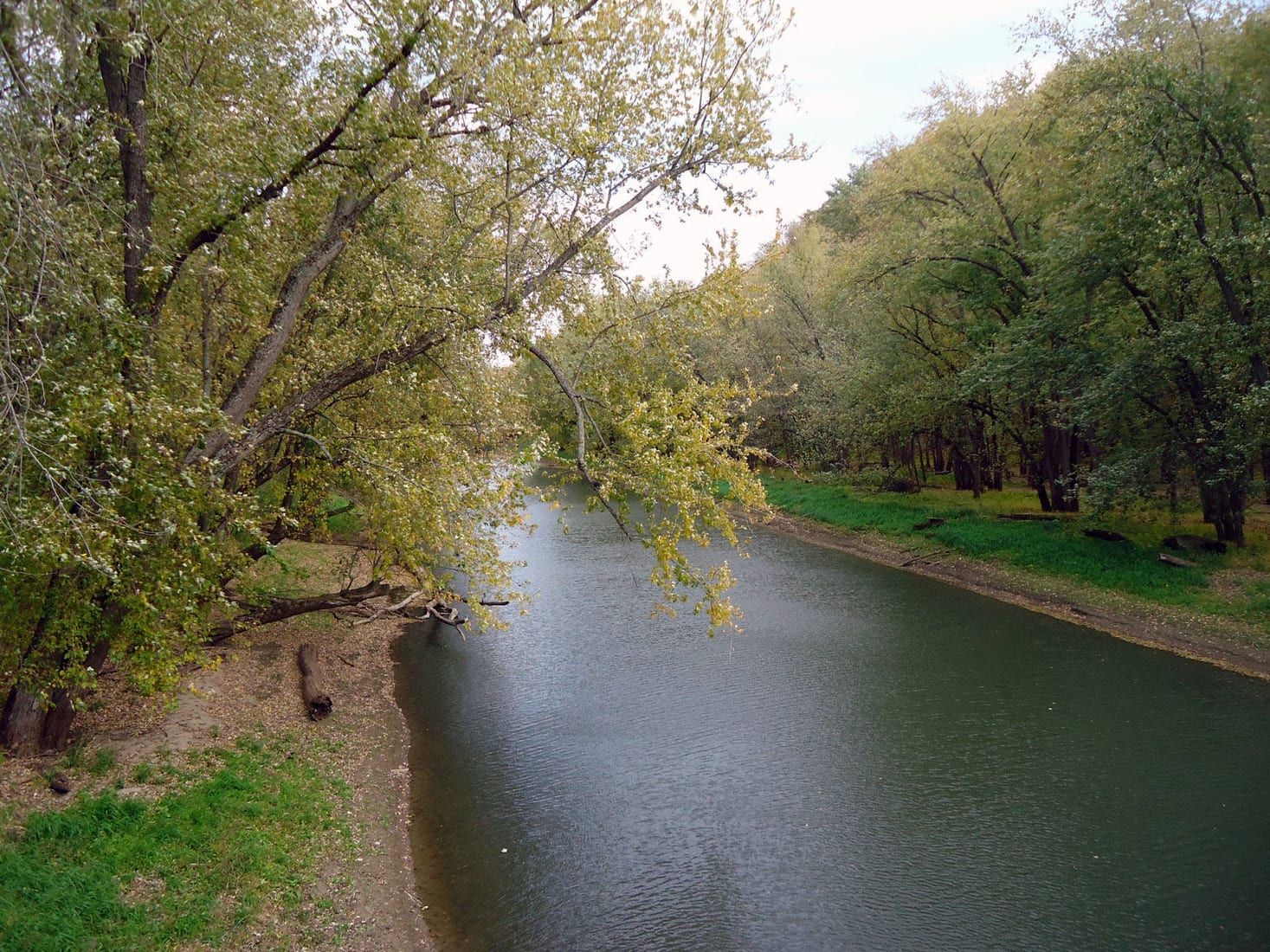
Route gallery
See this route on the water
Photos help show what the access looks like and what the route actually feels like on the water.
Sources
Check the data behind today's call.
Use this section when the page shows stale data, limited confidence, or a call you want to verify before driving.
Why this score Today's data confidence is checking
Data confidence mostly comes down to three things: how direct the gauge is, how clear the range is, and how fresh the data is.
- Checking data confidence notes.
- Checking data confidence cautions.
Outlook Tomorrow and weekend
This is a cautious early look. If the data is too thin, we leave it out.
Waiting on forecast.
Waiting on forecast.
Data behind the score Gauge, thresholds, and timing
These are the live readings and threshold notes behind today's score.
| Gauge site | Yellow River near Ion, IA |
| Discharge | Checking |
| Gauge height | Checking |
| 24h trend | Checking |
| 24h change | Checking |
| Current band | Checking |
| Rain last 24h | Checking |
| Rain last 72h | Checking |
| Air temp | Checking |
| Water temp | Checking |
| Wind | Checking |
| Gusts | Checking |
| Rain timing | Checking |
| Target band | 201 cfs to 300 cfs |
| Low threshold | 100 cfs |
| High threshold | 601 cfs |
| Data confidence behind the range | Local route guidance |
| Gauge observed | Checking |
| Paddle Today updated | Checking |
| Main source behind this score | Wisconsin River Trips Yellow River Iowa gauge ladder |
| Gauge source | Checking |
| Weather source | Checking |
| Rainfall source | Checking |
Notes What to know before you go
These notes cover the access details, route quirks, and source caveats most likely to matter once you get there.
- Published route report Old Sixteen Road to Highway 76, 16.75 miles
Miles Paddled documents the lower Yellow River from Old Sixteen Road to the Highway 76 railroad bridge near the Mississippi mouth, with put-in/take-out GPS points and a five-hour trip time.
- Lower route character Riffles, Class I+, public-land lower miles
Miles Paddled describes swift riffles, rock outcrops, strainers and sweepers, then public land through Yellow River State Forest and Effigy Mounds in the final lower section.
- Target range 201 to 300 cfs
Wisconsin River Trips describes 201 to 300 cfs at the Ion gauge as average depth and a good target range for a well-padded Yellow River.
- Low-water floor 100 cfs
The WRT Yellow River ladder treats below 50 cfs as likely too low and 51 to 100 cfs as very shallow; Miles Paddled separately says this lower route needs enough water and gives 80 cfs as a minimum caution.
- High-water ceiling 601+ cfs
WRT treats 601 to 1000 cfs as very high and perhaps only suitable for expert paddlers, with 1001+ cfs maybe too high for kayaking. The app keeps 601+ cfs outside broad recommendation.
- Direct gauge USGS 05389000
USGS operates Yellow River near Ion, IA with current discharge and gage-height observations, and both lower-Yellow route reports tie their conditions to the Ion gauge.
- Put-in support Bridge Sixteen public launch
Wisconsin River Trips says paddlers should use the public launch downstream and left of Sixteen Bridge, not the nearby private campground. Existing app research also identifies Bridge Sixteen Canoe Access as a named public access.
- Take-out support Highway 76 / Yellow River mouth access context
Miles Paddled used the Highway 76 and railroad bridge area as the safer take-out. NPS describes the Yellow River boardwalk and South Unit highway access area, while Iowa DNR maps canoe access and parking in the Yellow River State Forest lower corridor.
Verify it yourself Check the source links
Use these links to double-check the gauge, route details, and access notes before you head out.
Paddler reports
Recent notes from paddlers
A few quick notes from people who were on this route recently.
Reports
Photos, paddler notes, and updates.
See what others have shared, then add a condition report, upload photos, or flag anything that needs fixing.
Share your trip
Keep exploring
More routes to check next
Compare another stretch on this river, or jump to nearby options before you pick a plan.
Quick answers
Yellow River paddling FAQ
What water level is good for paddling Yellow River?
Paddle Today watches Yellow River near Ion, IA and treats 201 cfs to 300 cfs as the target band for this route, with weather and recent trend included in the final score.
Where does this Yellow River route start and end?
This route starts at Bridge Sixteen Canoe Access and ends at Highway 76 / Yellow River mouth access, about 16.75 mi on the water.
Is this Yellow River route good for beginners?
This is listed as a moderate route. Expect more planning than an easy float, and use the live score, route notes, and source links before committing.
Flag a change
See something outdated?
Access, hazards, wood, and shuttle details change. Send a quick correction if something looks off.