See all 2 routes on Pigeon River
Tennessee | East Tennessee
Pigeon River
Hartford Bridge to Denton
Check current paddling conditions for this Pigeon River route, including water level, recent gauge trend, weather, and route details.
Route snapshot
Loading the route snapshot. This usually takes a few seconds.
Today
Get the answer fast, then scan the route.
Start with the verdict, current conditions, route plan, and quick facts before you commit to the drive.
Today's conditions
Gauge
Recent trend
Checking preferred range.
Checking trend.
Gauge source
-- Checking timestampMN DNR provides the current paddling level here, but not chart-ready recent samples.
Weather
Best window today
Checking weather.
Today by hour
Short-route forecast
Checking the next several hours.
Quick facts
Plan
Dial in the shuttle, distance, and access.
Use this section once the route looks viable and you need to turn it into an actual trip plan.
Access plan
Access, shuttle, and map
Launch at Hartford Bridge and take out near Denton / Greasy Cove for the lower Pigeon. Use the Waterville USGS gauge and current release schedule, with extra caution around ledges and Maytag at higher water.
Put-in
Hartford Bridge put-in Open mapAmerican Whitewater says to make sure you have permission before parking at an outfitter and, at the take-out, to park near the bridge.
Take-out
Denton / Greasy Cove lower take-out Open mapThe Hartford Bridge access is also the upper-run take-out and can be busy during release windows. Keep staging compact and leave room for commercial traffic and emergency vehicles.
Pulling access map tiles. Usually under 5 seconds.
Access caveats
- American Whitewater says to make sure you have permission before parking at an outfitter and, at the take-out, to park near the bridge.
- The Hartford Bridge access is also the upper-run take-out and can be busy during release windows. Keep staging compact and leave room for commercial traffic and emergency vehicles.
- The lower take-out is on river right a few hundred feet after the Greasy Cove bridge. Identify it before launching so the group does not miss the exit.
- Release water takes time to reach Hartford. Do not launch on a dry-looking river without confirming the schedule and expected arrival window.
Watch for
- Class I-II ledge drops, Class II+ ledges, fast shoals, holes, rocks, and Maytag at Class II(III).
- Higher-water holes around the ledges and Maytag, especially above about 2,000 cfs where American Whitewater notes stronger features.
- Bridge supports, commercial rafts, swimmers, mixed-skill private groups, and broad channels where rescue can be harder than the grade suggests.
- Dam-release timing mismatches, sudden generation changes, storms, and any access restriction or river-control instruction.
- Low water below American Whitewater's runnable range, which can expose ledges and make the route scrape, pin, or strand boats.
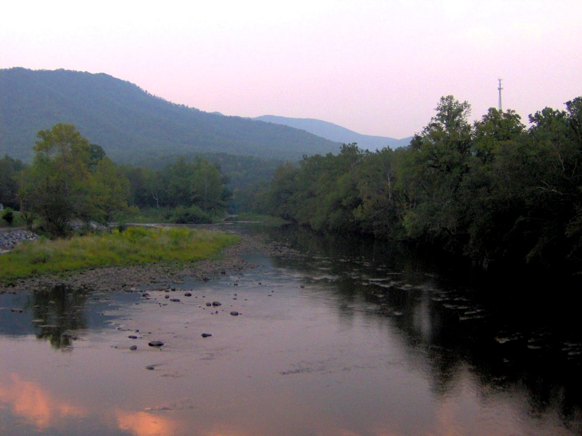
Route gallery
See this route on the water
Photos help show what the access looks like and what the route actually feels like on the water.
Sources
Check the data behind today's call.
Use this section when the page shows stale data, limited confidence, or a call you want to verify before driving.
Why this score Today's data confidence is checking
Data confidence mostly comes down to three things: how direct the gauge is, how clear the range is, and how fresh the data is.
- Checking data confidence notes.
- Checking data confidence cautions.
Outlook Tomorrow and weekend
This is a cautious early look. If the data is too thin, we leave it out.
Waiting on forecast.
Waiting on forecast.
Data behind the score Gauge, thresholds, and timing
These are the live readings and threshold notes behind today's score.
| Gauge site | Pigeon River below Power Plant near Waterville, NC |
| Discharge | Checking |
| Gauge height | Checking |
| 24h trend | Checking |
| 24h change | Checking |
| Current band | Checking |
| Rain last 24h | Checking |
| Rain last 72h | Checking |
| Air temp | Checking |
| Water temp | Checking |
| Wind | Checking |
| Gusts | Checking |
| Rain timing | Checking |
| Target band | 1,200 cfs to 2,500 cfs |
| Low threshold | 1,200 cfs |
| High threshold | 2,500 cfs |
| Data confidence behind the range | Official and local sources |
| Gauge observed | Checking |
| Paddle Today updated | Checking |
| Main source behind this score | American Whitewater Lower Pigeon runnable range |
| Gauge source | Checking |
| Weather source | Checking |
| Rainfall source | Checking |
Notes What to know before you go
These notes cover the access details, route quirks, and source caveats most likely to matter once you get there.
- Exact whitewater route Hartford Bridge to Denton, 4.8 mi
American Whitewater lists the lower Pigeon as Bridge at Hartford to Denton, 4.8 miles, Class II(III), using the Pigeon River below Power Plant near Waterville gauge.
- Manager route context Lower Pigeon below Hartford
The Forest Service describes the lower Pigeon as starting in Hartford and running almost five miles through Class II and III rapids to the lower take-out before Denton.
- AW runnable range 1,200-2,500 cfs
American Whitewater exposes the USGS 03460795 gauge correlation for this reach with begin-low-runnable 1,200 cfs and end-high-runnable 2,500 cfs.
- Live direct gauge USGS 03460795 at 1,450 cfs / 9.04 ft
USGS Water Services returned same-day discharge and gage height at 10:30 EDT on June 1, 2026 for Pigeon River below Power Plant near Waterville.
- Access and timing Hartford bridge put-in, Greasy Cove / lower public take-out
American Whitewater describes putting in on river right just upstream of Hartford Bridge, taking out on river right a few hundred feet after the Greasy Cove bridge, and allowing 1 to 1.5 hours for release water to arrive from the Waterville powerhouse.
- Coordinate anchors 35.8177, -83.1450 to 35.8443, -83.1865
American Whitewater route geometry anchors the Hartford Bridge put-in and Denton / Greasy Cove lower take-out corridor.
Verify it yourself Check the source links
Use these links to double-check the gauge, route details, and access notes before you head out.
Paddler reports
Recent notes from paddlers
A few quick notes from people who were on this route recently.
Reports
Photos, paddler notes, and updates.
See what others have shared, then add a condition report, upload photos, or flag anything that needs fixing.
Share your trip
Keep exploring
More routes to check next
Compare another stretch on this river, or jump to nearby options before you pick a plan.
Quick answers
Pigeon River paddling FAQ
What water level is good for paddling Pigeon River?
Paddle Today watches Pigeon River below Power Plant near Waterville, NC and treats 1,200 cfs to 2,500 cfs as the target band for this route, with weather and recent trend included in the final score.
Where does this Pigeon River route start and end?
This route starts at Hartford Bridge put-in and ends at Denton / Greasy Cove lower take-out, about About 4.8 mi on the water.
Is this Pigeon River route good for beginners?
This is listed as a moderate route. Expect more planning than an easy float, and use the live score, route notes, and source links before committing.
Flag a change
See something outdated?
Access, hazards, wood, and shuttle details change. Send a quick correction if something looks off.