See all 2 routes on Pigeon River
Tennessee | East Tennessee
Pigeon River
Waterville / Big Creek Bridge to Hartford Bridge
Check current paddling conditions for this Pigeon River route, including water level, recent gauge trend, weather, and route details.
Route snapshot
Loading the route snapshot. This usually takes a few seconds.
Today
Get the answer fast, then scan the route.
Start with the verdict, current conditions, route plan, and quick facts before you commit to the drive.
Today's conditions
Gauge
Recent trend
Checking preferred range.
Checking trend.
Gauge source
-- Checking timestampMN DNR provides the current paddling level here, but not chart-ready recent samples.
Weather
Best window today
Checking weather.
Today by hour
Short-route forecast
Checking the next several hours.
Quick facts
Plan
Dial in the shuttle, distance, and access.
Use this section once the route looks viable and you need to turn it into an actual trip plan.
Access plan
Access, shuttle, and map
Launch at the current Waterville / Big Creek bridge put-in and take out at Hartford Bridge for the upper Pigeon Gorge. Use USGS 03460795 and the active release schedule, and treat American Whitewater post-Helene notes as required pre-trip reading.
Put-in
Waterville / Big Creek bridge put-in Open mapAmerican Whitewater says the 2026 put-in is at the bridge just off the Waterville exit rather than farther upstream near the powerhouse until roadwork is finished and the upper access area is reestablished.
Take-out
Hartford Bridge public take-out Open mapParking is limited and the corridor has ongoing construction impacts. Do not block work areas, commercial outfitters, emergency access, or narrow road shoulders.
Pulling access map tiles. Usually under 5 seconds.
Access caveats
- American Whitewater says the 2026 put-in is at the bridge just off the Waterville exit rather than farther upstream near the powerhouse until roadwork is finished and the upper access area is reestablished.
- Parking is limited and the corridor has ongoing construction impacts. Do not block work areas, commercial outfitters, emergency access, or narrow road shoulders.
- Hartford Bridge is the planned take-out. Confirm the public take-out field/ramp and vehicle plan before launching, especially during busy release windows.
- This route starts in North Carolina and ends in Tennessee; make sure every paddler understands the shuttle, release timing, and no-go alternatives before leaving vehicles.
Watch for
- Class II-III+ big-water rapids, holes, ledges, wave trains, changing surf waves, and stronger moves around Lost Guide, Double Reactionary, and Accelerator.
- Post-Helene changes: shifted rocks, new holes, changed banks, construction material, metal/debris near banks, strainers, and evolving lines.
- Dam-release timing and sudden changes. The gauge can look different before release water reaches the route or after generation changes.
- Commercial raft traffic, limited eddies, swimmers, cold water, and difficult rescue in pushy current.
- Flows outside American Whitewater's runnable range, rising water, storms, or any current access closure or construction restriction.
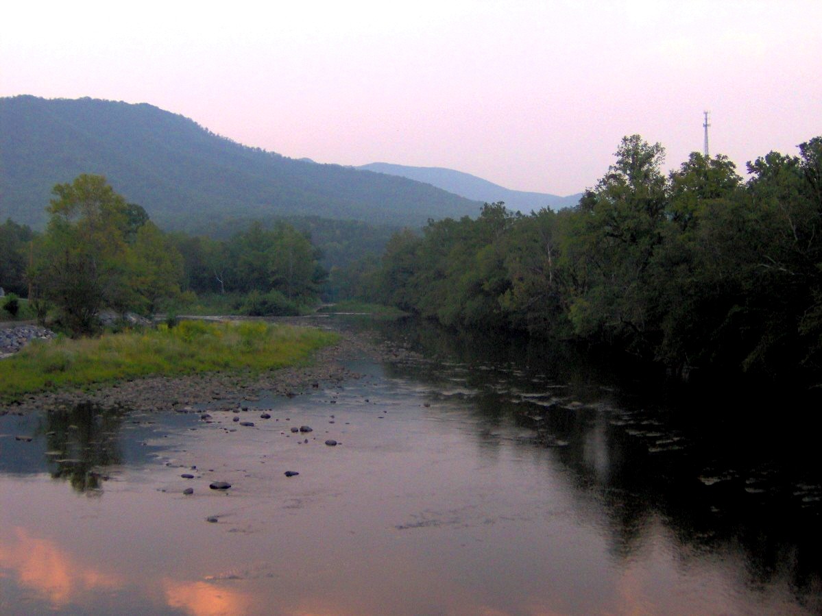
Route gallery
See this route on the water
Photos help show what the access looks like and what the route actually feels like on the water.
Sources
Check the data behind today's call.
Use this section when the page shows stale data, limited confidence, or a call you want to verify before driving.
Why this score Today's data confidence is checking
Data confidence mostly comes down to three things: how direct the gauge is, how clear the range is, and how fresh the data is.
- Checking data confidence notes.
- Checking data confidence cautions.
Outlook Tomorrow and weekend
This is a cautious early look. If the data is too thin, we leave it out.
Waiting on forecast.
Waiting on forecast.
Data behind the score Gauge, thresholds, and timing
These are the live readings and threshold notes behind today's score.
| Gauge site | Pigeon River below Power Plant near Waterville, NC |
| Discharge | Checking |
| Gauge height | Checking |
| 24h trend | Checking |
| 24h change | Checking |
| Current band | Checking |
| Rain last 24h | Checking |
| Rain last 72h | Checking |
| Air temp | Checking |
| Water temp | Checking |
| Wind | Checking |
| Gusts | Checking |
| Rain timing | Checking |
| Target band | 300 cfs to 4,500 cfs |
| Low threshold | 300 cfs |
| High threshold | 4,500 cfs |
| Data confidence behind the range | Official and local sources |
| Gauge observed | Checking |
| Paddle Today updated | Checking |
| Main source behind this score | American Whitewater Pigeon Gorge runnable range |
| Gauge source | Checking |
| Weather source | Checking |
| Rainfall source | Checking |
Notes What to know before you go
These notes cover the access details, route quirks, and source caveats most likely to matter once you get there.
- Exact whitewater route Waterville / Big Creek to Hartford Bridge, 4.3 mi
American Whitewater lists the Pigeon Gorge route as Walters Power Plant at Waterville / Big Creek to Hartford Bridge, 4.3 miles, Class II-III+.
- Manager route context Upper Pigeon to Hartford
The Forest Service describes the dam-controlled upper Pigeon as running from just below Walters Power Plant at Waterville through Class III and III+ rapids to the Hartford, Tennessee take-out.
- AW runnable range 300-4,500 cfs
American Whitewater exposes the USGS 03460795 gauge correlation for this reach with begin-low-runnable 300 cfs and end-high-runnable 4,500 cfs.
- Live direct gauge USGS 03460795 at 1,450 cfs / 9.04 ft
USGS Water Services returned same-day discharge and gage height at 10:30 EDT on June 1, 2026 for Pigeon River below Power Plant near Waterville.
- Post-Helene access and hazard caveat 2026 bridge put-in, construction and changed rapids
American Whitewater says Hurricane Helene dramatically changed rapids and access, that roadwork may continue into 2027 or 2028, and that the 2026 put-in is at the bridge just off the Waterville exit rather than farther upstream near the powerhouse.
- Coordinate anchors 35.7755, -83.1000 to 35.8131, -83.1450
American Whitewater route geometry anchors the current Waterville / Big Creek bridge put-in corridor and Hartford Bridge take-out.
Verify it yourself Check the source links
Use these links to double-check the gauge, route details, and access notes before you head out.
Paddler reports
Recent notes from paddlers
A few quick notes from people who were on this route recently.
Reports
Photos, paddler notes, and updates.
See what others have shared, then add a condition report, upload photos, or flag anything that needs fixing.
Share your trip
Keep exploring
More routes to check next
Compare another stretch on this river, or jump to nearby options before you pick a plan.
Quick answers
Pigeon River paddling FAQ
What water level is good for paddling Pigeon River?
Paddle Today watches Pigeon River below Power Plant near Waterville, NC and treats 300 cfs to 4,500 cfs as the target band for this route, with weather and recent trend included in the final score.
Where does this Pigeon River route start and end?
This route starts at Waterville / Big Creek bridge put-in and ends at Hartford Bridge public take-out, about About 4.3 mi on the water.
Is this Pigeon River route good for beginners?
This is listed as a hard route. Treat the live score as a planning aid, then confirm conditions, hazards, access, and group skill before launching.
Flag a change
See something outdated?
Access, hazards, wood, and shuttle details change. Send a quick correction if something looks off.