Tennessee | Chattanooga
South Chickamauga Creek
Shallowford Road to Sterchi Farm Park
Check current paddling conditions for this South Chickamauga Creek route, including water level, recent gauge trend, weather, and route details.
Route snapshot
Loading the route snapshot. This usually takes a few seconds.
Today
Get the answer fast, then scan the route.
Start with the verdict, current conditions, route plan, and quick facts before you commit to the drive.
Today's conditions
Gauge
Recent trend
Checking preferred range.
Checking trend.
Gauge source
-- Checking timestampMN DNR provides the current paddling level here, but not chart-ready recent samples.
Weather
Best window today
Checking weather.
Today by hour
Short-route forecast
Checking the next several hours.
Quick facts
Plan
Dial in the shuttle, distance, and access.
Use this section once the route looks viable and you need to turn it into an actual trip plan.
Access plan
Access, shuttle, and map
Launch at Shallowford Road and take out at Sterchi Farm Park for a short South Chickamauga Creek blueway trip through the Chattanooga greenway corridor. Use the South Chickamauga near Chickamauga USGS gauge as the direct same-day check and keep the decision conservative after rain.
Put-in
Shallowford Road canoe/kayak launch Open mapOutdoor Chattanooga lists Shallowford Road to Sterchi Farm as a recommended paddle, but this is still an urban creek corridor with bridges, industrial edges, private banks, and changing debris.
Take-out
Sterchi Farm Park public boat launch Open mapSterchi Farm Park is the planned take-out. Do not drift downstream toward the Tennessee River without a separate plan for backwater, current, river traffic, and a confirmed downstream landing.
Pulling access map tiles. Usually under 5 seconds.
Access caveats
- Outdoor Chattanooga lists Shallowford Road to Sterchi Farm as a recommended paddle, but this is still an urban creek corridor with bridges, industrial edges, private banks, and changing debris.
- Sterchi Farm Park is the planned take-out. Do not drift downstream toward the Tennessee River without a separate plan for backwater, current, river traffic, and a confirmed downstream landing.
- The lower creek can be affected by Chickamauga Dam releases and Tennessee River backwater. The gauge is direct for South Chickamauga, but same-day visual judgment at the launch still matters.
- Check Chattanooga greenway and park notices before committing to the shuttle, especially during stormwater, sewer-overflow reduction, trail, or access construction work.
Watch for
- Low water below about 180 cfs, when shallow bars and scraping become likely.
- Fast rises after rain, stormwater runoff, sewer-overflow/water-quality concerns, floating trash, broken glass, and industrial corridor debris.
- Strainers, fresh wood, bridge debris, tight bends, and swift current that can surprise casual paddlers even on a short route.
- High or rising water, thunderstorms, poor visibility, cold water, and any posted flooding or sanctuary/access closure upstream or downstream.
- Private banks and greenway users near launches; keep staging compact, use public access points only, and leave room for other trail and park users.
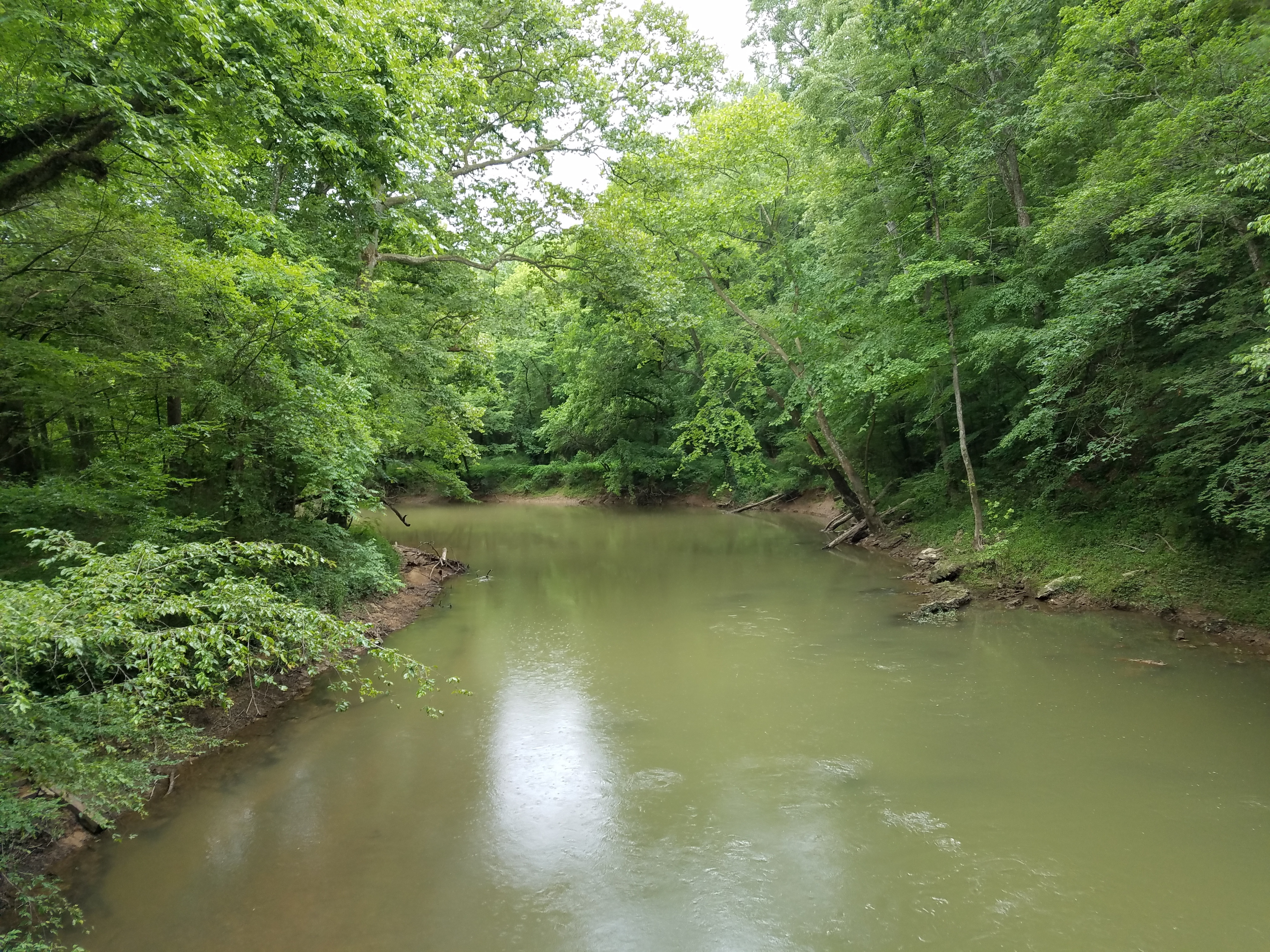
Route gallery
See this route on the water
Photos help show what the access looks like and what the route actually feels like on the water.
Sources
Check the data behind today's call.
Use this section when the page shows stale data, limited confidence, or a call you want to verify before driving.
Why this score Today's data confidence is checking
Data confidence mostly comes down to three things: how direct the gauge is, how clear the range is, and how fresh the data is.
- Checking data confidence notes.
- Checking data confidence cautions.
Outlook Tomorrow and weekend
This is a cautious early look. If the data is too thin, we leave it out.
Waiting on forecast.
Waiting on forecast.
Data behind the score Gauge, thresholds, and timing
These are the live readings and threshold notes behind today's score.
| Gauge site | South Chickamauga Creek Near Chickamauga, TN |
| Discharge | Checking |
| Gauge height | Checking |
| 24h trend | Checking |
| 24h change | Checking |
| Current band | Checking |
| Rain last 24h | Checking |
| Rain last 72h | Checking |
| Air temp | Checking |
| Water temp | Checking |
| Wind | Checking |
| Gusts | Checking |
| Rain timing | Checking |
| Ideal range | Needs paddler reports |
| Known low-water floor | 180 cfs |
| High threshold | Not calibrated yet |
| Data confidence behind the range | Local route guidance |
| Gauge observed | Checking |
| Paddle Today updated | Checking |
| Main source behind this score | Canoeing & Kayaking Georgia South Chickamauga Creek minimum level |
| Gauge source | Checking |
| Weather source | Checking |
| Rainfall source | Checking |
Notes What to know before you go
These notes cover the access details, route quirks, and source caveats most likely to matter once you get there.
- Official route shape Shallowford Road to Sterchi Farm, 2-hour paddle
Outdoor Chattanooga lists Shallowford Road to Sterchi Farm as a recommended South Chickamauga Creek paddle and identifies canoe/kayak launches at Riverpoint, Sterchi Farm Park, Camp Jordan, and Shallowford Road.
- City paddle-program support About 6 miles
A City of Chattanooga Parks & Outdoors Blueway Paddle Trails listing describes the Shallowford Road to Sterchi Farm Park route as a scenic six-mile kayak trip with gentle current and a Sterchi take-out.
- Live direct gauge USGS 03567500 at 385 cfs / 5.20 ft
USGS Water Services and the legacy current-conditions page showed same-day discharge and gage height at 09:15 EDT on June 1, 2026 for South Chickamauga Creek near Chickamauga.
- Low-water floor 180 cfs minimum-only
Canoeing & Kayaking Georgia source material ties South Chickamauga Creek downstream at Chickamauga to a 180 cfs minimum runnable level. Paddle Today uses that as a conservative floor and does not infer an ideal range or high-water cutoff.
- Rapid-change and access cautions Urban creek, dam/backwater influence, debris, and swift current
Outdoor Chattanooga warns creek levels and current can fluctuate due to Chickamauga Dam releases, while Chattanooga Audubon says levels can change rapidly and notes debris, swift current, flooding closures, and PFD requirements.
- Endpoint coordinates 35.049, -85.214 to 35.084, -85.226
The Canoeing & Kayaking Georgia access page lists Shallowford Road at river mile 8 and Sterchi Farm Park at river mile 3 with these coordinates; Outdoor Chattanooga corroborates the public launch/take-out context.
Verify it yourself Check the source links
Use these links to double-check the gauge, route details, and access notes before you head out.
Paddler reports
Recent notes from paddlers
A few quick notes from people who were on this route recently.
Reports
Photos, paddler notes, and updates.
See what others have shared, then add a condition report, upload photos, or flag anything that needs fixing.
Share your trip
Keep exploring
More routes to check next
Compare another stretch on this river, or jump to nearby options before you pick a plan.
More in Tennessee
All 4 routesNearby routes by distance
Quick answers
South Chickamauga Creek paddling FAQ
What water level is good for paddling South Chickamauga Creek?
Paddle Today watches South Chickamauga Creek Near Chickamauga, TN and uses 180 cfs as the conservative low-water floor for this route. The ideal range still needs more paddler reports.
Where does this South Chickamauga Creek route start and end?
This route starts at Shallowford Road canoe/kayak launch and ends at Sterchi Farm Park public boat launch, about About 6 mi on the water.
Is this South Chickamauga Creek route good for beginners?
This is listed as an easy route, but conditions still matter. Check today's score, water level, weather, and access notes before you go.
Flag a change
See something outdated?
Access, hazards, wood, and shuttle details change. Send a quick correction if something looks off.