See all 14 routes on Kansas River
Kansas | Kansas City Metro
Kansas River
Edwardsville to Turner Bridge
Check current paddling conditions for this Kansas River route, including water level, recent gauge trend, weather, and route details.
Route snapshot
Loading the route snapshot. This usually takes a few seconds.
Today
Get the answer fast, then scan the route.
Start with the verdict, current conditions, route plan, and quick facts before you commit to the drive.
Today's conditions
Gauge
Recent trend
Checking preferred range.
Checking trend.
Gauge source
-- Checking timestampMN DNR provides the current paddling level here, but not chart-ready recent samples.
Weather
Best window today
Checking weather.
Today by hour
Short-route forecast
Checking the next several hours.
Quick facts
Plan
Dial in the shuttle, distance, and access.
Use this section once the route looks viable and you need to turn it into an actual trip plan.
Access plan
Access, shuttle, and map
Launch at Edwardsville and take out at Turner Bridge for a lower-Kaw link that includes the WaterOne low-head dam. Portage river left only, never use the river-right notch, and skip the route if the group cannot safely land, carry, and relaunch around the dam.
Put-in
Edwardsville Access Ramp / River Front Park Open mapEdwardsville has strong public-ramp amenities, but same-day city, park, ramp, mud, debris, or event conditions still control.
Take-out
Turner Bridge Access Ramp Open mapThe WaterOne low-head dam is about 1.8 miles below Edwardsville. Friends of the Kaw says not to go over it in any vessel and to portage on the north bank, river left, only.
Pulling access map tiles. Usually under 5 seconds.
Access caveats
- Edwardsville has strong public-ramp amenities, but same-day city, park, ramp, mud, debris, or event conditions still control.
- The WaterOne low-head dam is about 1.8 miles below Edwardsville. Friends of the Kaw says not to go over it in any vessel and to portage on the north bank, river left, only.
- The WaterOne portage is a rough 100+ yard carry over large loose rocks. Wheels and carts are not useful, and high water can require an earlier landing on slick mud upstream.
- Turner Bridge has no amenities and a small gravel parking lot that Friends of the Kaw says is not often well graded and can be muddy after recent high water.
Watch for
- WaterOne low-head dam at river mile 14.8. Land river left well above the structure, avoid the river-right low-water notch, and do not enter the dam hydraulic.
- Low flows below about 1,000 cfs can expose mud, rocks, and awkward carry footing while making lower-channel travel slow.
- Flows above 5,000 cfs are outside the novice band, and above 8,000 cfs Friends of the Kaw says sandbar rest stops become scarce.
- This lower reach has well-defined banks and almost no sandbars, so do not count on easy mid-route stops beyond the required portage.
- Wind in the open lower valley, storms, rising water, floating wood, strainers, bridge current, bank hooks and fishing lines, and industrial riverfront traffic.
- Private banks along the Kaw; stay with public ramps, the documented dam portage, and legal stops rather than climbing banks elsewhere.
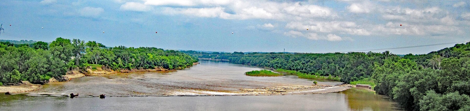
Route gallery
See this route on the water
Photos help show what the access looks like and what the route actually feels like on the water.
Sources
Check the data behind today's call.
Use this section when the page shows stale data, limited confidence, or a call you want to verify before driving.
Why this score Today's data confidence is checking
Data confidence mostly comes down to three things: how direct the gauge is, how clear the range is, and how fresh the data is.
- Checking data confidence notes.
- Checking data confidence cautions.
Outlook Tomorrow and weekend
This is a cautious early look. If the data is too thin, we leave it out.
Waiting on forecast.
Waiting on forecast.
Data behind the score Gauge, thresholds, and timing
These are the live readings and threshold notes behind today's score.
| Gauge site | Kansas River at De Soto, KS |
| Discharge | Checking |
| Gauge height | Checking |
| 24h trend | Checking |
| 24h change | Checking |
| Current band | Checking |
| Rain last 24h | Checking |
| Rain last 72h | Checking |
| Air temp | Checking |
| Water temp | Checking |
| Wind | Checking |
| Gusts | Checking |
| Rain timing | Checking |
| Target band | 1,500 cfs to 5,000 cfs |
| Low threshold | 1,000 cfs |
| High threshold | 8,000 cfs |
| Data confidence behind the range | Official and local sources |
| Gauge observed | Checking |
| Paddle Today updated | Checking |
| Main source behind this score | Friends of the Kaw safety bands and USACE Kansas River recreation flow impacts |
| Gauge source | Checking |
| Weather source | Checking |
| Rainfall source | Checking |
Notes What to know before you go
These notes cover the access details, route quirks, and source caveats most likely to matter once you get there.
- Public put-in Edwardsville Access Ramp, RM 16.6
Friends of the Kaw lists the Edwardsville ramp at River Front Park with GPS 39.05056, -94.81665, concrete ramp, large lighted parking lot, restroom, trash can, picnic tables, and lighting.
- Public take-out Turner Bridge Access Ramp, RM 9.2
Friends of the Kaw lists Turner Bridge Access Ramp near 32 Highway and Turner Diagonal with GPS 39.09396, -94.71176, a river-left concrete ramp, and a gravel parking lot for about 10 vehicles.
- Route distance About 7.4 river miles
The access map places Edwardsville at river mile 16.6 and Turner Bridge at river mile 9.2. The Edwardsville page names Turner Bridge as the next day-trip access ramp downstream.
- Mandatory portage WaterOne dam, RM 14.8
Friends of the Kaw says the WaterOne low-head dam should not be run in any vessel. Portage river left only, over a rough 100+ yard carry with loose rock and no useful wheels or carts.
- Public river and ramps Kansas, Arkansas, and Missouri Rivers public in Kansas
Friends of the Kaw says the Kansas, Arkansas, and Missouri Rivers are public rivers in Kansas and that all Kansas River boat ramps are open to the public.
- Flow safety bands Novices under 5,000 cfs; all paddlers under 8,000 cfs
Friends of the Kaw recommends novice paddlers stay below 5,000 cfs and more experienced paddlers stay below 8,000 cfs; at 8,000 cfs and higher, few sandbars remain for rest stops.
- Low-flow recreation impacts <1,000 / 1,500-5,000 / 8,000+ cfs
USACE Kansas River recreation material identifies difficult paddling below 1,000 cfs, no recreation impacts from 1,500 to 5,000 cfs, novice impacts from 5,000 to 8,000 cfs, and extremely difficult paddling from 8,000 to 11,000 cfs.
- Gauge USGS 06892350 De Soto proxy
USGS operates Kansas River at De Soto, KS upstream of this lower-Kaw reach. The closer Kansas City gauge is stage-only and does not compute discharge, so the app uses De Soto as the conservative cfs proxy.
Verify it yourself Check the source links
Use these links to double-check the gauge, route details, and access notes before you head out.
- Friends of the Kaw Kansas River access map
- Friends of the Kaw Edwardsville access
- Friends of the Kaw WaterOne low-head dam
- Friends of the Kaw Turner Bridge access
- Friends of the Kaw River Access Tips
- Friends of the Kaw Paddle FAQ
- Friends of the Kaw river and sandbar safety
- USACE Kansas River recreation appendix
- USGS 06892350 Kansas River at De Soto
Paddler reports
Recent notes from paddlers
A few quick notes from people who were on this route recently.
Reports
Photos, paddler notes, and updates.
See what others have shared, then add a condition report, upload photos, or flag anything that needs fixing.
Share your trip
Keep exploring
More routes to check next
Compare another stretch on this river, or jump to nearby options before you pick a plan.
Quick answers
Kansas River paddling FAQ
What water level is good for paddling Kansas River?
Paddle Today watches Kansas River at De Soto, KS and treats 1,500 cfs to 5,000 cfs as the target band for this route, with weather and recent trend included in the final score.
Where does this Kansas River route start and end?
This route starts at Edwardsville Access Ramp / River Front Park and ends at Turner Bridge Access Ramp, about About 7.4 mi on the water.
Is this Kansas River route good for beginners?
This is listed as a moderate route. Expect more planning than an easy float, and use the live score, route notes, and source links before committing.
Flag a change
See something outdated?
Access, hazards, wood, and shuttle details change. Send a quick correction if something looks off.