See all 5 routes on Meramec River
Missouri | Missouri Ozarks
Meramec River
Campbell Bridge Access to Sappington Bridge Access
Check current paddling conditions for this Meramec River route, including water level, recent gauge trend, weather, and route details.
Route snapshot
Loading the route snapshot. This usually takes a few seconds.
Today
Get the answer fast, then scan the route.
Start with the verdict, current conditions, route plan, and quick facts before you commit to the drive.
Today's conditions
Gauge
Recent trend
Checking preferred range.
Checking trend.
Gauge source
-- Checking timestampMN DNR provides the current paddling level here, but not chart-ready recent samples.
Weather
Best window today
Checking weather.
Today by hour
Short-route forecast
Checking the next several hours.
Quick facts
Plan
Dial in the shuttle, distance, and access.
Use this section once the route looks viable and you need to turn it into an actual trip plan.
Access plan
Access, shuttle, and map
Launch at MDC Campbell Bridge Access and take out at MDC Sappington Bridge Access for the middle Meramec link through Blue Springs Creek. MDC documents the access spacing as two five-mile legs, and the app uses the Sullivan USGS gauge at the take-out corridor as a conservative low-water check.
Put-in
Campbell Bridge Access Open mapCampbell Bridge and Sappington Bridge are MDC river accesses with concrete ramps, dedicated canoe launches, restrooms, and parking, but same-day signs and local access conditions still control use.
Take-out
Sappington Bridge Access Open mapBlue Springs Creek is an intermediate route landmark, not a recommended take-out in this app route. Plan to continue to Sappington unless you have a separate legal access plan.
Pulling access map tiles. Usually under 5 seconds.
Access caveats
- Campbell Bridge and Sappington Bridge are MDC river accesses with concrete ramps, dedicated canoe launches, restrooms, and parking, but same-day signs and local access conditions still control use.
- Blue Springs Creek is an intermediate route landmark, not a recommended take-out in this app route. Plan to continue to Sappington unless you have a separate legal access plan.
- Coordinates are practical public paddling-location anchors paired with MDC route and map evidence; verify both landings from the road before leaving vehicles.
Watch for
- Shallow riffles and dragging when the Sullivan gauge falls near or below the 200 cfs floor.
- High water, fresh wood, bridge current, pushy bends, and harder landings after rain; MoHERP high and flood categories are not broad casual-float conditions.
- Ten-mile pacing, warm-weather crowds, anglers, swimmers, rental traffic, and occasional motorized users in the Sullivan-area Meramec corridor.
- Private land away from public accesses and legal gravel-bar stops; stay within Missouri stream-access rules and respect posted land.
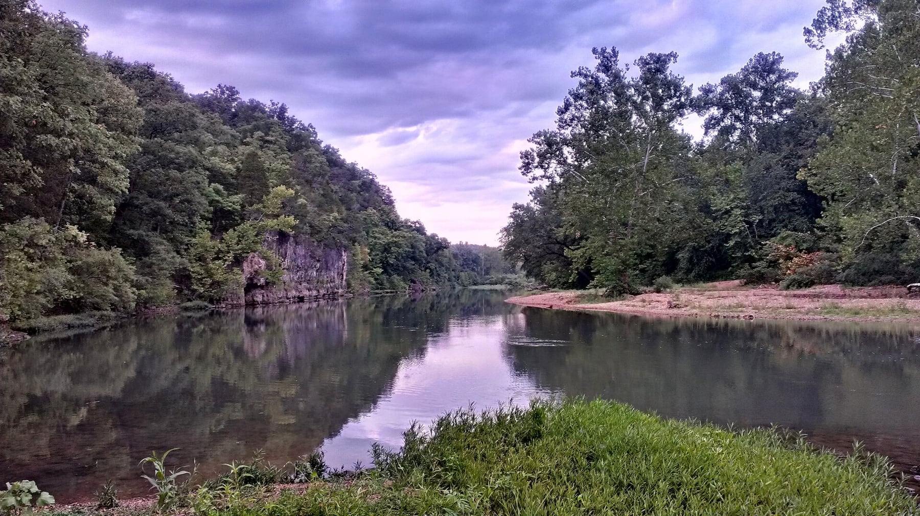
Route gallery
See this route on the water
Photos help show what the access looks like and what the route actually feels like on the water.
Sources
Check the data behind today's call.
Use this section when the page shows stale data, limited confidence, or a call you want to verify before driving.
Why this score Today's data confidence is checking
Data confidence mostly comes down to three things: how direct the gauge is, how clear the range is, and how fresh the data is.
- Checking data confidence notes.
- Checking data confidence cautions.
Outlook Tomorrow and weekend
This is a cautious early look. If the data is too thin, we leave it out.
Waiting on forecast.
Waiting on forecast.
Data behind the score Gauge, thresholds, and timing
These are the live readings and threshold notes behind today's score.
| Gauge site | Meramec River near Sullivan, MO |
| Discharge | Checking |
| Gauge height | Checking |
| 24h trend | Checking |
| 24h change | Checking |
| Current band | Checking |
| Rain last 24h | Checking |
| Rain last 72h | Checking |
| Air temp | Checking |
| Water temp | Checking |
| Wind | Checking |
| Gusts | Checking |
| Rain timing | Checking |
| Ideal range | Needs paddler reports |
| Known low-water floor | 200 cfs |
| High threshold | Not calibrated yet |
| Data confidence behind the range | Local route guidance |
| Gauge observed | Checking |
| Paddle Today updated | Checking |
| Main source behind this score | Rivers.MOHERP Sullivan gauge rating and Meramec trip logs |
| Gauge source | Checking |
| Weather source | Checking |
| Rainfall source | Checking |
Notes What to know before you go
These notes cover the access details, route quirks, and source caveats most likely to matter once you get there.
- Official route shape Campbell Bridge to Sappington Bridge, about 10 miles
MDC planning material says continued floating from Campbell Bridge Access to Blue Springs Creek is 5 miles and from Blue Springs Creek to Sappington Bridge Access is another 5 miles.
- Public put-in Campbell Bridge Access
MDC says Campbell Bridge Access provides Meramec River access with a concrete boat ramp, dedicated canoe launch, restroom, and ample parking.
- Public take-out Sappington Bridge Access
MDC says Sappington Bridge Access provides Meramec River access with a concrete boat ramp, dedicated canoe launch, restroom, and parking.
- Direct gauge USGS 07014500
USGS operates Meramec River near Sullivan, MO, the live Meramec gauge at the Sappington / Sullivan route corridor and the same gauge already configured for neighboring V2 routes.
- Low-water floor 200 cfs minimum-only
Rivers.MOHERP rates the Sullivan gauge good beginning at 200 cfs and includes a Campbell Bridge to Blue Springs Creek trip rated good at 506 cfs, plus nearby Meramec trip logs rated good from roughly 294 to 543 cfs.
- Current check 574 cfs / 3.38 ft at 2026-05-30 16:30
Rivers.MOHERP showed same-day Sullivan gauge data during this run, supporting the same USGS gauge path already used for adjacent Meramec route scoring. The app does not use that snapshot as a fixed recommendation.
- High-water caution High and flood categories are not casual-float water
Rivers.MOHERP describes high water as potentially dangerous for young or inexperienced paddlers and flood water as avoidable for casual trips because obstacles can be treacherous or deadly.
Verify it yourself Check the source links
Use these links to double-check the gauge, route details, and access notes before you head out.
Paddler reports
Recent notes from paddlers
A few quick notes from people who were on this route recently.
Reports
Photos, paddler notes, and updates.
See what others have shared, then add a condition report, upload photos, or flag anything that needs fixing.
Share your trip
Keep exploring
More routes to check next
Compare another stretch on this river, or jump to nearby options before you pick a plan.
Quick answers
Meramec River paddling FAQ
What water level is good for paddling Meramec River?
Paddle Today watches Meramec River near Sullivan, MO and uses 200 cfs as the conservative low-water floor for this route. The ideal range still needs more paddler reports.
Where does this Meramec River route start and end?
This route starts at Campbell Bridge Access and ends at Sappington Bridge Access, about About 10 mi on the water.
Is this Meramec River route good for beginners?
This is listed as an easy route, but conditions still matter. Check today's score, water level, weather, and access notes before you go.
Flag a change
See something outdated?
Access, hazards, wood, and shuttle details change. Send a quick correction if something looks off.