See all 5 routes on Meramec River
Missouri | Missouri Ozarks
Meramec River
Scotts Ford Access to Riverview Access
Check current paddling conditions for this Meramec River route, including water level, recent gauge trend, weather, and route details.
Route snapshot
Loading the route snapshot. This usually takes a few seconds.
Today
Get the answer fast, then scan the route.
Start with the verdict, current conditions, route plan, and quick facts before you commit to the drive.
Today's conditions
Gauge
Recent trend
Checking preferred range.
Checking trend.
Gauge source
-- Checking timestampMN DNR provides the current paddling level here, but not chart-ready recent samples.
Weather
Best window today
Checking weather.
Today by hour
Short-route forecast
Checking the next several hours.
Quick facts
Plan
Dial in the shuttle, distance, and access.
Use this section once the route looks viable and you need to turn it into an actual trip plan.
Access plan
Access, shuttle, and map
Launch at MDC Scotts Ford Access and take out at MDC Riverview Access for a 7-mile upper Meramec day near Steelville. MDC documents the route, and the Steelville USGS gauge is used as a conservative low-water check.
Put-in
Scotts Ford Access Open mapScotts Ford is an MDC department area with posted 4 a.m. to 10 p.m. hours and local signs or area maps controlling exact use.
Take-out
Riverview Access Open mapRiverview is an MDC access with a concrete boat ramp and small parking lot; the final road segment is beyond state maintenance, so inspect it before leaving a vehicle.
Pulling access map tiles. Usually under 5 seconds.
Access caveats
- Scotts Ford is an MDC department area with posted 4 a.m. to 10 p.m. hours and local signs or area maps controlling exact use.
- Riverview is an MDC access with a concrete boat ramp and small parking lot; the final road segment is beyond state maintenance, so inspect it before leaving a vehicle.
- Coordinates are practical public paddling-location anchors paired with MDC access confirmation; follow on-site signs for exact ramp, parking, and closure conditions.
Watch for
- Shallow riffles, dragging, and a slower day when the Steelville gauge is near or below the 343 cfs floor.
- High or rising water after rain, fresh wood, pushy bends, cloudy water, and harder landings at small access areas.
- Warm-weather crowding from private paddlers, outfitters, anglers, swimmers, and gravel-bar users in the Steelville-area corridor.
- Private land away from public accesses and lawful gravel-bar stops; do not assume banks are public picnic or camping areas.
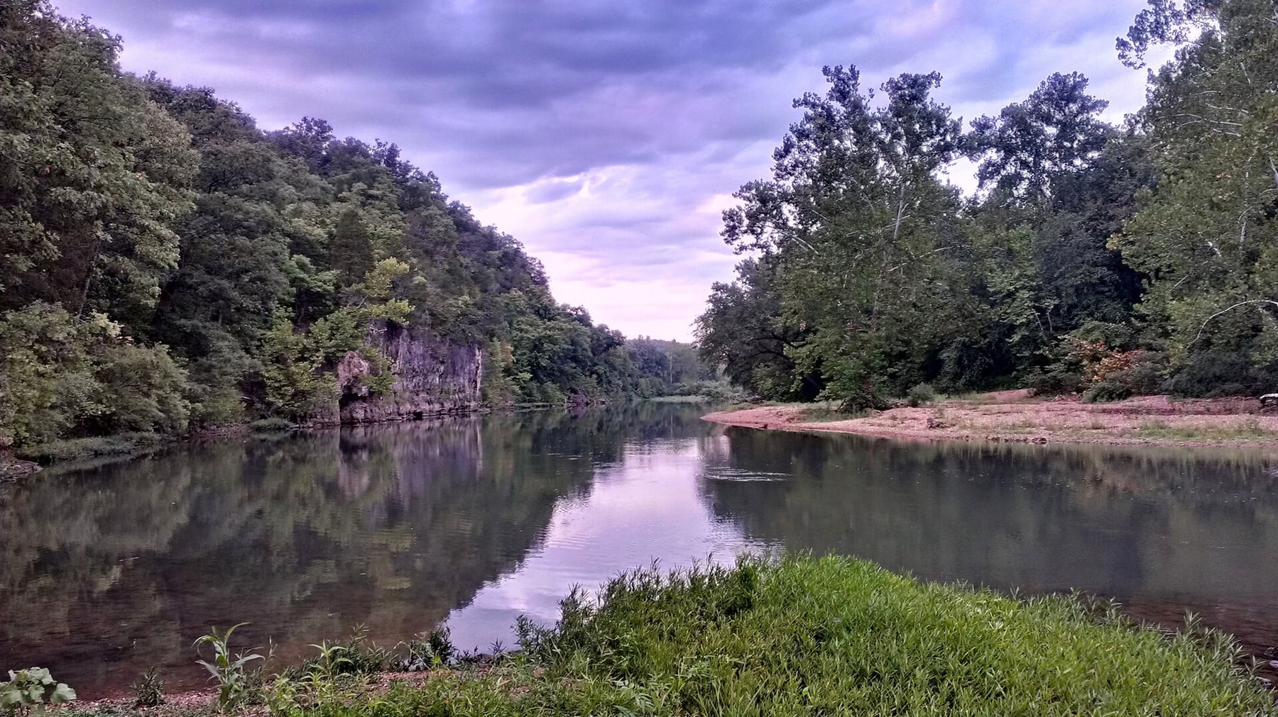
Route gallery
See this route on the water
Photos help show what the access looks like and what the route actually feels like on the water.
Sources
Check the data behind today's call.
Use this section when the page shows stale data, limited confidence, or a call you want to verify before driving.
Why this score Today's data confidence is checking
Data confidence mostly comes down to three things: how direct the gauge is, how clear the range is, and how fresh the data is.
- Checking data confidence notes.
- Checking data confidence cautions.
Outlook Tomorrow and weekend
This is a cautious early look. If the data is too thin, we leave it out.
Waiting on forecast.
Waiting on forecast.
Data behind the score Gauge, thresholds, and timing
These are the live readings and threshold notes behind today's score.
| Gauge site | Meramec River near Steelville, MO |
| Discharge | Checking |
| Gauge height | Checking |
| 24h trend | Checking |
| 24h change | Checking |
| Current band | Checking |
| Rain last 24h | Checking |
| Rain last 72h | Checking |
| Air temp | Checking |
| Water temp | Checking |
| Wind | Checking |
| Gusts | Checking |
| Rain timing | Checking |
| Ideal range | Needs paddler reports |
| Known low-water floor | 343 cfs |
| High threshold | Not calibrated yet |
| Data confidence behind the range | Local route guidance |
| Gauge observed | Checking |
| Paddle Today updated | Checking |
| Main source behind this score | Rivers.MOHERP Steelville gauge bands and upper Meramec trip evidence |
| Gauge source | Checking |
| Weather source | Checking |
| Rainfall source | Checking |
Notes What to know before you go
These notes cover the access details, route quirks, and source caveats most likely to matter once you get there.
- Official route shape Scotts Ford to Riverview, 7 miles
MDC planning material for Riverview Access says a canoe float from Scotts Ford Access to Riverview Access is 7 miles.
- Public put-in MDC Scotts Ford Access
MDC lists Scotts Ford Access as a public department area on the Meramec River, with area hours, directions from Steelville, parking, and river-access map material.
- Public take-out MDC Riverview Access
MDC says Riverview Access provides fishing and boat access to the Meramec River, with a concrete boat ramp and parking lot described in MDC planning material.
- Direct live gauge USGS 07013000
USGS Meramec River near Steelville showed same-day May 31, 2026 discharge and gage-height observations, including 358 cfs and 1.84 ft at 02:15 CDT during review.
- Low-water floor 343 cfs minimum-only
Rivers.MOHERP Steelville gauge bands put the start of Low near 343 cfs and the start of Good near 543 cfs. The app uses the start of Low as a conservative floor and does not infer a preferred range.
- Nearby trip evidence Upper Meramec rows at 200-420 cfs
Rivers.MOHERP includes nearby upper-Meramec rows on the Steelville gauge, including Scott's Ford-to-Indian Springs at 200 cfs and Riverview-to-MO 19 at 420 cfs, both rated good. Those rows support the gauge relationship but are not used to claim an ideal range for this exact route.
- High-water caution No shipped upper cutoff
Rivers.MOHERP describes high water as potentially dangerous for young or inexperienced paddlers and flood water as avoidable for casual trips. This route should be skipped on rising or storm-swollen water even though the app does not claim a numeric high cutoff.
- Coordinate anchors 37.9783, -91.4563 to 37.9924, -91.4255
The Paddling Hub publishes access coordinates while MDC supplies the public-access authority. Mapcarta / OpenStreetMap independently places the Scotts Ford slipway at essentially the same put-in coordinate.
Verify it yourself Check the source links
Use these links to double-check the gauge, route details, and access notes before you head out.
- MDC St. Louis Region southern small river accesses plan
- MDC Scotts Ford Access
- MDC Scotts Ford Access map
- MDC Riverview Access
- MDC Riverview Access map
- Rivers.MOHERP Meramec Steelville gauge
- USGS 07013000 monitoring location
- USGS 07013000 legacy current conditions
- Scotts Ford Access coordinate record
- Riverview Access coordinate record
Paddler reports
Recent notes from paddlers
A few quick notes from people who were on this route recently.
Reports
Photos, paddler notes, and updates.
See what others have shared, then add a condition report, upload photos, or flag anything that needs fixing.
Share your trip
Keep exploring
More routes to check next
Compare another stretch on this river, or jump to nearby options before you pick a plan.
Quick answers
Meramec River paddling FAQ
What water level is good for paddling Meramec River?
Paddle Today watches Meramec River near Steelville, MO and uses 343 cfs as the conservative low-water floor for this route. The ideal range still needs more paddler reports.
Where does this Meramec River route start and end?
This route starts at Scotts Ford Access and ends at Riverview Access, about About 7 mi on the water.
Is this Meramec River route good for beginners?
This is listed as an easy route, but conditions still matter. Check today's score, water level, weather, and access notes before you go.
Flag a change
See something outdated?
Access, hazards, wood, and shuttle details change. Send a quick correction if something looks off.